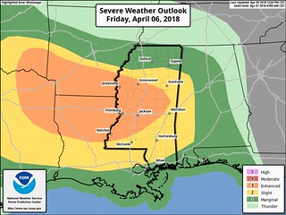
As the next round of thunderstorms swings through parts of Louisiana, Mississippi and Alabama, the risk for severe weather continues.
From the Storm Prediction Center:
The convective line may initially be slow to organize but strengthening mid-level northwesterly flow as well as increasing low-level flow will act to enhance vertical shear, encouraging upscale growth into a well organized MCS.
Anticipated well organized nature of this convective system is expected to support damaging wind gusts, some potentially significant, across the lower MS Valley. Embedded mesovorticies/tornadoes are also possible within this line, particularly across the northern end of the line where mesolow development is favored. However, confidence regarding the location of these mesoscale processes is currently low.
Steep mid-level lapse rates, favorable low-level moisture (i.e. dewpoints the mid-60s), and adequate vertical shear (around 50 kt from 0-6 km) will exist throughout the region, supporting the potential for severe hail. Some isolated very large hail is possible with the initial development, although confidence in occurrence is mitigated somewhat by the quick transition to a linear mode.
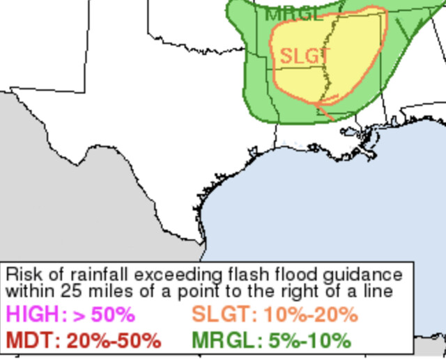
Flooding may also be a concern, the Weather Prediction Center shows a Slight Risk for excessive rainfall across parts of the lower Mississippi valley.
Remember, you can keep up on the latest details about the forecast nationally by checking the forecast discussions from the Storm Prediction Center and Weather Prediction Center here.


