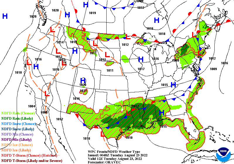
Get the raincoats and umbrellas out, as it looks to be a very wet upcoming week for much of the Gulf coast. A stationary front that was responsible for the historic flooding in Dallas, Texas will begin encroaching its way southeast over the coming days and bring with it the opportunity for heavy rainfall. While the majority of the heavy rainfall will be most likely the further north you go, flooding events may be possible down towards the coast depending on the positioning of these repeated rounds of thunderstorms.
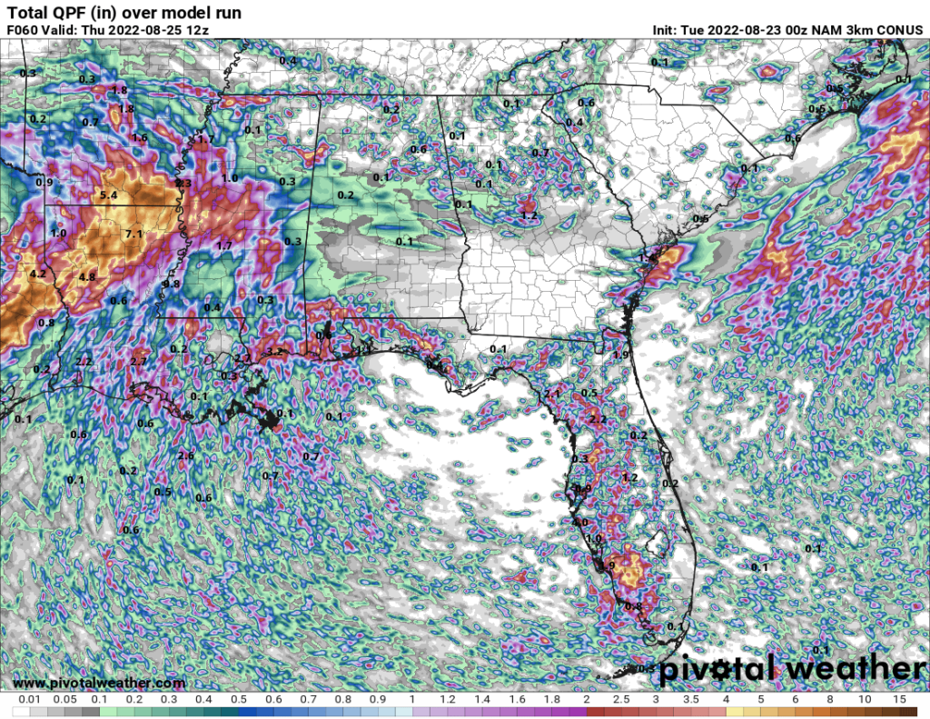
Very moist air, with PW values over 2 inches widespread across the region, will interact with this stationary front and continue to form scattered to numerous showers and thunderstorms over the next few days, as well as support very efficient rainfall production. The overall west to east storm motion, riding along and south of the stationary front, will allow for the training of thunderstorms and will have many areas seeing multiple rounds throughout coming days. Widespread amounts of 1-3 inches are expected, but locally higher amounts are possible.
After the eventual dissipation of this stationary front toward the end of the week, expect more seasonal conditions by late this week and through the weekend. conditions will return to about what has been experienced for a good majority of the summer, with seasonal temperatures and scattered precipitation fueled by the diurnal heating and cooling cycle will be the main theme through the weekend and into early next week.
A little side note…
After a very thrilling summer forecasting for you guys, this will be my last duo of weather forecasts (Coast and CONUS) for this internship. It has been an absolute blast and huge privilege to be able to work with Nick and write these forecasts for you guys over the last few months. Hopefully you guys have enjoyed these forecasts and I will definitely cherish and use this experience to assist in the pursuit of my meteorology career. I cannot wait to see the things to come for this website and all the stops Nick will pull out in the future. Thank you to everyone and until we meet again!
Kaden Schroeder
Day to Day Forecast
Tuesday
Mostly cloudy skies, with showers and thunderstorms likely. High temperatures in the low 80s. Low temperatures in the mid to upper 70s. Chance of rain 80%.
Wednesday
Mostly cloudy skies, with showers and thunderstorms likely. High temperatures in the low to mid 80s. Low temperatures in the mid to upper 70s. Chance of rain 90%.
Thursday
Partly cloudy skies, with showers and thunderstorms likely. High temperatures in the low to mid 80s. Low temperatures in the mid to upper 70s. Chance of rain 80%.
Friday
Mostly cloudy skies, with showers and thunderstorms likely. High temperatures in the mid 80s. Low temperatures in the mid to upper 70s. Chance of rain 70%.
Saturday
Partly cloudy skies, with a chance of showers and thunderstorms. High temperatures in the mid to upper 80s. Low temperatures in the mid to upper 70s. Chance of rain 60%.
Sunday
Partly cloudy skies, with a chance of showers and thunderstorms. High temperatures in the mid to upper 80s. Low temperatures in the mid to upper 70s. Chance of rain 60%.
Monday
Partly cloudy skies, with a chance of showers and thunderstorms. High temperatures in the mid to upper 80s. Low temperatures in the mid to upper 70s. Chance of rain 50%.


