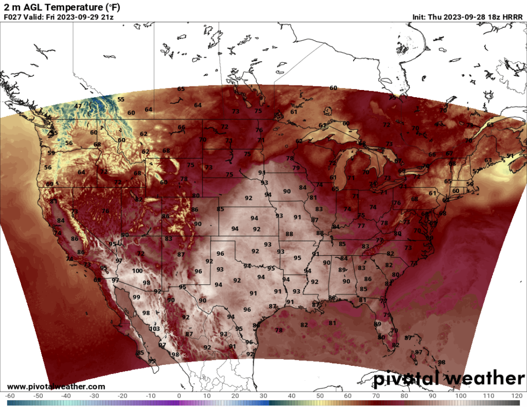
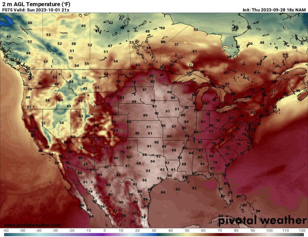
Looking to the weekend, temperatures across the US will feel like fall for some, while other places are still holding onto the summer temperatures. The central and southern Plains and a few Midwest states have a ridge in place, which will bring hot weather, reaching the low to mid 90s as far north as Iowa.
The northwestern states will see cool temperatures this weekend, with some of the higher elevations experiencing highs only in the 40s. This cool weather is associated with a trough moving in from the Pacific, which will also bring clouds and precipitation to some of these areas.
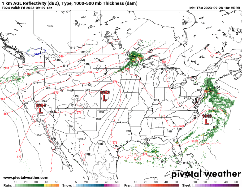
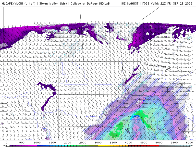
In addition to the Northwest, precipitation is also forecast in the northern Midwest and Plains and in parts of the Northeast US on Friday. The SPC has a Marginal Risk over the Midwest storms for wind and hail.
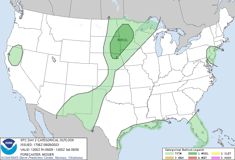
At this point, I feel there is too much uncertainty regarding severe potential on Friday. Cloud cover and possible morning rain/storms are possible and may limit CAPE. Additionally, as you can see from the map above, while CAPE values may reach 1000+ and even 2000+ in some areas, there is also a lot of convective inhibition (or CIN, marked by the dashed lines over the shaded CAPE areas on the map below). This acts as a “cap”, which suppresses storm development. The flip side is if the cap breaks, severe storm potential is greatly increased, so it almost becomes an all or nothing scenario for storms and poses a challenge for forecasters.
The other thing to look at here is whether later storms will form on a boundary created by the cold outflow from the earlier storms. Severe storms like boundaries, so it’s entirely possible that a severe storm forms along a boundary in the evening. Of course, if the atmosphere is too stable, not much will develop. In summary, there’s too much uncertainty at this point, and I think it is wise of the SPC to keep the risk at Marginal for now until we have more certainty. The HRRR model is more optimistic about severe storms than the NAMNEST model, which goes to show that even the models disagree on tomorrow’s risk.
Severe risk after Friday is low. The SPC does note the possibility of adding a Marginal Risk for hail in parts of eastern North Dakota and northern Minnesota, but it is too soon to tell, and even if they do add a Marginal Risk, I do not anticipate at this point that the risk would be higher than that. Overall, this weekend does not currently have any significant threats for widespread severe weather.


