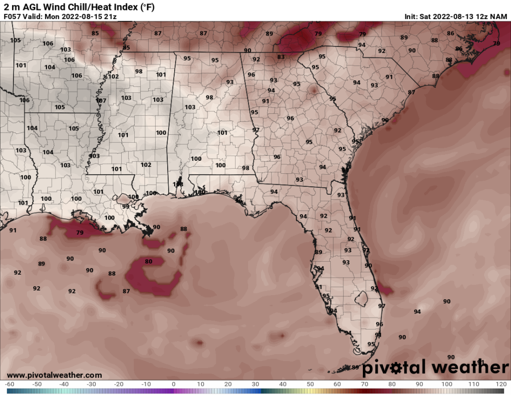
For the next few days, temperatures will be hot. The heat index may even get above 100 tomorrow. Rain chances over the next couple days will be 30 to 40 percent during the day, which means that an isolated summer storm cannot be ruled out.
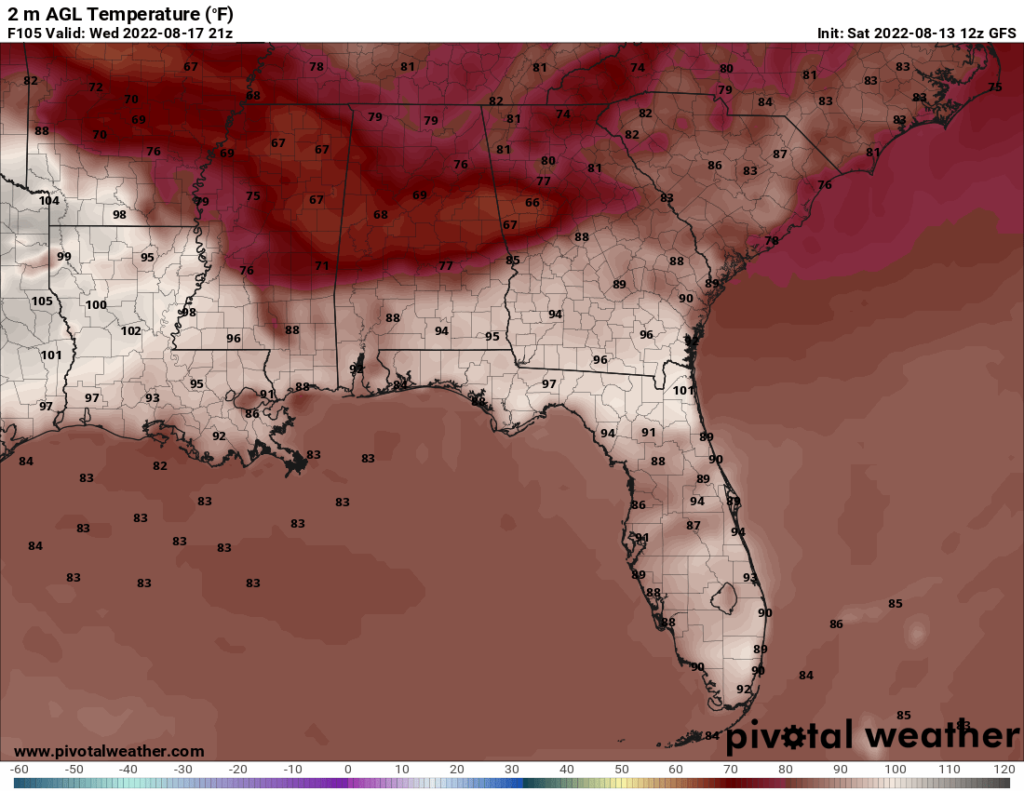
On Wednesday, a cold front moves in. This front will bring down high temperatures below average for this time of year. On Thursday, the highs may not even reach 80, which is well below average. The low temperatures will stay in the lower to mid 70s, though, which is closer to average.
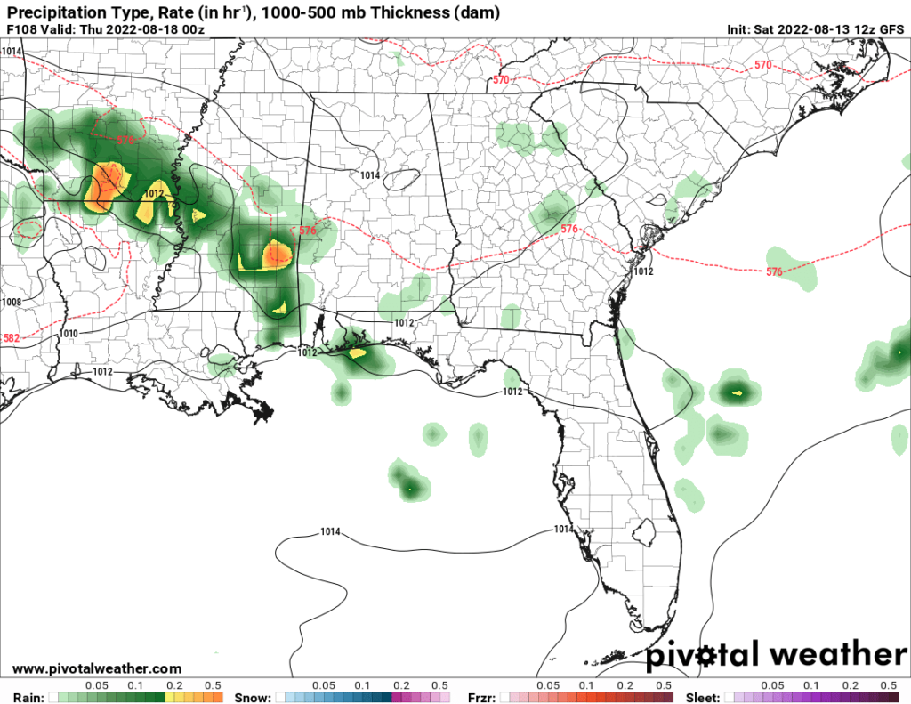
A big reason for the temperature drop, besides the cooler air itself, is the widespread cloud cover and precipitation chances during the latter part of the week. From Wednesday to Saturday, daytime rain chances are over 50 percent. The rain and cloud cover will keep the daytime temperatures down while also preventing nighttime temperatures from dropping much below average.
Day to Day Forecast
Sunday
Slight chance of a morning shower or thunderstorm, otherwise mostly sunny. Highs in the lower 90s. Heat index around 100. Chance of rain 30 percent.
Sunday Night
Mostly clear. Lows in the upper 70s. Chance of rain 10 percent.
Monday
Mostly sunny with a slight chance of thunderstorms later in the day. Highs in the lower 90s. Heat index between 100 and 105. Chance of rain 30 percent.
Monday Night
Mostly clear. Lows in the upper 70s. Chance of rain 20 percent.
Tuesday
Mostly sunny with a chance for thunderstorms later in the day. Highs in the lower 90s. Heat index in the upper 90s. Chance of rain 40 percent.
Tuesday Night
Mostly cloudy with a slight chance of thunderstorms. Lows in the mid 70s. Chance of rain 30 percent.
Wednesday
Partly cloudy with a chance of thunderstorms. Highs in the upper 80s. Chance of rain 60 percent.
Wednesday Night
Cloudy with a chance of thunderstorms. Lows in the lower 70s. Chance of rain 70 percent.
Thursday
Cloudy with showers and thunderstorms. Highs in the upper 70s. Chance of rain 80 percent.
Thursday Night
Mostly cloudy with a chance of showers and thunderstorms. Lows in the lower 70s. Chance of rain 70 percent.
Friday
Mostly cloudy with a chance of thunderstorms. Highs in the mid 80s. Chance of rain 70 percent.
Friday Night
Partly cloudy with a slight chance of thunderstorms. Lows in the mid 70s. Chance of rain 30 percent.
Saturday
Cloudy with showers and thunderstorms. Highs in the lower 80s. Chance of rain 80 percent.
Saturday Night
Cloudy with a slight chance of showers and thunderstorms. Lows in the mid 70s. Chance of rain 30 percent.


