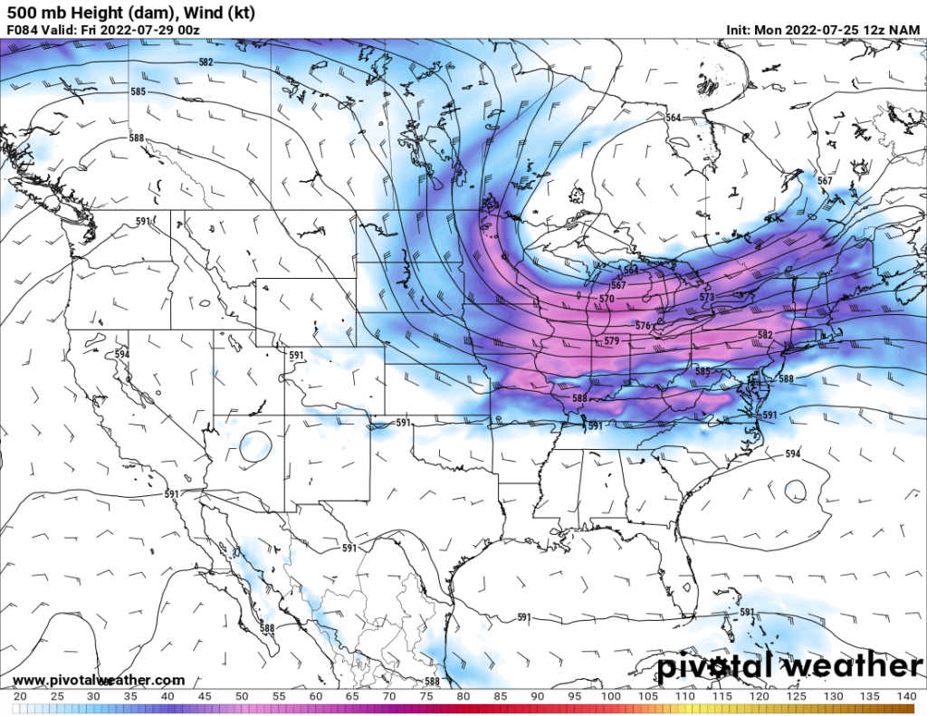
As we look at the 500 mb chart for Thursday evening, two things stand out to me. The first, which I will discuss right now, is the ridge over the Pacific Northwest. This ridge will persist in the area until the weekend. With the ridging in place, temperatures will climb, and temperatures into the upper 90s and even low 100s can be expected in areas as far north as interior Washington state.
Meanwhile, the other feature that stands out is the trough over the Midwest and Great Lakes region, which will enter the area Wednesday night and persist until Friday morning or so. This will bring down the temperatures on those days. More than that, rain and thunderstorms ahead of the trough are likely to occur, with some potential for severe thunderstorms in the southern Midwest and into Kentucky on Wednesday.
Over the weekend, a ridge should move over the Great Lakes region, which will bring the temperatures back up.
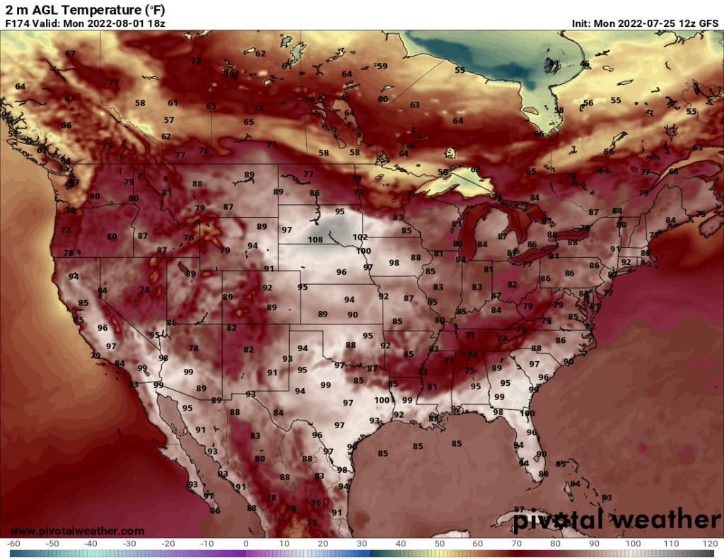
In the Southeast, most of the week will be typical summer weather: hot with a few pop up storms. Things get more interesting over the weekend and into next week. A slow-moving cold front will enter part of the region on over the weekend and slowly progress southward, bringing rain and thunderstorms with it. On the map below, you can see a clear front in place that divides hot temperatures in the 90s from cooler temperatures in the 70s and 80s. Arkansas, northern Mississippi, and Tennessee may see rounds of thunderstorms over the weekend and into Monday as the front moves through.