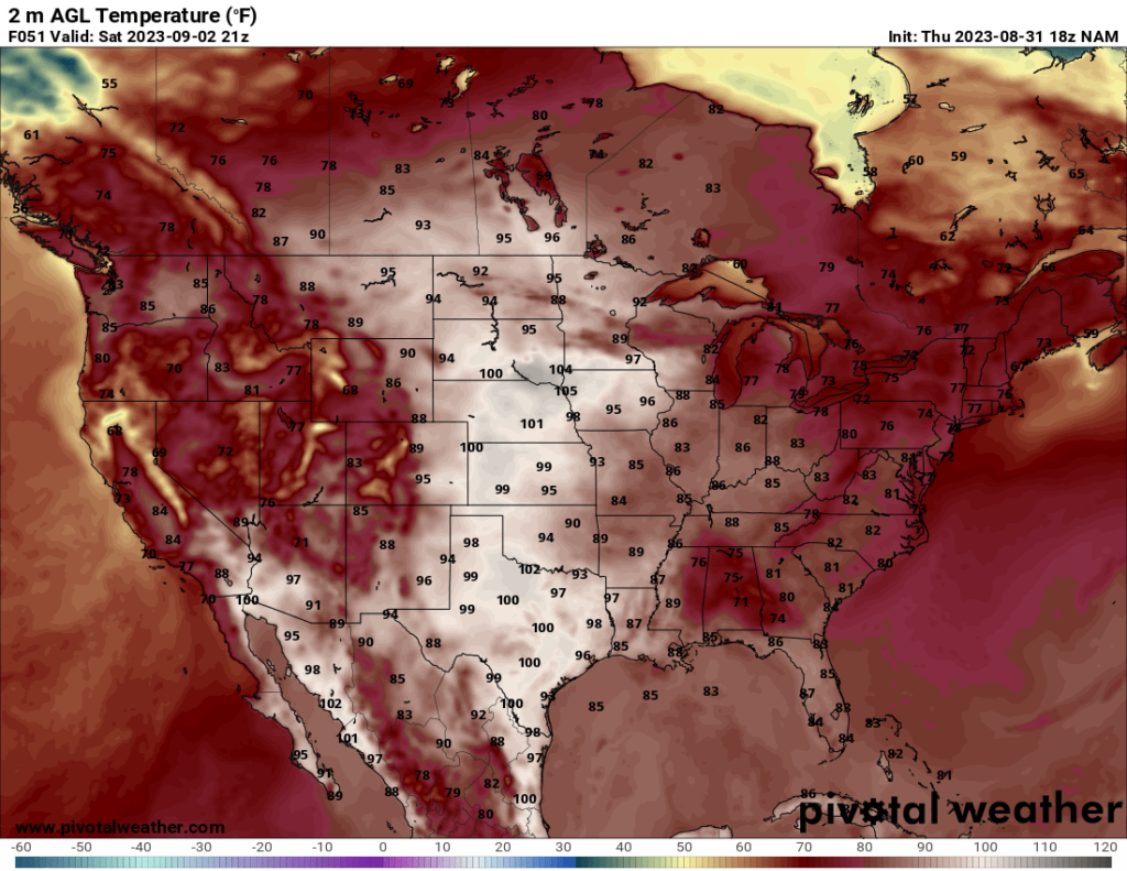
As we start the month of September and head into the beginning of meteorological autumn, many are probably wondering when the temperatures will start cooling down. Unfortunately for the folks in the central US, hot temperatures will persist through the weekend, though the heat will not be as intense as the past few weeks. Temperatures in the Northeast and much of the western US will be more comfortable, with high temperatures generally ranging from the mid 70s to the mid 80s throughout the forecast period. As the weekend ends, the warmer temperatures are forecast to spread eastward, while most of the western US should see temperatures drop a bit.
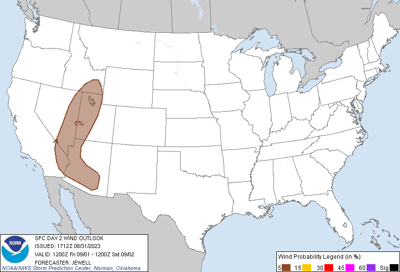
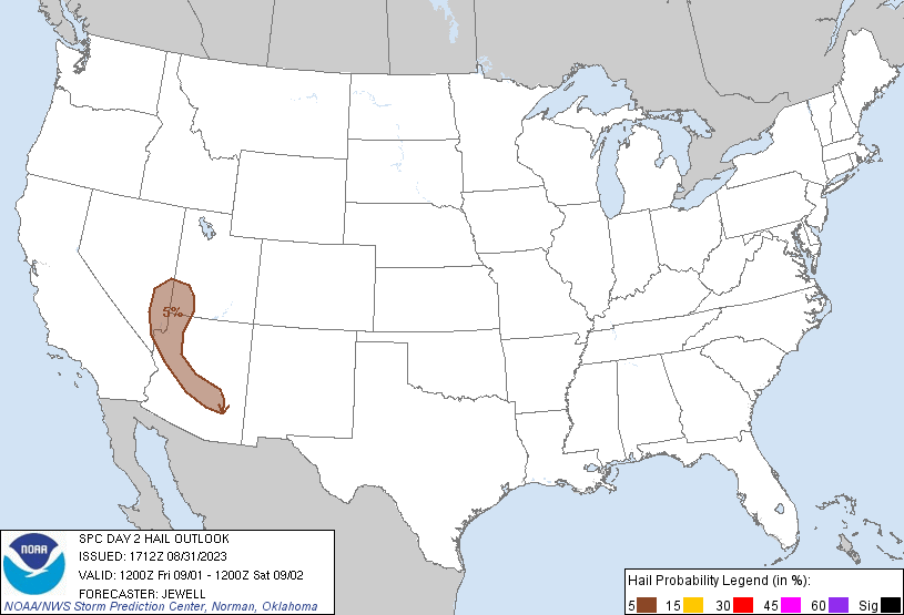
There is a marginal risk for severe weather across parts of the Southwest on Friday. The SPC has a Marginal Risk across parts of Arizona, SE California, eastern Nevada, western Utah, and SE Idaho. The main risk is isolated damaging wind gusts and/or isolated severe hail. As I was analyzing the region, I immediately noticed that the 500 mb flow is modest in some parts of the region, reaching above 30 kts in plenty of areas. Usually that creates decent shear for severe storms, so I initially wondered why the SPC only has a Marginal for the area. Additionally, the moisture in the southern part of the region is sufficient for severe weather, with dew points reaching into the 60s in some areas.
One issue that I found is that, just like some of these previous Marginal Risk days, the best CAPE (instability) does not overlap the best upper level flow. In this case, the best CAPE is found in western Arizona, SE California, and southern Nevada, with values ranging from 1000 J/kg to just under 3000 J/kg in some places, which is enough to produce severe storms if adequate shear is present. The upper level winds in these areas are weaker, which explains why the severe risk is only Marginal there, but the models forecast some isolated areas of 1000+ J/kg CAPE to overlap the 30+ kt 500 mb winds further north, so I knew there must be another factor limiting severe potential.
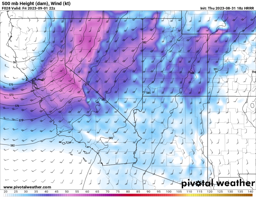
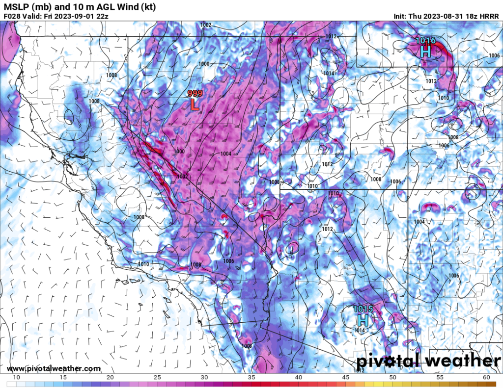
I think a major reason why the SPC only has the severe risk at Marginal is the low amount of directional shear. If you compare the wind barbs on these two maps above, you will see that in many areas, the surface winds are flowing in a similar direction as the upper level winds. For example, in SE Nevada at 3 PM PDT, the 500 mb winds are coming from the SSW, and the surface winds are generally coming from the south. That’s not a major change in direction. Supercells tend to form when the winds change direction significantly with altitude (a 90 degree directional change from surface to upper levels is ideal). This lack of significant directional shear is my guess as to why the SPC has the risk at Marginal. Additionally, the models show storms forming relatively early in the afternoon and clustering together, which limits the strength of any given storm.
In summary, I agree with the SPC estimate on the severe threat. The main threat will be for isolated damaging winds and isolated large hail. Aside from this marginal severe threat, I currently do not see any other areas with any notable severe risk over the next few days. That’s not to say that could not change as the models update, but as of now, I’d expect things to be relatively quiet over the CONUS this weekend.


