Things are actually looking pretty decent for today and through the weekend – so long as you can handle the chance for a few showers and storms here and there.
Today, the chance for rain – before we hit peak heating for the day – should limit afternoon highs to just the upper 80s to low 90s in many spots.

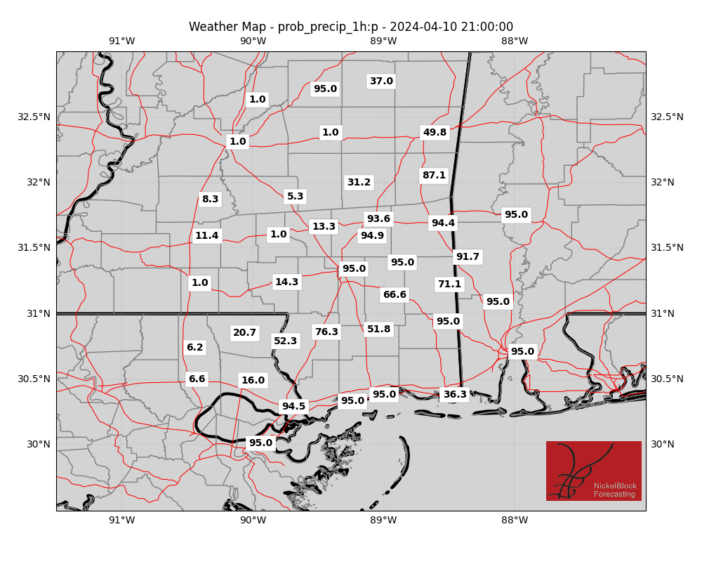
Over the weekend, there’s an upper-level low hanging out along the border of Louisiana and Texas. It’s bringing some much-needed moisture and southerly winds to our region. This means continued shots for rain for points south of Interstate 20.
Thankfully, at this point, we’re not expecting severe storms because there isn’t quite enough instability, especially during the hottest part of the day.
By Sunday, our low-pressure system will start moving to the northwest, while a mid-upper level high sets up to our east-northeast. This will shift most of the moist air westward, meaning the best chances for rain will be to the west of Interstate 55.
As for temperatures this weekend, expect highs in the upper 80s to low 90s across the area.
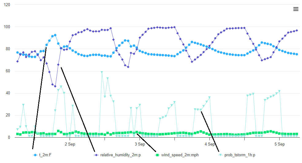
On the chart below, you can see the temperature, humidity, wind and storm chance trends for each day.
Moving into early to mid-next week, that low-pressure system will weaken, and the upper-level high will strengthen over the eastern U.S. This will keep most of the moisture to our west, and our region will dry out once again. But it won’t be 100-percent dry. I think we hold onto a few shots for rain here and there.
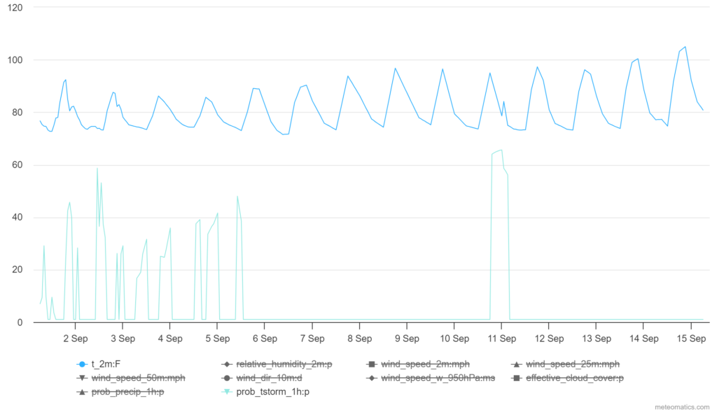
The chart above is some of the model guidnace sugesting that we hold on to a 30-to-50 percent shot for ain through the middle of next week. With the high-pressure system in control, though,, temperatures will climb back into the mid to upper 90s by the middle of the week, too.
[wpcode id=”41149″]
REGIONAL DAY TO DAY FORECAST
Today: Partly sunny with a chance of showers and thunderstorms in the morning, then mostly cloudy with showers and thunderstorms in the afternoon. Highs in the lower 90s. East winds 5 to 10 mph. Chance of rain 80 percent.
Tonight: Showers and thunderstorms likely. Lows in the lower 70s. East winds around 5 mph. Chance of rain 70 percent.
Saturday: Showers and thunderstorms. Humid with highs in the mid 80s. East winds 5 to 10 mph. Chance of rain 90 percent.
Saturday Night: Mostly cloudy with a chance of showers and thunderstorms. Lows in the lower 70s. East winds around 5 mph. Chance of rain 50 percent.
Sunday: Partly sunny. A chance of showers and thunderstorms in the morning, then showers and thunderstorms likely in the afternoon. Highs in the upper 80s. Chance of rain 70 percent.
Sunday Night: Mostly cloudy in the evening, then becoming partly cloudy. A chance of showers and thunderstorms. Lows in the lower 70s. Chance of rain 30 percent.
Labor Day: Mostly sunny with a chance of showers and thunderstorms. Highs around 90. Chance of rain 50 percent.
Monday Night: Partly cloudy. A slight chance of showers and thunderstorms in the evening. Lows in the lower 70s. Chance of rain 20 percent.
Tuesday: Mostly sunny with a slight chance of showers and thunderstorms. Highs in the mid 90s. Chance of rain 20 percent.
Tuesday Night: Partly cloudy in the evening, then becoming mostly clear. Lows around 70.
Wednesday: Sunny. Highs in the mid 90s.
Wednesday Night: Mostly clear. Lows in the lower 70s.
Thursday: Sunny. A slight chance of showers and thunderstorms in the afternoon. Highs in the upper 90s. Chance of rain 20 percent.


