Hurricane Irma 8pm quick model update

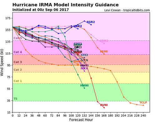
Here is a quick look at the spaghetti model data and intensity model data from Tropical Tidbits.

Evening model data // Courtesy: Tropical Tidbits
Operational models vs. Ensemble models // Courtesy: WSI

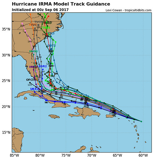
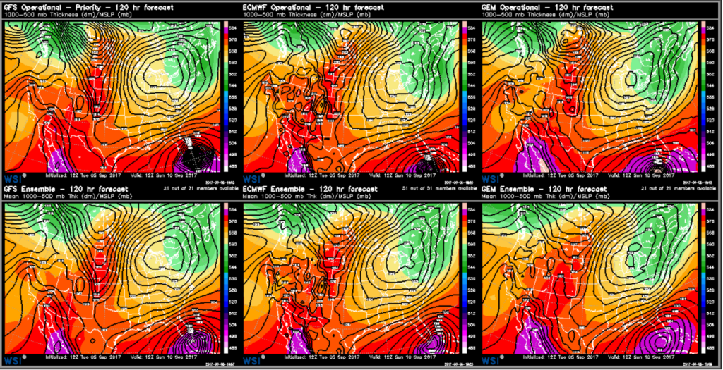
It is interesting to see the general shift in the track to the north and to the east. Once the full suite of data comes out as we move through the evening, I’ll get a better idea regarding that shift.

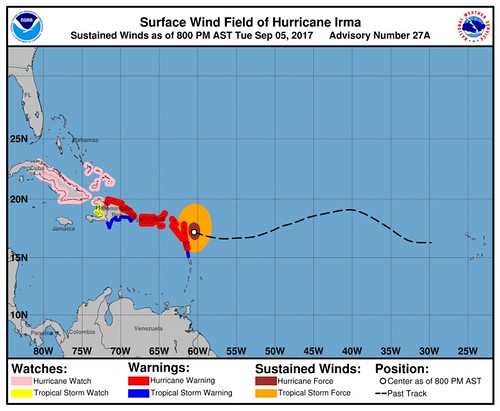
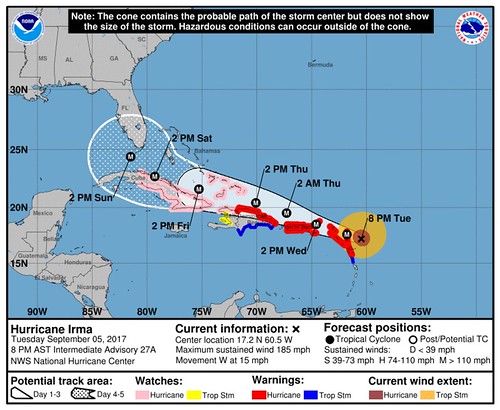
Here is the latest from the NHC:

Current Watches and Warnings // Courtesy: National Hurricane Center
Forecast from the NHC // Courtesy: National Hurricane Center


Author of the article:


Nick Lilja

Nick is former television meteorologist with stints in Amarillo and Hattiesburg. During his time in Hattiesburg, he was also an adjunct professor at the University of Southern Mississippi. He is a graduate of both Oregon State and Syracuse University that now calls Houston home. Now that he is retired from TV, he maintains this blog in his spare time.