Good morning, folks! I hope you all enjoyed your 3-day weekend and your Fourth of July! Let’s take a look at the current weather so we can get an idea of the weather to come this week…
Current Synoptic Picture

Let’s start by looking at the current state of the atmosphere… Right now, the center of a upper-level high pressure is located over northern Louisiana, as shown by the 5,940m contour in the image above.

This 500mb height is a bit above-average for this time of year, which will generally correspond to above-average temperatures. As this week continues, we’ll see this upper-level ridge continue to grow and shift westward, resulting in much of the Central and Southern United States seeing above-average temperatures.

While this is a great indicator of the temperatures that we’ll see, it doesn’t tell us much about the moisture in the air… For that, I like to look at the precipitable water values, which, like always in the Deep South during the summertime, are relatively high.

For most of the region, precipitable water values are over 2″, with some locally higher amounts in along the shores of the Gulf of Mexico. Across Southwestern Mississippi, the only place missing out on the 2″+ precipitable water values is portions of Warren County.
Regardless of the locally-lower levels of total moisture in the atmosphere, the dew points across the Southeast are relatively uniform this morning, which much of Southwestern Mississippi experiencing dewpoints in the lower 70s.

Increase Threat for Showers, Thunderstorms Early This Week
Normally, under a ridge, we’d expect above-average temperatures, however the energy from a weak disturbance will cause some lift in the atmosphere, enhancing the chances for an afternoon thunderstorm across the region today and Wednesday.

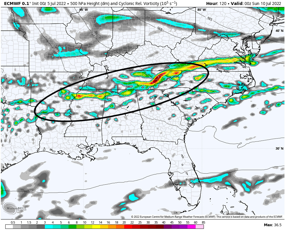
This packet of energy from the disturbance is best-viewed while looking at the upper-air vorticity. As positive (cyclonic) vorticity leads to rising air, the threat for showers or thunderstorms, which require air to rise in a hot and humid environment, will increase. This energy will cycle around the center of the mid-level anticyclone and will begin to leave the region on Wednesday.

While this weak upper-level disturbance will bring some showers and thunderstorms that will help to keep our temperatures down a little, it will only keep the temperatures feeling about average for this time of year; whereas, for regions where rain is not expected, temperatures will be about 3F above average.


After this disturbance moves out of our area, the chance for showers and thunderstorms really diminishes until at least the weekend, when a cold front approaches the region from the North. This absence of widespread showers or thunderstorms later this week will really help temperatures reach the above-average levels expected under the mediocre upper-level ridge over the Southeast, with temperatures anywhere between 2-4F above-average.

More Showers, Thunderstorms due to the Passage of a Cold Front this Weekend
As I touched on earlier, the chance for more showers and thunderstorms will return over the weekend, as a cold front will develop and move through the region from the north sometime Saturday afternoon through Sunday morning. While it is a little too early to give a specific timeframe, as of now, both the American and European weather models agree that the front will approach the region sometime late Saturday evening

While it’s wonderful that the models seem to agree with the timing of this frontal passage, what’s not good is the uncertainty introduced after the passage of this front. Last week, a boundary stalled over the region, and was responsible for scattered showers and thunderstorms across the Southeast – in fact, the energy from that stalled boundary spawned a weak tropical storm, Colin, that made landfall in South Carolina in the early morning hours last Saturday.
With this boundary, though, the American GFS model shows it clearing the region on Sunday, then stalling just offshore Monday afternoon and hanging around through late next week. The European ECMWF model, on the other hand, shows it stalling offshore in the Gulf of Mexico and gradually weakening.
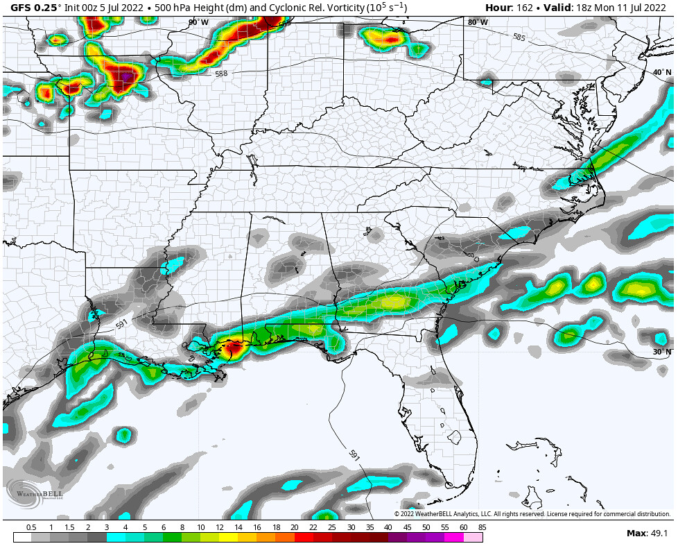


Regardless of the eventually outcome of this boundary, we’re likely to see some enhanced chances for showers and thunderstorms this weekend, with gradually lessening chances for Monday and Tuesday. Beyond that, we’ll have to wait for until the global models come to an agreement to confidently determine our chances for rain.
Day-to-day Forecast
Tuesday
Scattered showers and thunderstorms expected throughout the day, with an 80-percent chance of rain. Expect high temperatures in the upper 80s.
Wednesday
Scattered showers and thunderstorms expected throughout the day, with an 80-percent chance of rain. Expect high temperatures in the upper 80s.
Thursday
Partly cloudy skies likely, with a 20-percent chance of an afternoon storm. Expect high temperatures in around 90F.
Friday
Mostly sunny to partly cloudy skies likely, with a 20-percent chance of an afternoon storm. Expect high temperatures in the low 90s.
Saturday
Mostly sunny to partly cloudy skies likely, with a 30-percent chance of an afternoon storm. Expect high temperatures in the low 90s.
Sunday
Scattered showers and thunderstorms likely, with a 70-percent chance of rain. Expect high temperatures in the upper 80s.
Monday
Scattered showers and thunderstorms likely, with a 70-percent chance of rain. Expect high temperatures in the upper 80s.


