Buckle up!

If you follow this site, you probably know that when I look at tropical weather model data I don’t often look beyond five days. But when I do, there has to be some level of agreement between at least one operational model and one ensemble.
But today I’m looking out 10 days because there is some level of agreement between both the operational European model and the GFS model as well as both the EPS ensembles and the GEFS ensembles.
That is a lot of agreement. And it isn’t something we see frequently.
What’s Out There…
What do they agree upon? That the northwest Caribbean may eventually be the spot where a tropical system resides about 10 days from now.

What isn’t odd? Well, that is about a climatologically normal as it gets for this time of year. Late September / early October is often the time of year we see a system pass through this area – either born there, or just drift on by.
So while it is odd for a handful of model guidance to point to a potential system there, it isn’t odd to actually have one there.
Named storms to pass through that area and impact either Louisiana, Mississippi or Alabama: Hurricane Hilda (1964), Hurricane Helene (2000), Hurricane Nate (2017), Hurricane Zeta (2020), and Hurricane Delta (2020).
That’s it. Most storms either move toward Florida or move into Mexico.
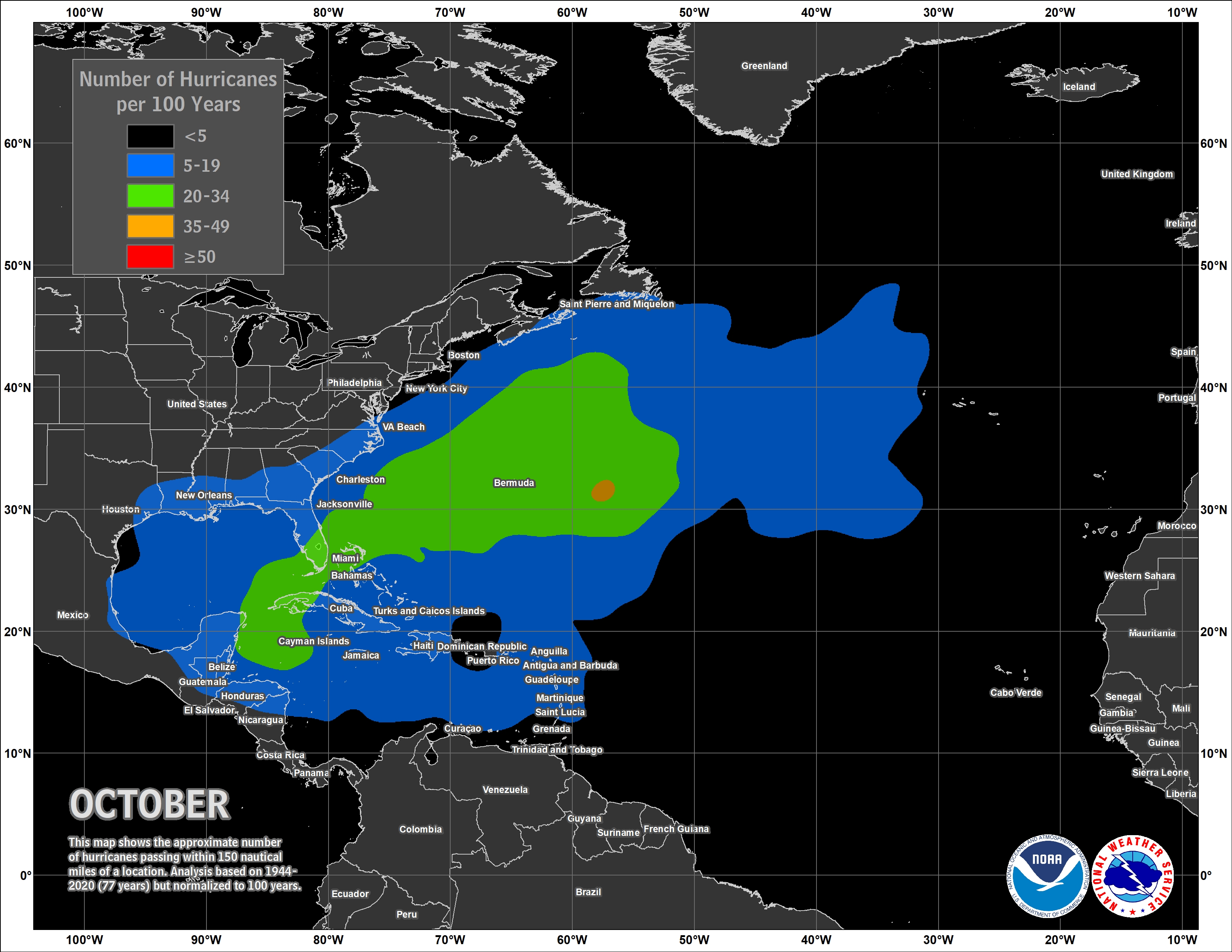
Historically
Looking at the last 30 years, as we move through September and October the atmosphere is usually lined up in a general way that allows for tropical systems to escape to the north from the Gulf toward Texas, Louisiana, Mississippi, Alabama and Florida.

But the latest into September and into October we go, the more and more Texas gets cut off. Then Louisiana, then Mississippi, then Alabama.
And eventually we end up with a situation where systems – on average – go west or northeast from the Yucatan.
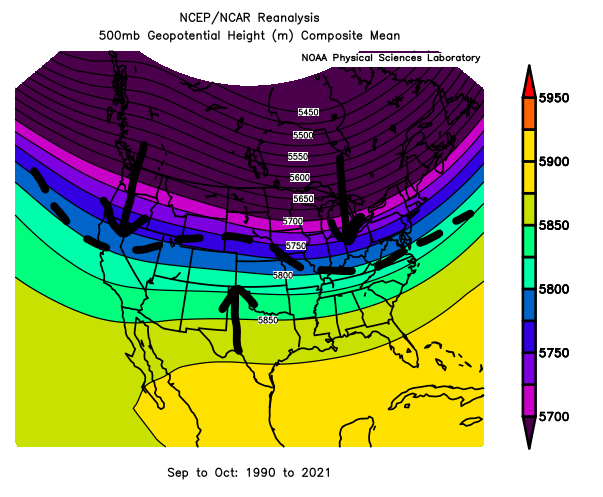
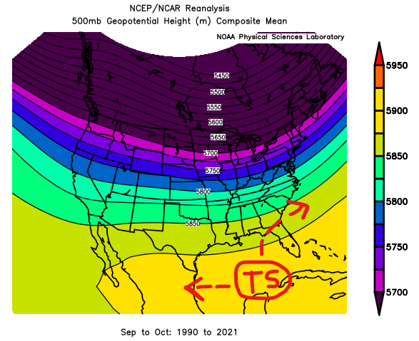
So when you see things like this:

Please know that climatologically this isn’t anything out of the ordinary. And that historically, only a handful of storms from this area have moved due north toward the northern Gulf Coast. So the likelihood is small. Not zero, but small.
Please keep up with the forecast in the coming few days. If you want to “tune out” for a few days on this one, that’s fine. But I would check back in later this week. And double check that Hurricane Prep kit to make sure you have all of the stuff you need.


