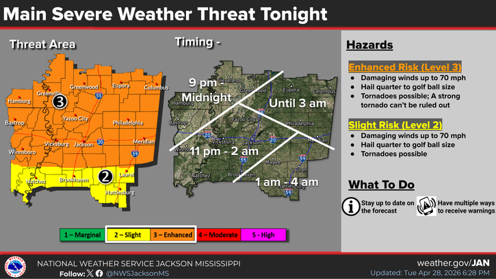
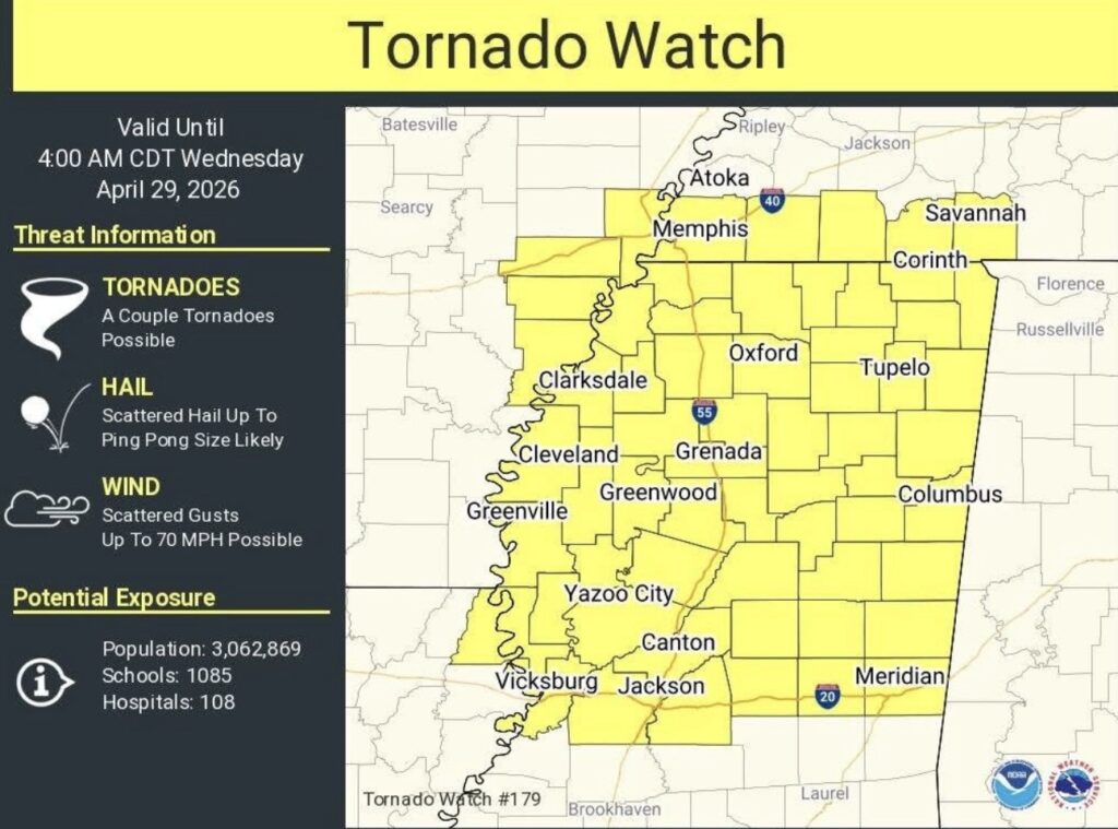
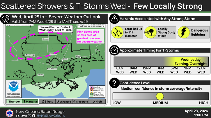
It’s been a busy day and night so far for those to our north, but we are still expecting a few batches of heavy rain and thunderstorms to move southward into our region through tonight and tomorrow. There’s an Enhanced Risk for those a little farther north, and a Slight Risk of severe weather tonight, with the potential for very large hail, damaging winds, and an isolated tornado or two. The NWS graphic above shows the approximate timing of the severe weather threat coming through the area, highlighting only Mississippi. For everyone else, expect later on the further south you are. This is only a scattered event tonight, but any storms that do get into our area could become severe.
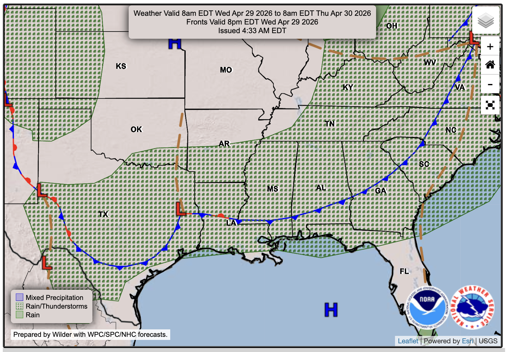
Where’s this threat coming from? There is a low-pressure system over Texas with an associated cold front that brings all the severe weather ingredients: wind shear, lots of moisture, and instability (rising air). Since we are in the warm sector of the front, we have all these ingredients ready for any storm to tap into, which is why it’s difficult to predict where any storm can form or where it will go. That’s why the SPC outlines just a general area that could experience severe weather, so everyone can have a general idea. Looking at radar and high-res models, you can see where the storms might fire up based on previous storms, such as along outflow boundaries.

Tonight’s Forecast
Tonight, we’ll see low temperatures in the upper 60s, with some thunderstorms coming through overnight. Ensure you have your notifications turned on for emergency alerts, just in case your area is under an NWS-issued severe thunderstorm or tornado warning! Overall, I do think the bulk of the worst will stay north, say north of I-20, but a few sneaky cells could make it south into our area, so it’s worth keeping an eye on and ensuring we are aware that the threat exists.

Tomorrow’s Forecast: Wednesday, April 29th
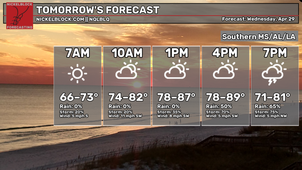
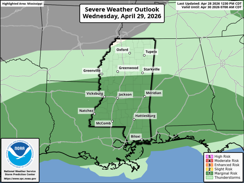
A mix of sun and clouds tomorrow will build up the instability in the atmosphere and will allow for some strong-to-severe thunderstorms to move in over our area. It looks like the main threat will be more centered on our region, southern MS/AL/LA, instead of farther north, but the overall threat is lower, as of tonight. We’re under a Level 1 (Marginal) risk for large hail, gusty winds, and the chance of a tornado. The HRRR shows some cells in the early afternoon, followed by a cluster of nasty storms later in the afternoon through the evening, likely with a wind threat, with some leftover rain through the night into Thursday morning. Expect a high in the upper 80s, near 90, with some very sticky humidity.
Thursday’s Forecast: April 30th
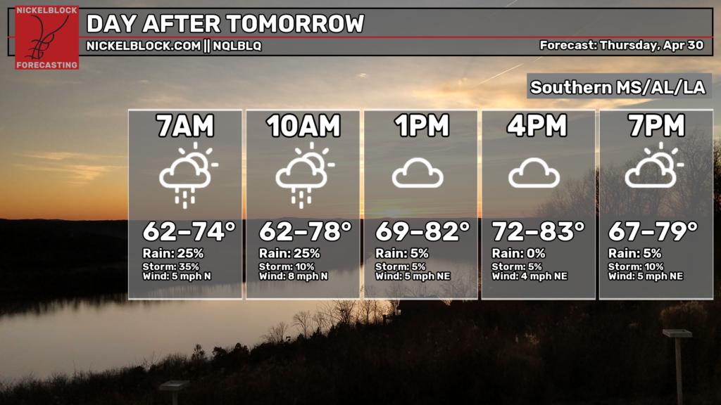
It’s another wet and humid day on Thursday with the chance of some scattered showers throughout the day. We’re not looking at any more severe threats, just some wet roads. We’ll be slightly cooler, thanks to the influence of some northerly air, sitting in the upper 70s and low 80s.

Extended Local Outlook
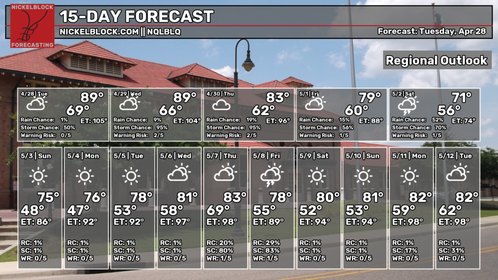
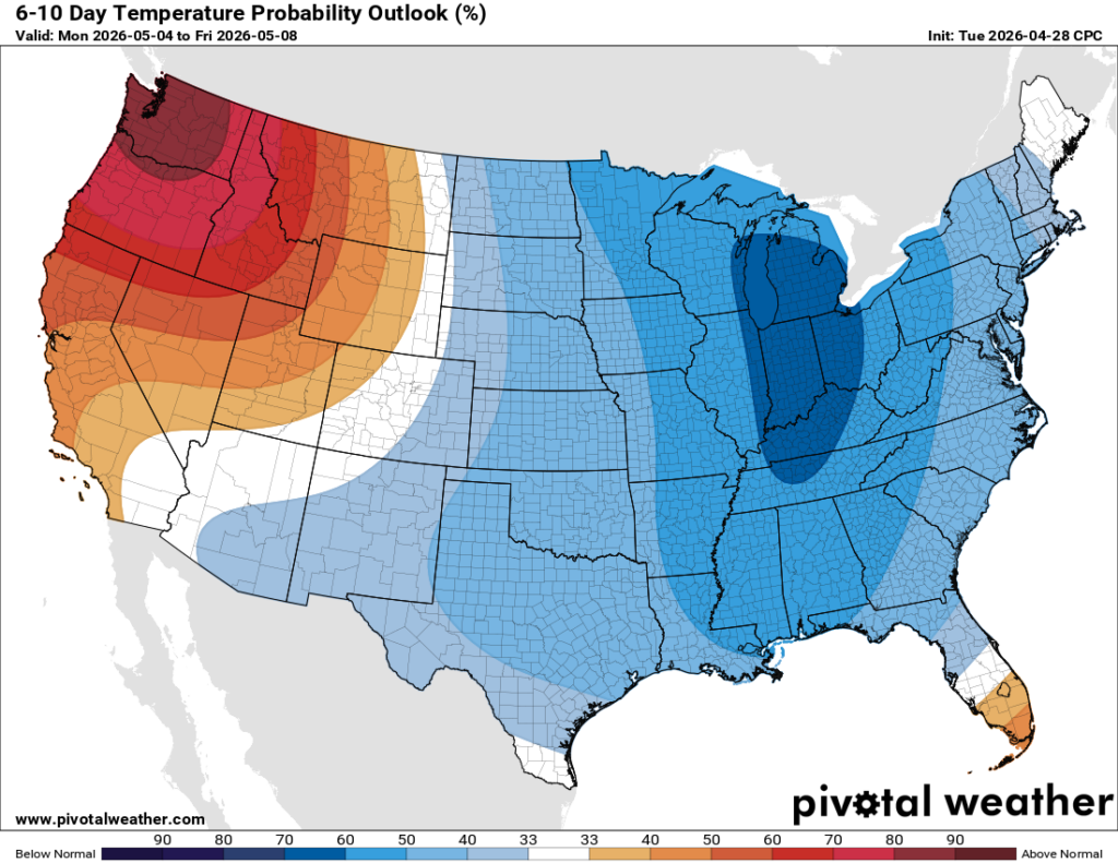
We’ll see more rain on Friday as the front stalls and stretches over the southeast, and into the first half of Saturday, according to current guidance. The rest of Saturday and Sunday are expected to be dry and definitely cooler than average, as is the first half of next week, which is why the 6-10 day outlook shows some blue over our region! This isn’t a huge cold shot by any means, since we’ll only be a few degrees below average, but you should certainly feel the relief, since we’ve been so much above average recently. The rainy pattern wants to stick around, though!


