Pretty peaceful out in both the Atlantic basin and the Pacific basin currently, with no organized storms currently ongoing or imminent over the next day or two. Over the next 7 days though, we will be monitoring two areas, one off the Mexican coast, and one in the Central Atlantic, for potential signs of organization and tropical development. It remains to be seen though if in fact these two areas pan out and are able to get their act together, or if they will fall apart as the days progress. We will keep an eye out though, as conditions and situations can always change in the blink of an eye.
Current Tropical Conditions
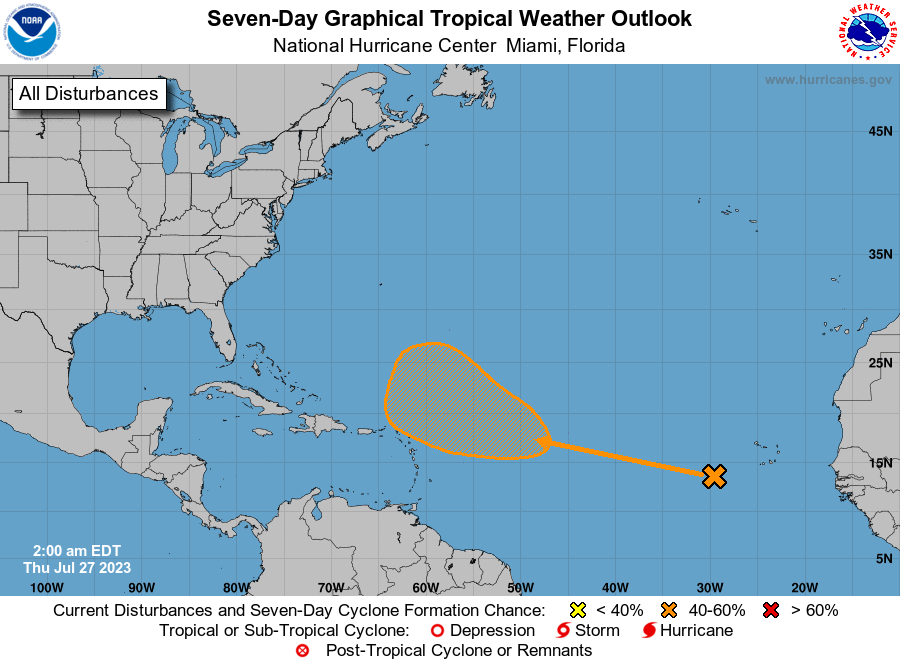
Out in the Atlantic, all will remain quiet over the next day or two. This may change however, as we are watching an open wave advance its way west northwestward into increasingly more favorable atmospheric conditions for tropical development. This wave will be running into an area with weaker wind shear, plenty warm ocean temperatures, and relatively good moisture throughout all levels of the atmosphere in front of and around it. It remains to be seen as to when this organization will occur, but most likely this will happen by the weekend.
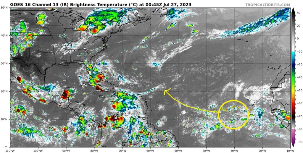
The National Hurricane Center is giving this area a 40-percent chance of development during the next seven days.
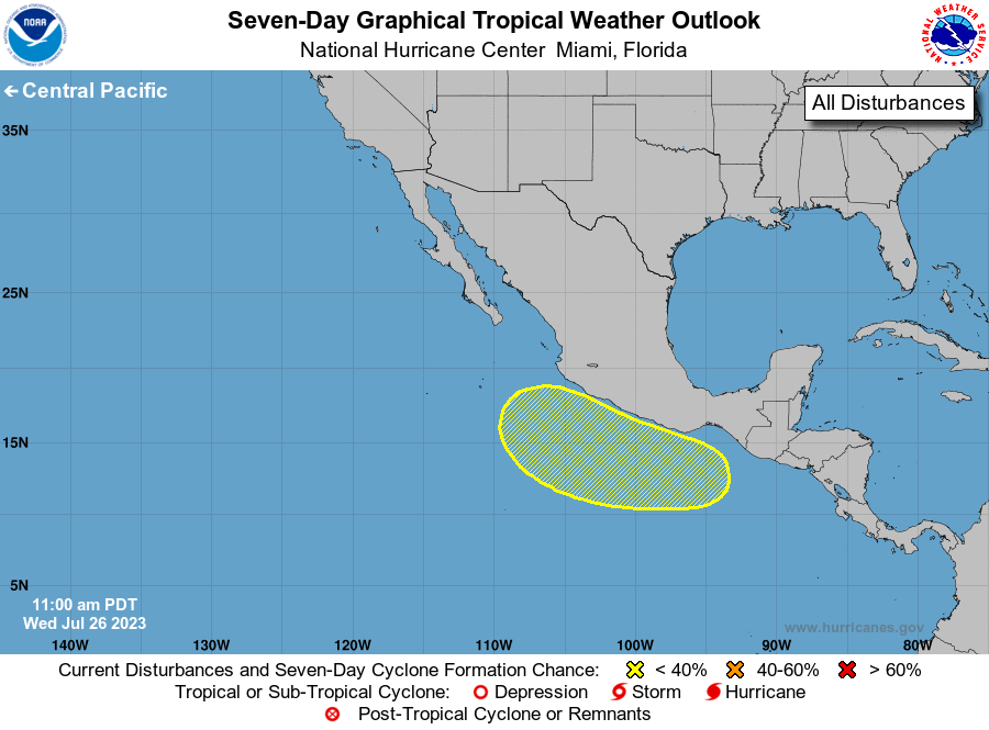
Out in the Eastern Pacific, things will be largely quiescent heading into the weekend. The main limiting factor out here is the moderate wind shear in place, keeping things largely calm in this basin in wake of favorable oceanic conditions. That all might change though as we head into the late weekend to early next week period, where things may get a little more active.
Extended Outlook
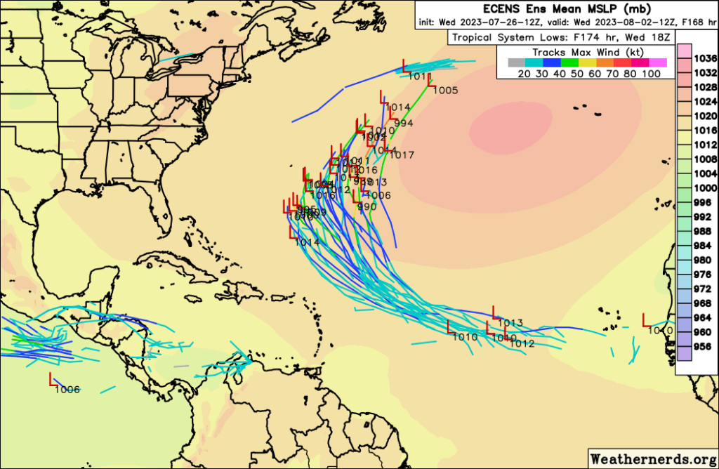
The aforementioned wave in the Atlantic may have the opportunity to get its act together and structure itself into some form of tropical system by the weekend and into next week. Conditions will still be favorable for tropical storms as this system makes its way northwest closer towards the Greater and Lesser Antilles by early next week. Both GEFS and ECENS ensemble members are in relatively good agreement with some sort of tropical disturbance organizing and moving off towards the northwest, before recurving back off towards the north and northeast in the Central Atlantic as it moves between two lobes of high pressure. Potential intensity of this system appears to be on the weaker side for now, but this could be subject to change.
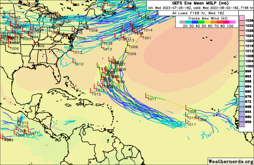
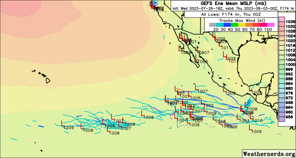
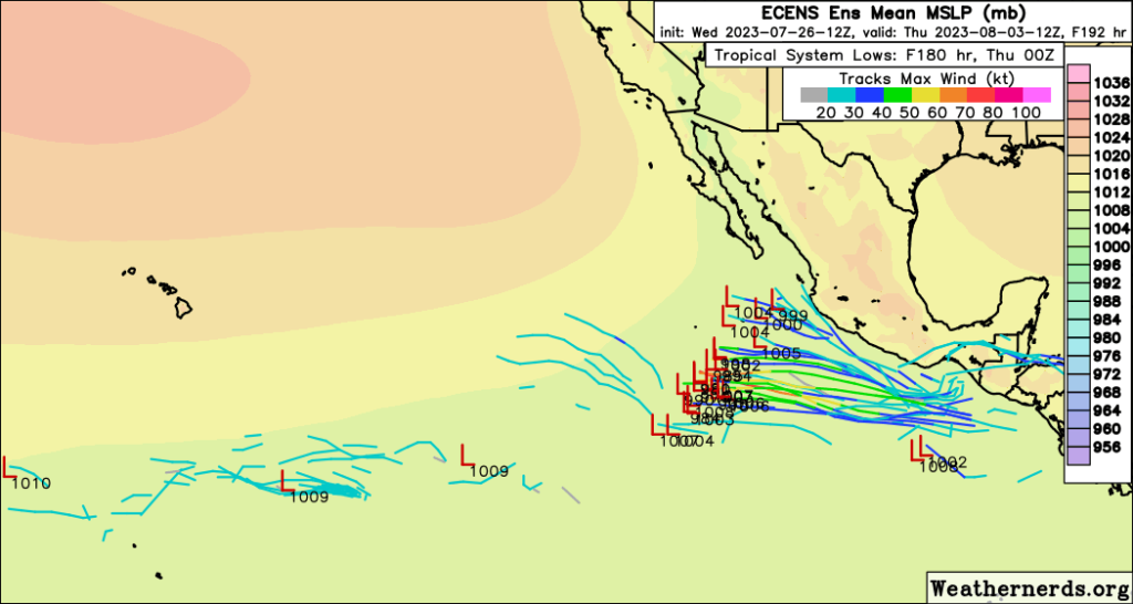
In the Eastern Pacific, things are a bit more ambiguous with tropical development. Wind shear will gradually lessen by early next week and allow for the chance for any opportunistic low-pressure system moving off of Mexico or further down from Central America by early next week and going through all of next week. Like out in the Atlantic, both the GEFS and ECENS ensemble members are picking up on new tropical development off the Mexican coast, with the ECENS being slightly more concentrated than the GFS as far as development placement is concerned. Time will tell if something does arise out here, but the conditions in place now and in the future will be favorable for tropical storms.
Conclusion
We will look to be largely quiet over the next couple of days in both oceans, but all of that might change by the weekend and early next week. Two, albeit weak, possible areas of interest (the Atlantic with one and the Pacific with one) may attempt to stir up and try to become something as the days progress on. In the Atlantic, a developing tropical wave will move northwest into a window of more favorable atmospheric and oceanic conditions where it could organize into a tropical disturbance by the weekend and through next week. Current guidance is relatively confident in development, so now we will have to wait and see if it verifies. Out in the Pacific, things will also be quiet for a few days before we see a system try to develop somewhere off the southwest coast of Mexico early next week. Confidence is slightly lower in the formation of an organized storm at the moment, but the overall conditions will permit it as the days progress.


