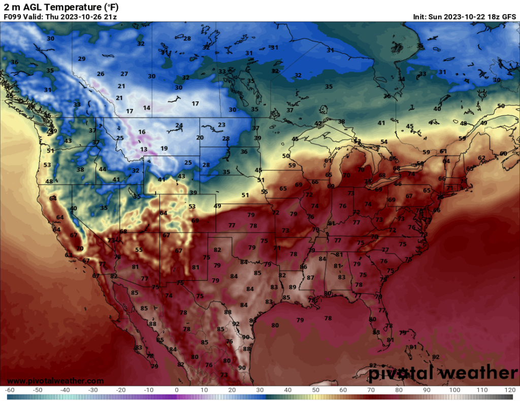
As we head into the week before Halloween, the people in the Northeast may be relieved to know that temperatures will warm up in a few days, with many places seeing highs in the 60s by Wednesday. Now, if you live in the northern Plains or northwestern states like Montana, you’re out of luck. A sharp cold front is forecast to move through these states over the next few days, and as you can see in the image below, the high temperatures in some of these northerly areas may not make it out of the 20s by midweek.
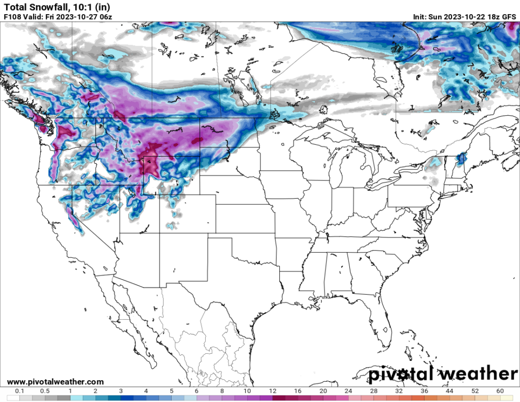
In addition to the cold, the front will also bring snow to the northwestern states and the Dakotas. The snow is currently forecast to enter the Northwest on Tuesday before also spreading into the Dakotas Wednesday and Thursday. Some areas may see 10+ inches of snowfall over a period of a few days, with locally higher amounts possible, particularly in the higher elevations.
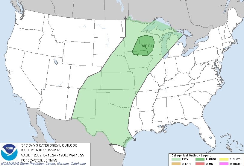
There may be some nonzero severe potential ahead of the cold front in the Midwest, but the models seem too inconsistent at this point to really say much else. In fact, while the SPC currently has a Marginal Risk for Tuesday over northern Iowa, southeast Minnesota, and western Wisconsin, this is actually a downgrade from the previous outlook for Tuesday. Instability appears to be too limited at this point to support a large-scale severe threat, so my guess is any severe events would be isolated.
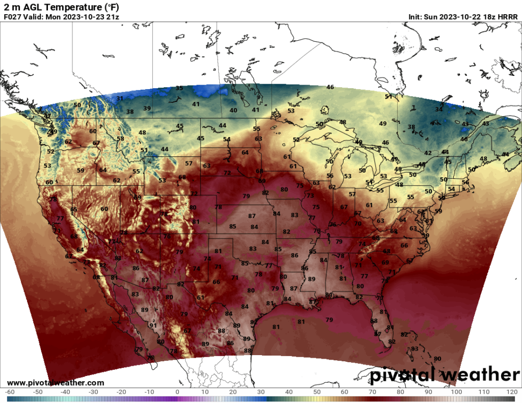
Meanwhile, for folks in the south (like me), the weather will be in the 70s (or even the 80s in some locations) with fairly sunny weather. The winter temperatures have yet to reach this far south, and I hope they stay away as long as possible.


