Another day and another chance for a few showers and storms across the area. Things won’t be nearly as robust as yesterday. Instead, today storms will be fewer and farther between. But some folks may be lucky enough to catch some more raindrops.
Idalia still looks to move to our east. That will leave us drier as we will be on the back-side of the system.

A quick note on Idalia, there are a handful of atmospheric puzzle pieces in place. Two mid-level areas of low pressure (Red Ls) pushing through the northern Gulf (black arrows) will help to nudge Idalia (Red I) to the as it lifts north (black arrow). the axis for the mid-level trough (orange lines) is nearer to us today, but will shift east and be the final nudge for Idalia. The general flow on the east side of Idalia is from the south (brown arrow) but on the west side it is from the west and, eventually, northwest.

As we move through the rest of the week, the trough that is set to pick up Idalia will pass through and flip us back to a northerly flow which will shut the rain chances back off again.
We may have some latest, background 20- to 30-percent shots for rain here and there, but for the most part I’m going to dry us back out through Labor Day.
Looking beyond Labor Day, it looks like we stay dry for most of next week, too. Model guidance is showing highs in the mid-90s, but I think it might be under-doing the temps given the setup
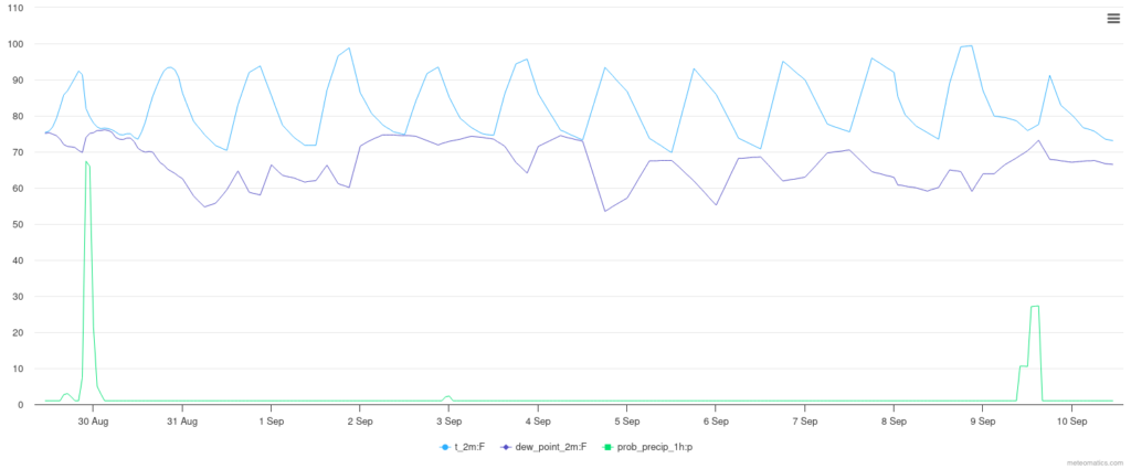
We may also see dewpoint values down in the 60s next week. That means the humidity will fall off a bit, too, allowing temperatures to get slightly warmer.
[wpcode id=”41149″]
REGIONAL DAY TO DAY FORECAST
Today: Mostly sunny with a few storms possible. Humid with highs in the lower 90s. Northeast winds 5 to 10 mph. Chance of rain 40 percent. Heat index values up to 106.
Tonight: Partly cloudy with a few lingering storms before midnight. Humid with lows in the lower 70s. North winds 5 to 10 mph. Chance of rain 30 percent.
Wednesday: Mostly sunny with a few storms possible. Not quite as widespread. Highs in the lower 90s. North winds 10 to 15 mph. Chance of rain 20 percent.
Wednesday Night: Mostly clear. A slight chance of showers and thunderstorms in the evening. Lows around 70. North winds 5 to 10 mph. Chance of rain 20 percent.
Thursday: Sunny. A slight chance of showers and thunderstorms in the afternoon. Highs in the mid 90s. Chance of rain 20 percent.
Thursday Night: Mostly clear with a slight chance of showers and thunderstorms. Lows in the lower 70s. Chance of rain 20 percent.
Friday: Mostly sunny with a isolated storms possible. Highs in the lower 90s. Chance of rain 30 percent.
Friday Night: Partly cloudy with a few lingering storms. Lows in the lower 70s. Chance of rain 10 percent.
Saturday: Mostly sunny with isolated storms possible. Highs in the lower 90s. Chance of rain 30 percent.
Saturday Night: Partly cloudy with a slight chance of showers and thunderstorms in the evening, then mostly clear after midnight. Lows in the lower 70s. Chance of rain 20 percent.
Sunday: Mostly sunny with a few storms possible. Highs in the mid 90s. Chance of rain 20 percent.
Sunday Night: Mostly clear. Lows in the lower 70s.
Labor Day: Sunny. Highs in the upper 90s.


Looking into the future, what I’ll be watching is what Idalia does after it goes across FL and gets into the Atlantic.