As we look ahead to the next few days, the most immediate weather concern over the CONUS is Hurricane Idalia. The hurricane is currently expected to make landfall sometime on Wednesday (most of the models I have looked at currently suggest landfall late morning Wednesday). The National Hurricane Center currently forecasts the hurricane to make landfall Wednesday morning as well.
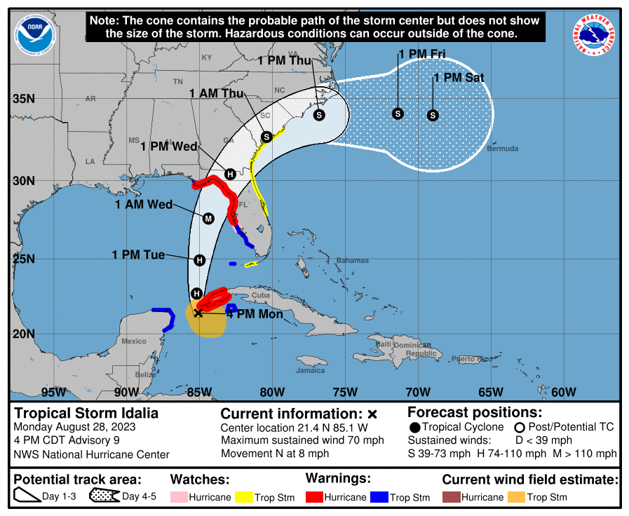
The hurricane may even reach major hurricane status (Category 3+), so this is not a system to ignore. Moisture in the Gulf is favorable for strengthening, and the warm waters of the Gulf will also aid in strengthening. Mild to moderate shear may be present over the Gulf, so my guess is the extent of Idalia’s intensification will depend on how much shear is present (more shear is less favorable for hurricane growth).
It is important to note that this forecast cone is a forecast of possible paths the center of the storm might take based on current model guidance. It has nothing to do with the size of the storm, and hazardous conditions such as strong winds and flooding rain will likely exist outside the cone. Additionally, the forecast cone can shift as models update.
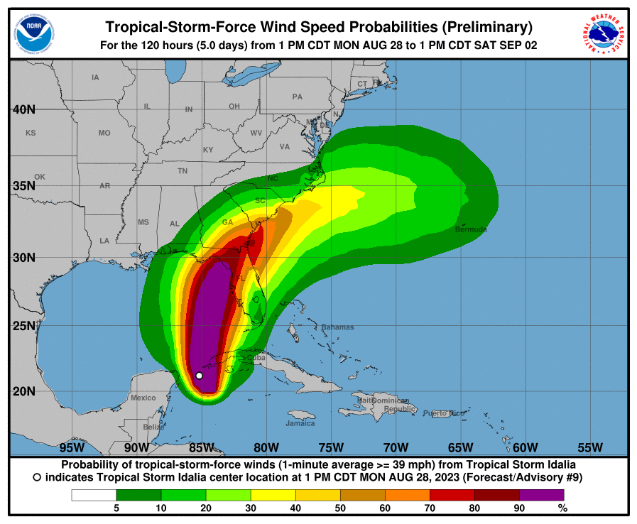
As the chart above shows, the threat for tropical storm force winds exists outside the forecast cone. I would advise anyone in the Florida area or in the coastal areas of Georgia and the Carolinas to monitor the forecast for updates. For the Atlantic coast regions in the threat area, a big factor in storm strength will be whether the center of the system stays inland as it passes over Georgia and the Carolinas or whether it moves offshore (and if so, how far offshore).
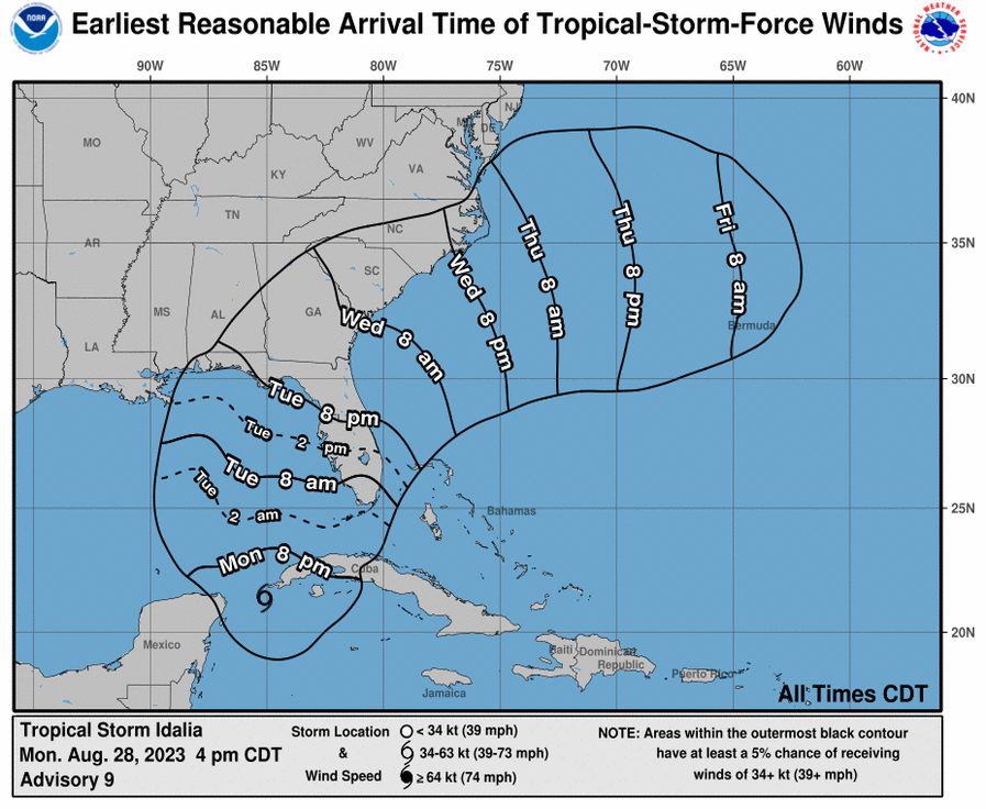
The above map shows the earliest reasonable time tropical storm force winds may arrive in any given location. That is, the winds may arrive later, but this is the earliest one would reasonably expect them to arrive, so ideally, all preparedness or evacuation plans should be completed before this time. Also, this map includes all areas with a 5% or greater chance of seeing tropical storm force winds (as referenced by the previous map), so there is no guarantee that everywhere in the outline will see tropical storm force winds (particularly at the edges of the outlined region), but it is better to be safe than sorry.
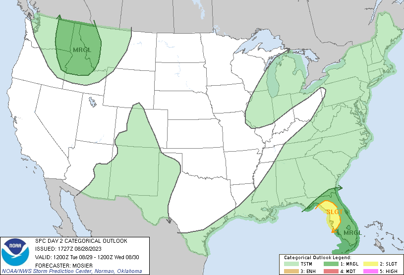
Besides the strong winds and the threat of flooding, some areas may also see a tornado threat from Hurricane Idalia. The risk areas highlighted by the SPC over Florida and the Atlantic coastline are mainly reflecting the tornado risk on those days, with the greatest risk in the Slight Risk area. The tornado threat with tropical cyclones is greatest in the right front quadrant region of the cyclone.
To find this region of the storm, look at which way the cyclone is moving and imagine the leading edge as the “front” of it, and the right front quadrant will be on the right (and front) side of this. For this hurricane, this region should be on the east to northeast side of the storm.
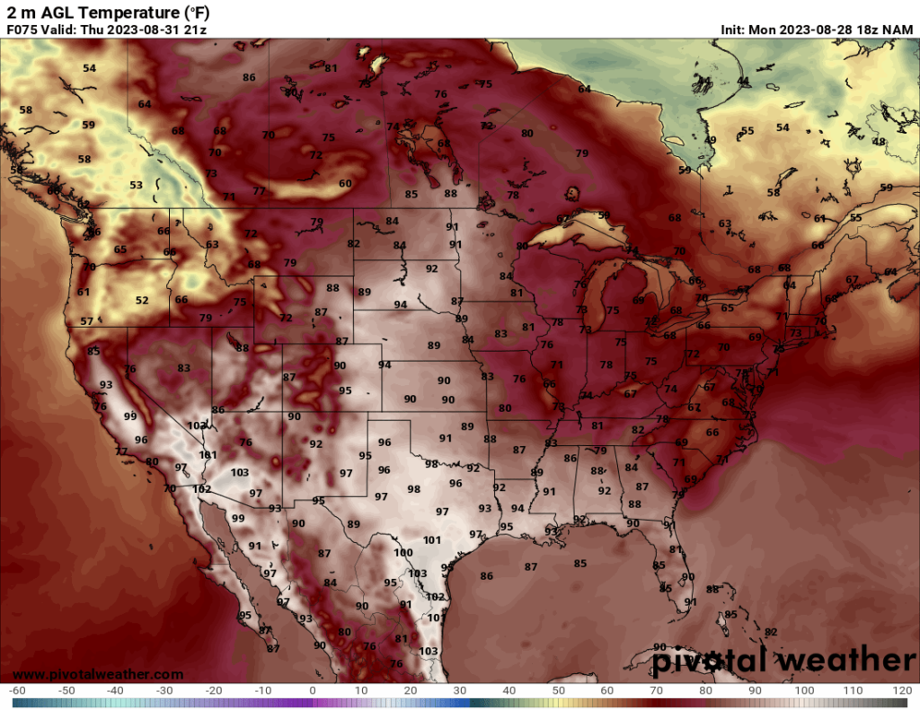
As for the rest of the US, the next few days should see a break from the intense heat over much of the US. Temperatures will still be warm to hot across the south and central CONUS, but it will be more manageable than the previous few weeks. The one exception is an area over the Desert Southwest, with some areas continuing to reach the mid 110s on Tuesday and possibly Wednesday. Those areas are currently under an excessive heat warning.
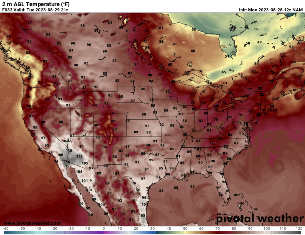
Temperatures over the Northeast and Pacific Northwest will be fairly mild over the next few days, with high temperatures cooling into the 70s and 60s across much of those regions.
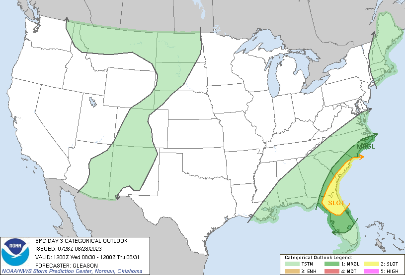
One last thing I would like to note for this forecast is the marginal severe threat over parts of the Northwest on Tuesday. If you refer to the SPC Day 2 map above, there is a Marginal Risk outlined over parts of Washington State, Idaho, Oregon, and Montana. The greatest threat for these storms, according to the SPC, is for damaging winds and hail. The storms are expected to form ahead of a negatively-tilted trough.
A negatively tilted trough means that the trough axis runs from SE to NW (while a neutral trough’s axis would run south to north, and a positively-tilted trough’s axis would run SW to NE). Negatively tilted troughs tend to provide more favorable conditions for lift. Additionally, the air east of a trough tends to rise, which will also provide a lifting mechanism. The relatively strong upper level winds will also provide shear, which is supportive of severe storms. The forecast CAPE (instability) is not impressing me that much, and the moisture may be a bit lacking too, so I would assume that is the reason the SPC has a marginal risk despite the favorable lift and shear.
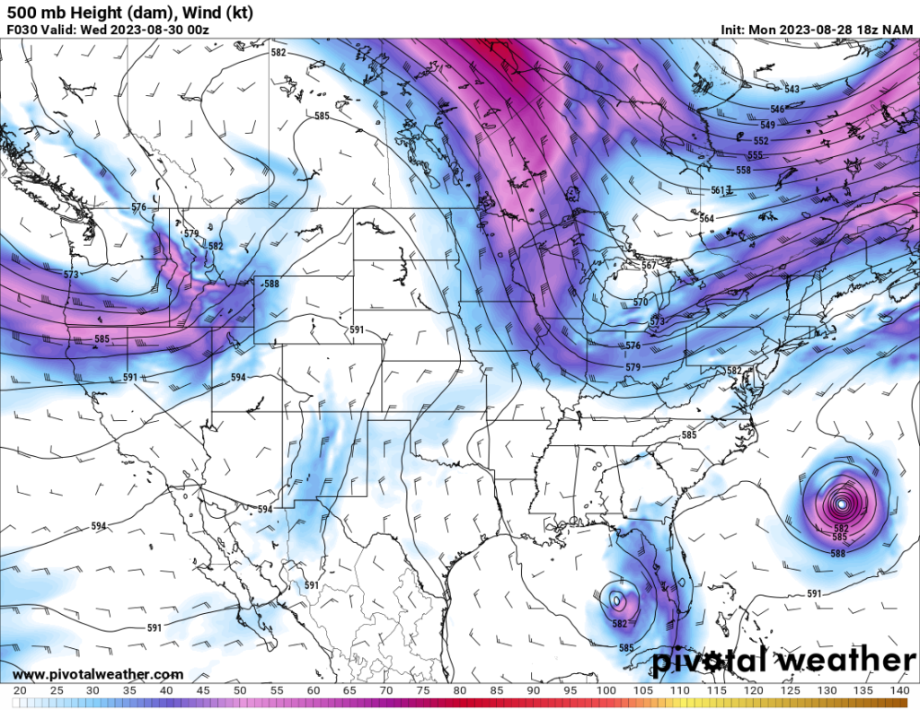
The most likely storm mode is linear, which means a line of storms will move through the area Tuesday afternoon into overnight. As stated before, the biggest risk is isolated damaging winds and hail, but I would not expect these impacts to be widespread, owing to the low instability and moisture.


Thank you Patrick! This was one of the best weather briefings I’ve had in a long time! You made it interesting and easy for everyone to understand. I have no doubt you will achieve your dream! Nice job!