Keep your friends and family safe by monitoring your phones and local news as these relentless storms continue to drench those in southern Mississippi. Heavy showers that have triggered flash flooding warnings in Pearl River and Hancock counties are moving northeast towards Hattiesburg and Laurel, which need to stay on watch for possible flash flooding, strong wind gusts, and a brief tornado.
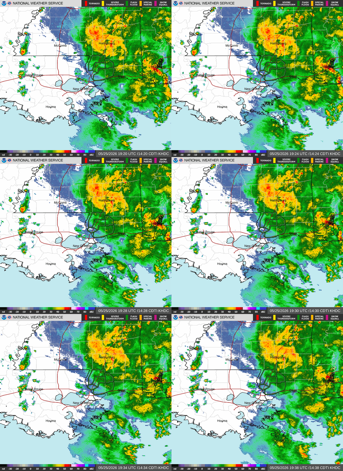
While Louisiana is enjoying partly cloudy skies with few scattered storms, please keep in mind that flash flooding can develop within minutes to hours even in areas that aren’t actively receiving rain!
As we look forward, this week, there will be more widespread, repeated rounds of rain/thunderstorms capable of triggering flooding.

TODAY
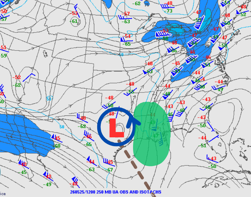
The set-up today is quite interesting! Taking a peek at the 12z (7 AM) maps and the jet stream, which is the first-order of control for what’s happening down at the surface, the map below shows a negatively tilted trough with a low. Thus, unsettled weather is occurring over the eastern half, as highlighted in green.
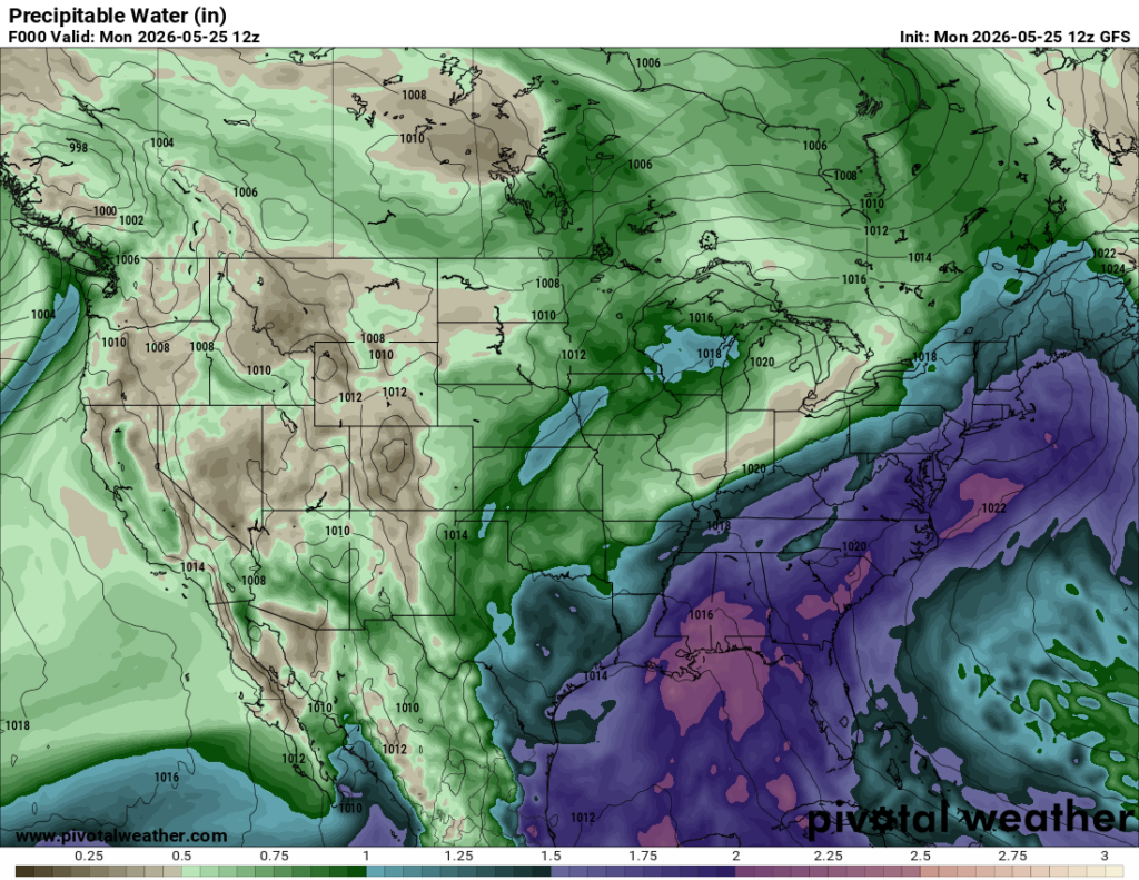
High precipitable water values are shown below (around 2”). This doesn’t necessarily mean we’ll get 2” of rain, but it does mean storms will have a massive reservoir of tropical moisture to tap into!
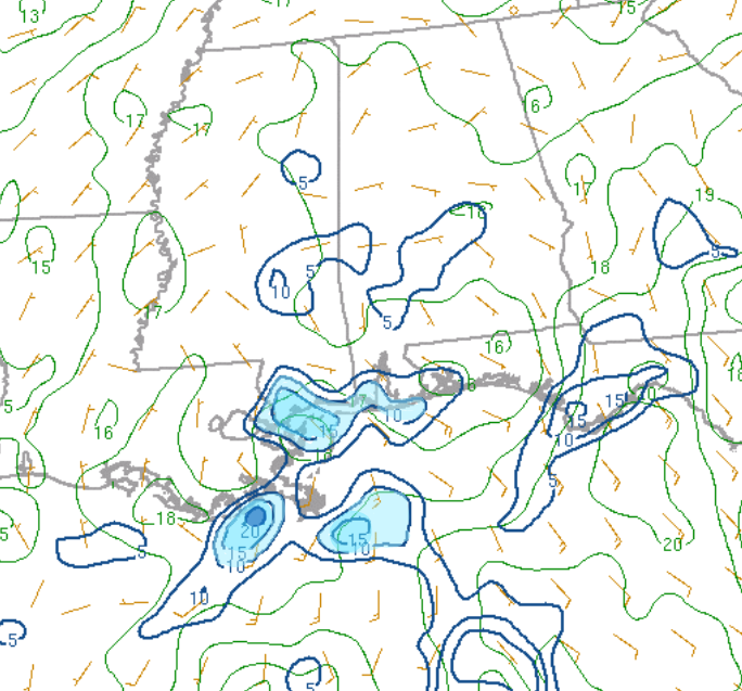
Moisture convergence is basically where moist air is colliding and has nowhere to go but up, cooling and condensing into clouds. Strong convergence (our area highlighted in blue) is providing the lift needed for these repeated rounds of heavy rain.
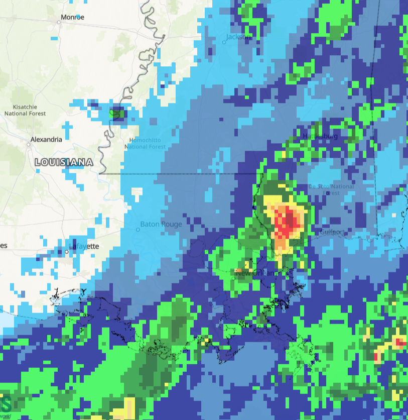
Some storms will be capable of producing rainfall rates of 1–3 inches per hour, which could lead to flash flooding and impassable roads across much of southeast Louisiana and coastal Mississippi. The map below shows 3–5 inches of total rainfall in Pearl River County and combined with the 2–5 inches received this weekend….no surprise there is a Flash Flood Warning in effect.
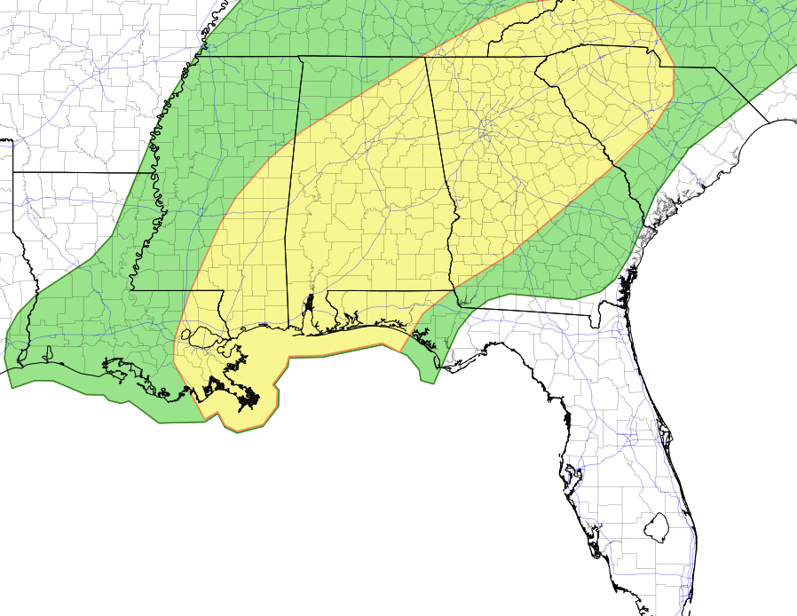
There is Slight Risk (Level 2/4) of Excessive Rainfall, meaning there is a risk of isolated significant flash flooding, along with minor river flooding, both today and tomorrow across the area highlighted in yellow below.
TONIGHT/TOMORROW
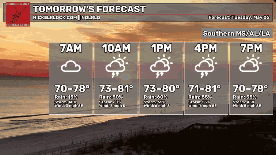
This evening and overnight we will see a brief break in the rain followed by the return of storms tomorrow morning, with short range models showing heaviest rainfall near Hattiesburg and Bogalusa. Slight risk of excessive rainfall is in place, continue watching roads and areas of poor drainage for flooding!

THE DAY AFTER TOMORROW
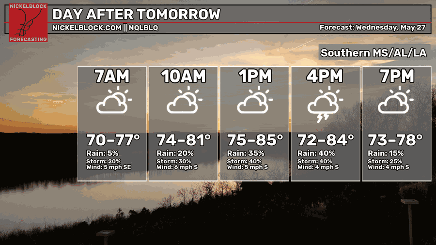
Another dry slot is expected Tuesday night before storms return Wednesday afternoon. Ensembles show heaviest rainfall near Baton Rouge and Zachary. Highs near 85, with humidity making it feel about 10 degrees warmer.
EXTENDED OUTLOOK
High rain chances and typical late May temperatures with highs peaking into the 80s will be possible each day this week. It’s important to note, humidity will make it feel 10-20 degrees warmer!
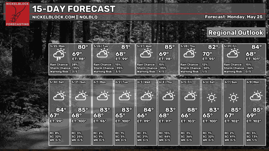
Wet pattern is here to stay this week, but drier conditions return late this weekend into early next week!
DAY-BY-DAY FORECAST
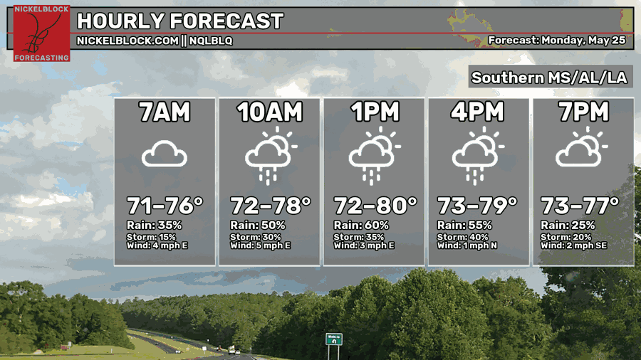
Today – A chance of showers and thunderstorms before 8pm. Mostly cloudy, with a high near 80. Calm wind.
Tonight – A calm night ahead with low chances of rain. Mostly cloudy, with a low around 70. Calm easterly wind.
Tuesday – High chance of showers and severe thunderstorms, mainly after 7am. Highs near 81 with humidity making it feel 10 degrees warmer. Calm wind becoming south around 5 mph in the afternoon
Tuesday Night – Chances of storms significant decrease after 10pm. Partly cloudy, with a low around 70. South wind around 5 mph
Wednesday – Heat and humidity continue building with highs near 85, but experienced temperature nearing 100. Showers and possibly thunderstorms all day. Calm southerly wind.
Wednesday Night –High chance of showers/thunderstorms before 1am, then becoming mostly cloudy with a low around 70. Calm wind.
Thursday – Storms continue, watch for flash flooding. Humid with highs near 82.
Thursday Night – Low chance of showers/thunderstorms. Lows near 70.
Friday – Numerous showers and thunderstorms expected. A bit warmer with highs near 84.
Friday Night – A few showers and storms may linger overnight under mostly cloudy skies. Low near 70.
Saturday – Wet weather hangs around into the weekend with additional showers and thunderstorms likely. Highs stay in the mid 80s.
Saturday Night – A few showers and storms may linger overnight under mostly cloudy skies. Low near 70.
Sunday – Low chance of showers and thunderstorms. Mostly sunny, with a high near 85. Calm wind becoming north around 5 mph
Sunday Night – A few showers and storms may linger overnight under mostly cloudy skies. Low near 70.
Next Monday – A warm and quiet start to the week with part sunshine. Highs climb to near 85 with a light south breeze at 5 to 10 mph.


