Hey all! I’m back with another National CONUS Forecast for you all! Most of the country has seen a LOT of rain in the past week. Looking at the week ahead as a whole, the pattern appears to remain favorable for multiple systems to pass through the country, soaking those under their paths. Let’s get into the details:
Today’s Overall Setup
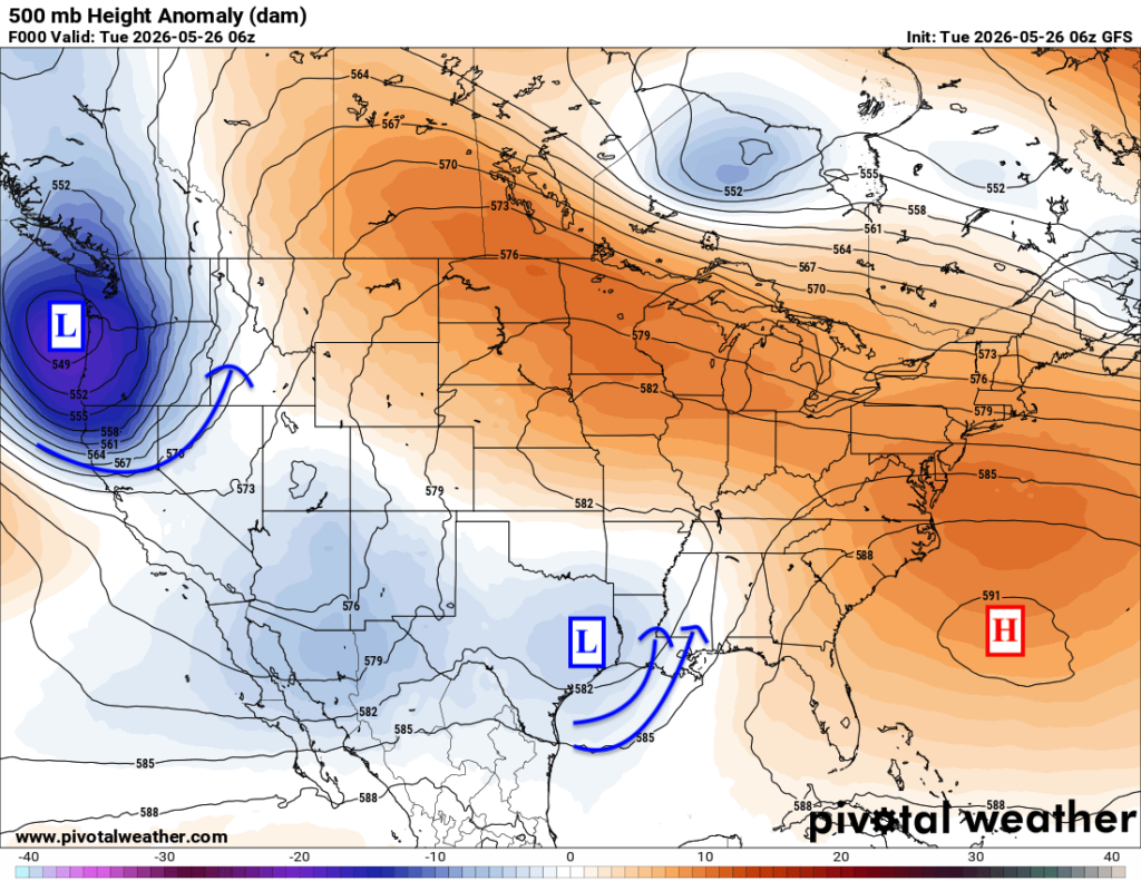
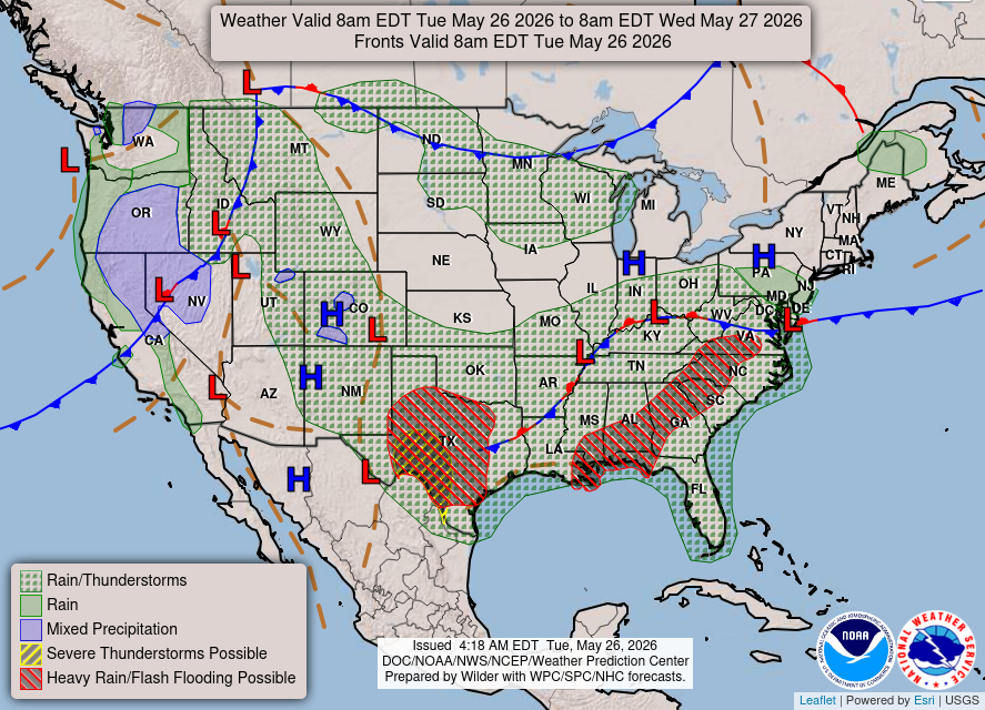
Taking a look at the 500 mb pattern, which is about 18,000 feet above the ground, we have a pretty active setup across a few parts of the country. There is troughing over the south-central U.S. and another trough near the Pacific Northwest. These troughs are helping to bring more unsettled weather, with rain and thunderstorms across parts of Texas, the lower Mississippi Valley, the Southeast, and back into the Northwest.
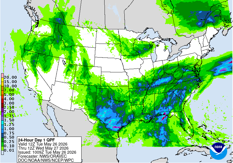
At the surface, there are also several lows and frontal boundaries helping to focus where the rain and storms set up. You can see that pretty well on the WPC map, with some of the heavier rainfall showing up from Texas into the Gulf Coast and Southeast. This is where some locally heavier downpours are possible, especially where storms can train or sit over the same areas for a while. The Northwest is also dealing with another round of rain as that trough stays nearby.
Farther north, ridging is starting to build back in across the northern tier. This is a much nicer change after much of Memorial Day weekend was stuck under troughing, which kept many areas cooler, cloudy, and rainy. As the ridge builds in, we are finally seeing more sunshine return, and temperatures are starting to climb back to more spring-like levels again. So overall, the active and wetter pattern stays focused across the South/Southeast and Northwest, while the northern tier begins to dry out and warm back up.
Today’s Severe Weather Threat
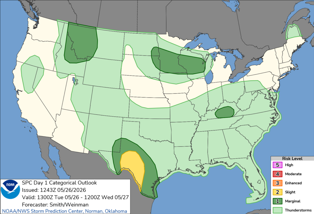
Taking a look at Today’s severe weather threat, the SPC has outlined four areas. The most prominent area to watch is southwestern Texas, which is under a Slight (Level 2 out of 5) risk. Some strong-to-severe storms are possible there this evening as an upper-level low brings in energy, with moderate wind shear and CAPE in place to get things going after sundown. All hazards are on the table, including wind, hail, and one or two tornadoes if any supercells form.
In the other three risk zones, including Kentucky, the Upper Midwest, as well as Montana and Idaho, some storms could fire up today, but it’s not a widespread severe weather event by any means. If you are in these areas, keep an eye on the sky throughout the late afternoon and early evening hours.
All areas in the lightest green have a risk of some non-severe thunderstorms today, including a large area of the U.S.
Tomorrow’s Weather
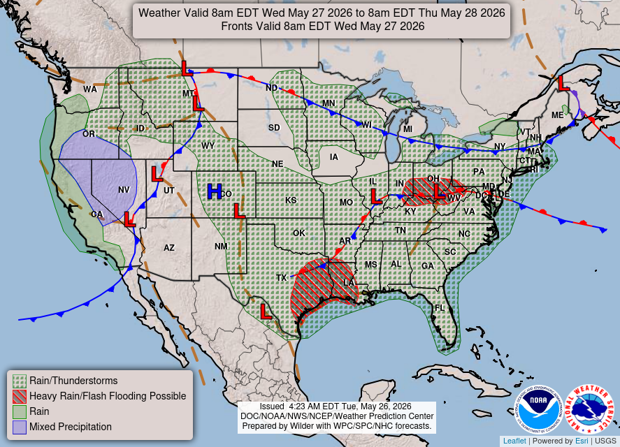
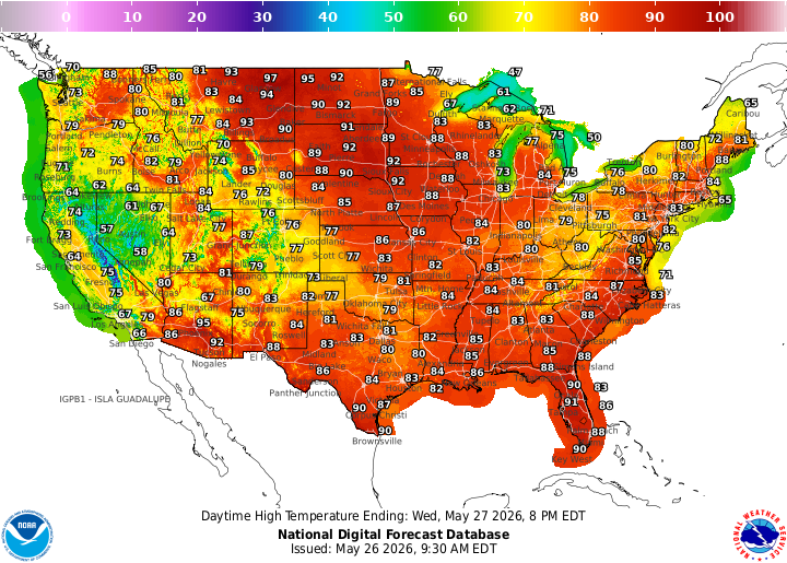
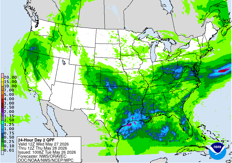
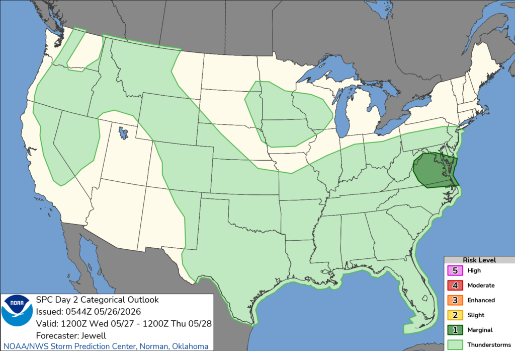
Tomorrow stays unsettled for a lot of the country. A front will stretch from the northern Plains into the Great Lakes and Northeast, helping to spark showers and thunderstorms along and ahead of it.
The main areas to watch for heavier rain look to be Texas into the western Gulf Coast, and then parts of the Ohio Valley into the Mid-Atlantic. WPC does highlight a flash flooding concern in a few spots, so any storms that repeat over the same areas could cause some issues.
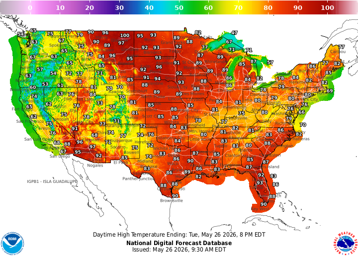
Temperature-wise, it will feel more like late May, with a lot of 80s from the Plains to the East Coast, and some 90s showing up across Texas, Florida, and the northern Plains. Severe weather does not look overly widespread, but SPC does have a Marginal Risk in parts of the Mid-Atlantic, where a few storms could produce gusty winds and heavy rain.
CONUS Weekly Temperature & Precipitation Outlook
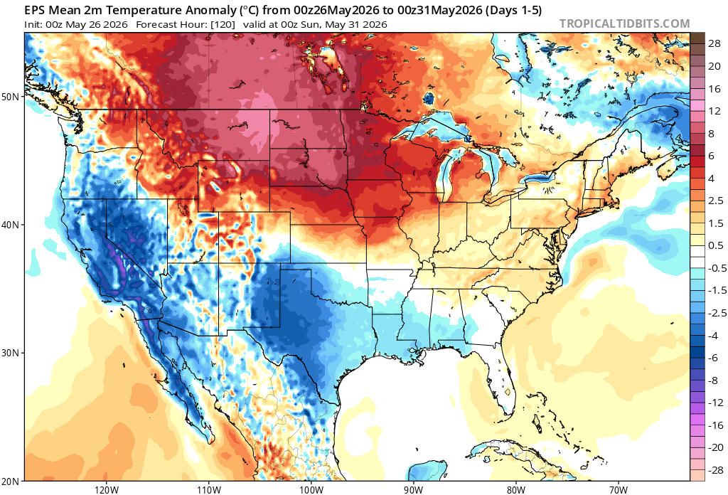
Here’s a look at the EPS modeled temperature anomalies through Sunday. Red indicates above-average temperatures on average for the week, white indicates average temperatures, and blue indicates below-average temperatures.
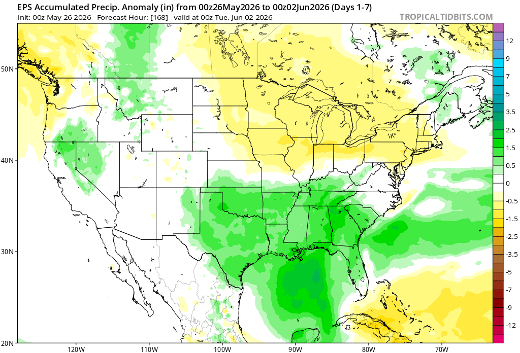
Here’s a look at the EPS modeled precipitation anomalies through next Tuesday. Green indicates above-average precipitation, white indicates average precipitation, and yellow indicates below-average precipitation. Let’s look into the details by region:
Weekly Outlook: Western & Central United States
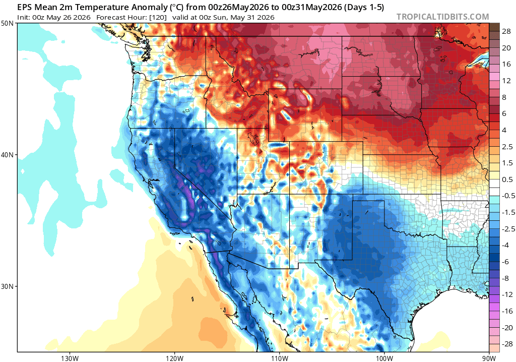
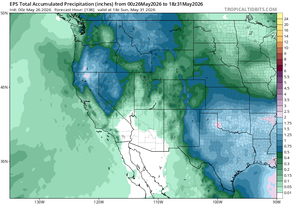
Through Sunday, the EPS shows a pretty sharp temperature split across the West, with above-normal temps across the Pacific Northwest and northern Rockies, while the Southwest into the southern Rockies stays cooler than normal. That cooler look lines up with troughing nearby, which also helps keep some unsettled weather around. The wetter signal is mainly focused from the Northwest into the northern Rockies, with another area of rain showing up across parts of Texas and the southern Plains, while the desert Southwest looks much drier overall.
Weekly Outlook: Eastern United States
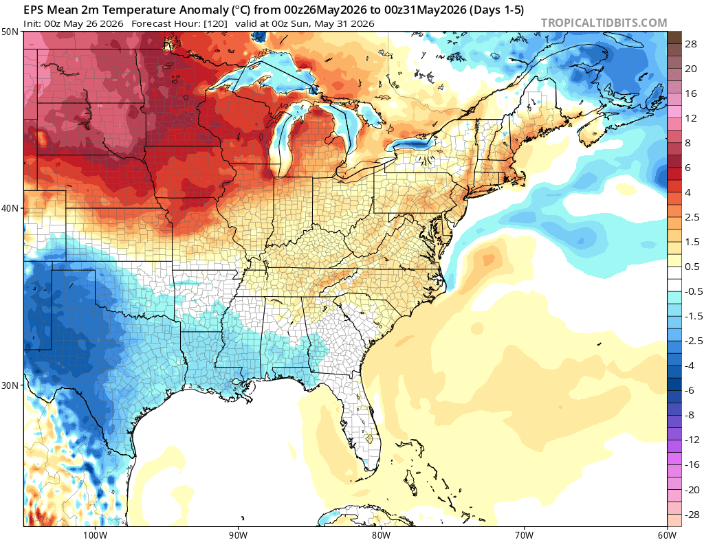
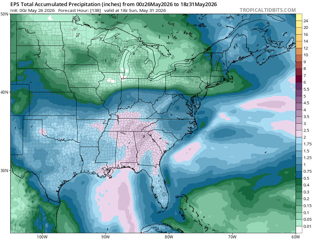
For the East through Sunday, the EPS keeps things pretty unsettled, especially from the Gulf Coast into the Southeast, Appalachians, and Mid-Atlantic. A lot of this is tied to an active subtropical jet, which helps send deeper moisture north and east out of the Gulf. As that moisture runs into the frontal boundary, we get better moisture convergence, so it makes sense that the heavier rain signal shows up from the Southeast into the Mid-Atlantic. Temperatures look closer to normal for many, or even a little warmer than normal across the north, but areas stuck under more clouds and rain, especially across the Southeast, may run a little cooler.
Extended Outlook
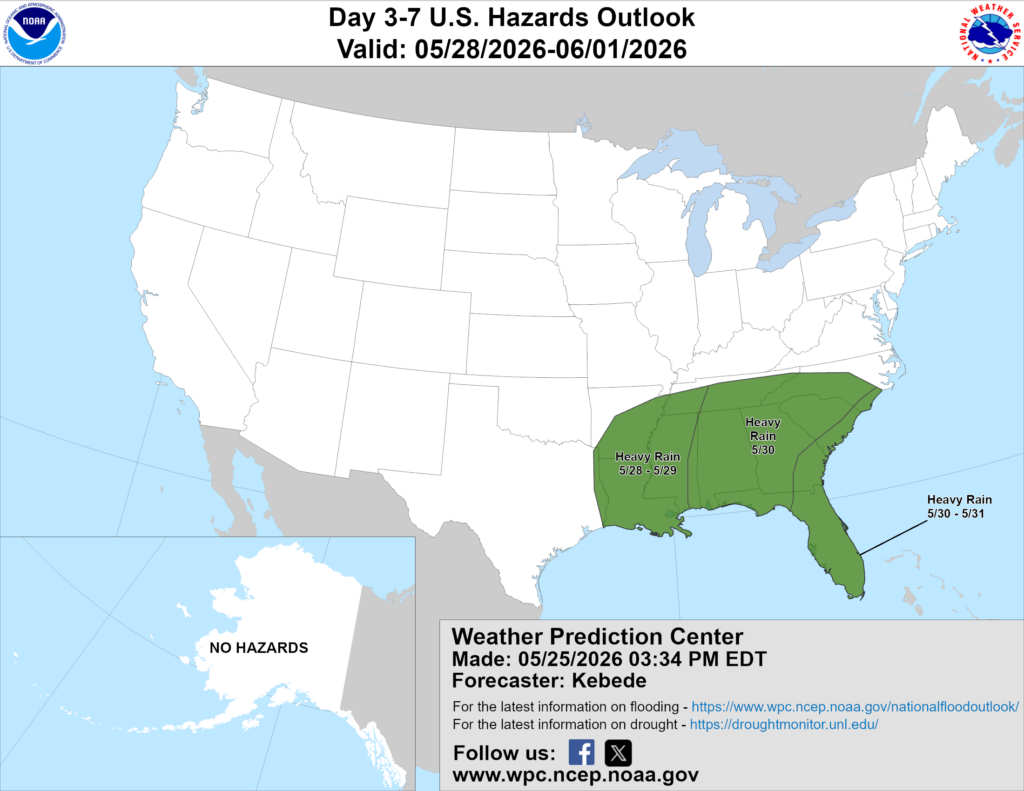
Above is a look at the U.S. Hazards Outlook from NOAA, highlighting areas of more impactful weather to be aware of over the next 3 to 7 days.
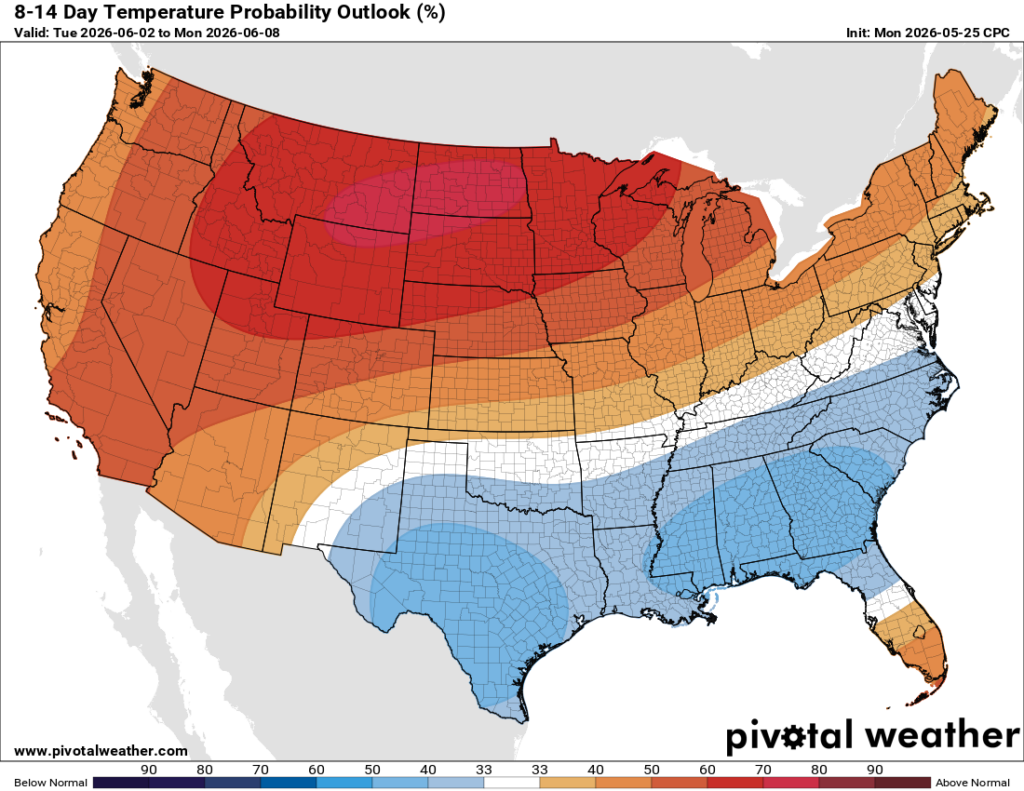
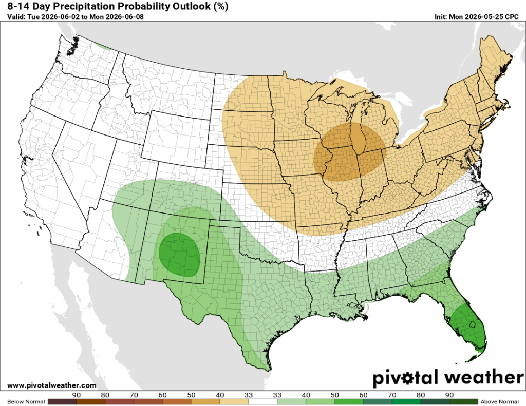
Looking ahead to the 8-14 day period, which would bring us into NEXT week, we can clearly see that the ridge in the northern tier will stick around, bringing warmer-than-average temperatures for much of the western, northern, and northeastern regions, as well as less-than-average precipitation overall. All while the southeast stays cooler and maybe a little bit wetter than average. There’s just so much moisture to tap into as we get into the summer months!
Thanks for tuning in to this National Forecast! Tune in to our local, tropical, and regional forecasts to stay updated on the latest!


