The Pacific is continuing its streak of cyclonic action while the Atlantic finally starts to wake up near the Caribbean. Tropical storm Don is still out there in the northern Atlantic and its path seems to be finally slowing down while new interests take over the scene. Let’s break each one down!
[wpcode id=”41149″]
Four-E in The Pacific
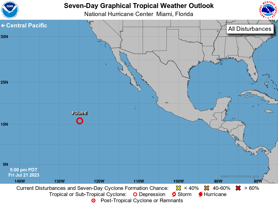
7 Day Graphical Outlook for the Eastern Pacific 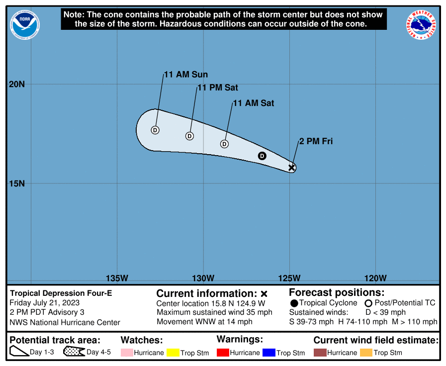
Forecasted Movement Cone for Four-E
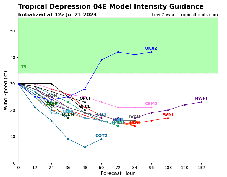
After Calvin last week a new Tropical Depression is in the Pacific this storm has a low chance of development and will most likely stay as a Tropical Depression early today and be lowered to post tropical cyclone status. Most models predict this storm to keep winds low and continue to weaken over the weekend. This weakening is due to the colder water temperatures and upper level winds that will kill further development. Most models show the storm dissipating by Monday and not getting anywhere near Hawaii.
[wpcode id=”41149″]
The Atlantic Picking Up
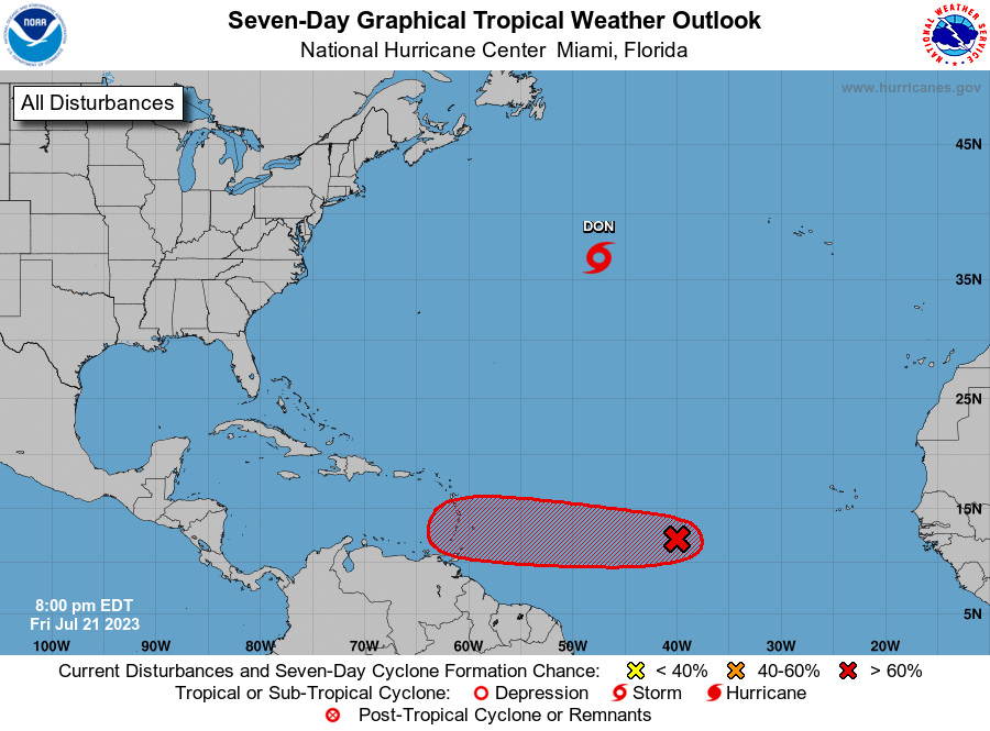
We are still monitoring Tropical Storm Don circling in the middle of the northern Atlantic. Don is brining no impacts to any mainland regions at it maintains tropical storm status for the weekend. However Don will start to dissipate and weaken early this coming week into a depression. The only possible impacts Don has is bringing some rain to the Newfoundland coast. Don will continue to keep stable in the area for the coming week.
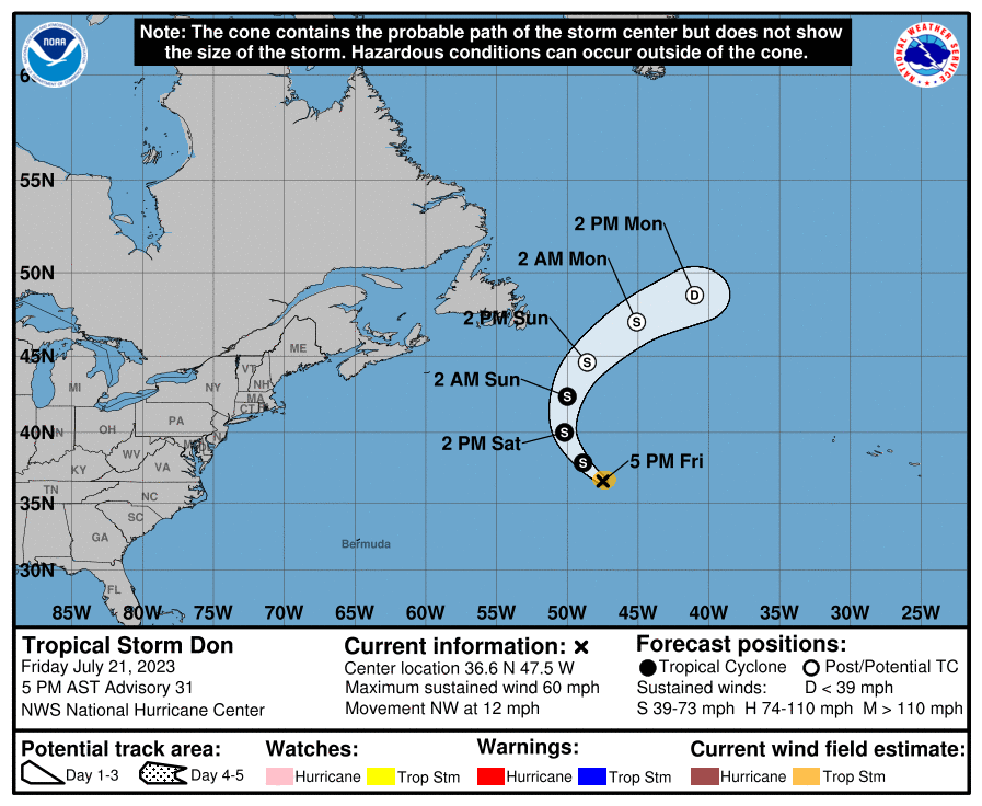
Forecasted Movement Cone for Don // Courtesy: National Hurricane Center – nhc.noaa.gov 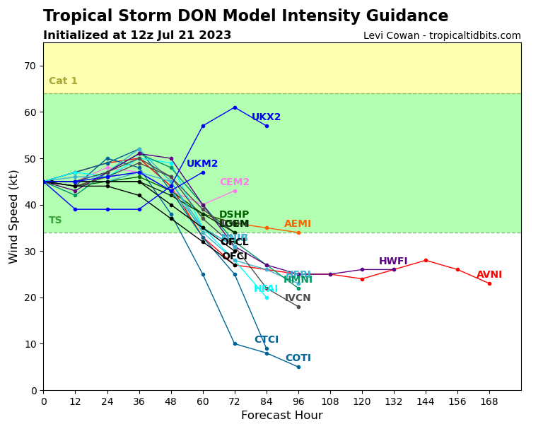
Intensity Over Time for Don // Courtesy: Tropical Tidbits – tropicaltidbits.com
A bigger area of interest comes off the coast of Africa nearing Cabo and the Verde Islands. Invest 95L is making its way westward as its low pressure system of disorganized storms has a 50 percent chance of development within the next two days and 70 percent chance within the next week. Many of the models are all over the place when it comes to how this storm will form. Some predict Hurricane status while others predict it to die out and never reach tropical storm status. Most of the models can agree that it will make a fairly straight path west towards the Caribbean and will definitely bring some rain and thunderstorms to many of the islands in the coming week. This will be one to closely watch.
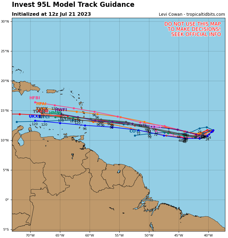
Ensemble Track for 95L 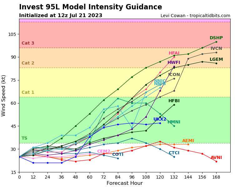
Intensity Over Time for 95L
[wpcode id=”41149″]
Extended Outlook
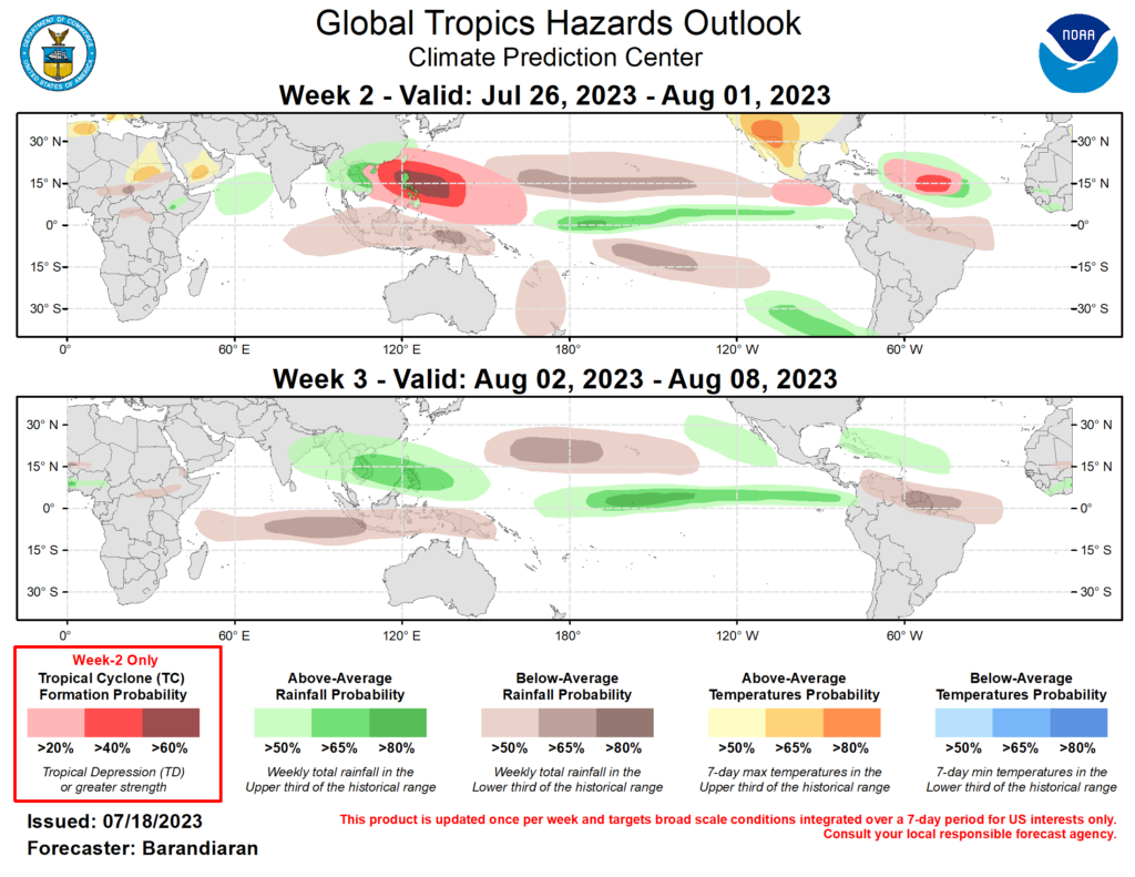
The Atlantic is starting to wake up and will have a few storms to monitor in the coming week. Invest 95L has some potential to grow and create some damage in the Caribbean with or without any official naming. The Atlantic’s conditions are favorable for the rest of July so some tropical cyclones may form during this time. However the beginning of August may be something to watch as we quickly approach August.
In the Pacific off the coast of Mexico is looking like a hotspot for new storms to start. Conditions are favorable with warm sea temperatures and plenty of low pressure areas to contribute to development. We will monitor Four-E but the likelihood of development there is rather low. However in the coming weeks we have a high chance of developments that may just strengthen into stronger cyclones.
[wpcode id=”41149″]
Conclusion
As we get deeper into Hurricane season we are starting to see more developments arise in the previously quiet Atlantic. We will watch Don spin around in the middle of the ocean while we watch invest 95L near the Caribbean. The Pacific continues to make some action as Four-E creates some stormy weather in the eastern Pacific. Further development is unlikely for Four-E but conditions off the coast of Mexico may lead to some more developments in the near future. Be sure to keep updated on all the tropical developments!


