The Eastern Pacific has been continuing to pump out these tropical storms and hurricanes this past week with Tropical Storm Greg and Hurricane Fernanda moving west out into the Central Pacific with another disturbance (Invest 90) to develop in the next couple days. Meanwhile, the Atlantic continues to be uninteresting, for better (for the Southeast) or for worse (for us weather enthusiasts).
[wpcode id=”41149″]
Tropical Storm Greg following in Dora’s Footsteps
Tropical Storm Greg will be passing by Hawaii about 500 miles south in a similar track to Hurricane Dora last week. Luckily for Hawaii however, this storm will not be nearly as intense as Dora which will significantly decrease the likelihood of the wind events seen last week across the islands. Compared to Dora’s 130 knot wind speed, TS Greg will continue to maintain its minimal strength sustained winds of around 30 knots by Friday. Especially after the tough week of recovery after the wildfires, the last thing Hawaii needs is another intense wind storm.
[wpcode id=”41149″]
Hurricane Fernanda
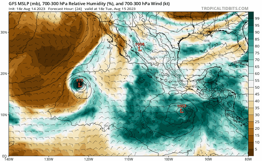
After ramping up intensely over the weekend, Hurricane Fernanda is sustaining winds of around 90 knots as it is making its way near almost due west towards Hawaii. However, Fernanda will not survive long as it heads right into intensely dry swath of air. By Friday, Fernanda will likely just be a tropical depression that could deliver some rain to the islands by the end of the weekend. Though I think what may be catching your eye more in the model below is Invest 90 that will be developing this week.
[wpcode id=”41149″]
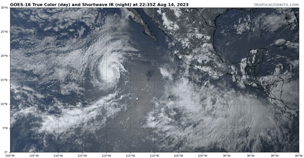
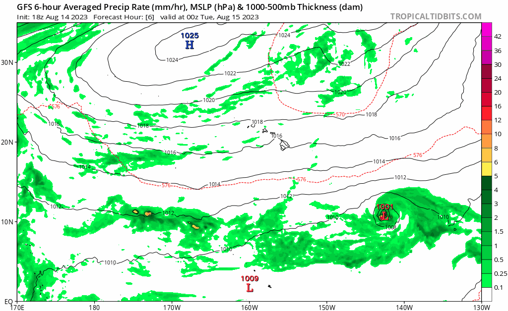
Invest 90 (Hilary) Making Its Way To California

I’ve been recently listening to a song called “It Never Rains in Southern California,” but that might not be the case by next week. There is another strong collection of thunderstorms forming from a tropical wave off the Southern coast of Mexico this week. Given the environmental conditions with plenty of moisture surrounding this storm, Invest 90 is expected to spin up likely to at least Category 3 strength as it follows parallel up the coast of Mexico.
This will definitely be the storm to keep track of for the following days as to whether or not this storm will curl off to the West or head inland. Following the letter G after Greg, Invest 90 will be named Tropical Storm Hilary once it reaches sufficient wind speeds over the next two days. Now the question is: Will we be seeing headlines next week of Hurricane Hilary devastating Southern California? It is difficult to say at this point what the storm will do but it will important to prepare this coming week for whatever may happen in the Southwest.

[wpcode id=”41149″]
The Atlantic Basin

This past week has been a bummer for any Atlantic hurricane enthusiasts but it is likely for the better for all of our friends in the Southeast with no major storms (like Hurricane Ian last year) hitting the area this season. With only one small disturbance off the West coast of Africa, the Atlantic has been under-performing this season with Don being the only hurricane to be produced from the Atlantic as of yet. Although the National Hurricane Center expected a near-average outlook for the season, we have yet to have any major hurricanes develop in the region so far.
This small disturbance is very unlikely to produce anything significant as it slowly makes it way westward. The National Hurricane Center issued a 20% chance of formation if anything at all.
[wpcode id=”41149″]
Extended Outlook
As the Pacific continually is pumping out these storms over the past couple weeks, it is hard to say if the Atlantic will pick up in next couple weeks as we head into September. Although the general conditions remain favorable for convection throughout the Tropical Atlantic, storms are just struggling to really develop. But perhaps this is for the better as the Southeast remains unaffected by tropics this season so far.

[wpcode id=”41149″]
Conclusion
With Hurricane Fernanda and Tropical Storm Greg both expected to dissipate by Friday, Invest 90 will be the storm to look out for this week as it makes it way up the Southern coast of Mexico. Although the Atlantic to looking to remain relatively quiet for the rest of August, we still have the month of September to get through.


