I’m listening to a 20 year old dance song writing this for title context.
I’m providing a little update about the rain for the next couple of days. So far, it’s looking pretty hit or miss. The cold front is coming, but with such a strong ridge over us, it’s going to be pretty hard to squeeze out some rain chances.
Monday
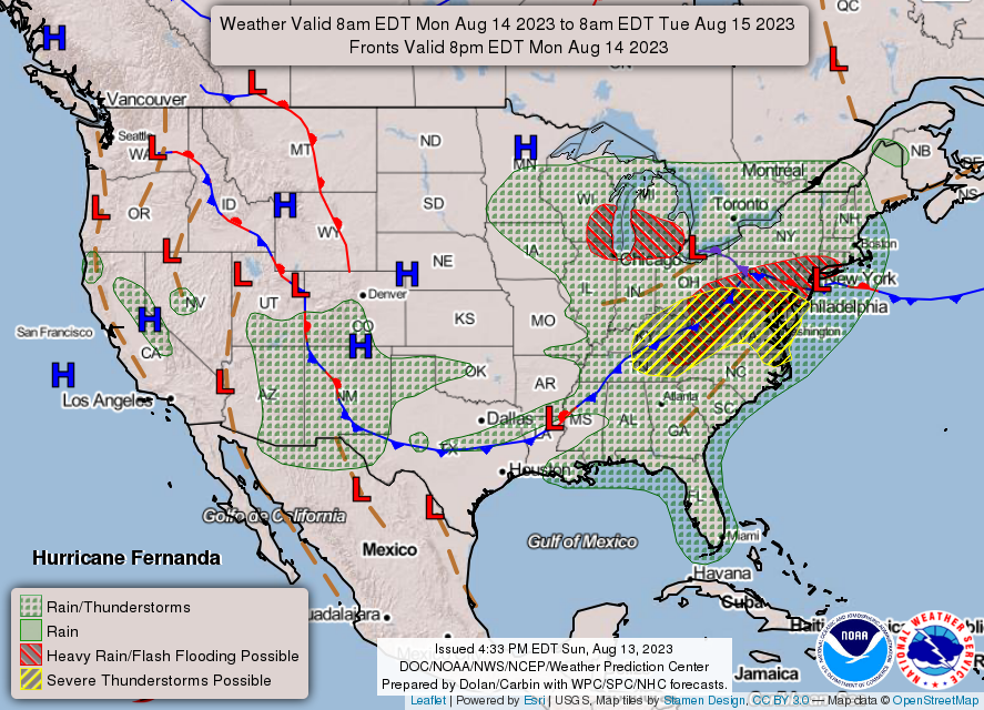
Looking at the surface analysis first, we can see there’s a slim window for rain possible diagonally across southern Mississippi and Louisiana. Most of this rain will hit closer to sunset and into the night due to the very high temperatures and lower dewpoints. While this front is organized, most of these storms will be isolated or scattered which means that it’ll be up to chance (no pun intended) as to who will receive the rain if at all. Temperatures will reach well above 100 tomorrow and heat indices will reach the 110s.

Tuesday

The surface analysis shows the stationary front moving towards the coastline by Tuesday night. This will give us one final chance of rain for the week. Dewpoints look to spike into the low to mid 70s. While the factors like instability and lower LCLs look good, we will have to see if anything can pop off by the time the front passes through. The window looks fairly slim, but it could be possible. The good news, at least for a day or so, temperatures will fall into the low and mid 90s with the passage of the front, so there is a tiny bit of relief!

[wpcode id=”41179″]
Regional Day-to-Day Forecast
Tonight – Mostly clear, with a low around 80. South southwest wind around 5 mph becoming calm.
Monday – Sunny and hot, with a high near 102. Heat index values as high as 113. Calm wind becoming west southwest around 5 mph in the morning.
Monday Night – A 20 percent chance of showers and thunderstorms before midnight. Partly cloudy, with a low around 79. West southwest wind around 5 mph becoming calm.
Tuesday – A 30 percent chance of showers and thunderstorms after 1pm. Sunny and hot, with a high near 98. Heat index values as high as 107. Light west wind becoming north northwest 5 to 10 mph in the morning. Winds could gust as high as 20 mph.
Tuesday Night – A 20 percent chance of showers and thunderstorms before 1am. Mostly clear, with a low around 70. North northwest wind around 5 mph becoming calm.
Wednesday – Sunny, with a high near 93. Calm wind becoming north northeast around 5 mph.
Wednesday Night – Clear, with a low around 68. North wind around 5 mph becoming calm.
Thursday – Sunny and hot, with a high near 98. Calm wind becoming north northwest around 5 mph in the afternoon.
Thursday Night – Mostly clear, with a low around 72. North wind around 5 mph becoming calm.
Friday – Sunny and hot, with a high near 101.
Friday Night – Mostly clear, with a low around 76.
Saturday – A 20 percent chance of showers and thunderstorms. Sunny and hot, with a high near 101.
Saturday Night – Mostly clear, with a low around 76.
Sunday – A 30 percent chance of showers and thunderstorms. Sunny and hot, with a high near 99.
[wpcode id=”41149″]


