Relief from the previous day’s high temperatures look to be on the way, as an approaching cold front associated with a passing upper-level low will sweep through our area and drive down our temperatures a bit. Rainfall will be largely scant as drier air sets in across the area and helps to limit the development of showers and thunderstorms.
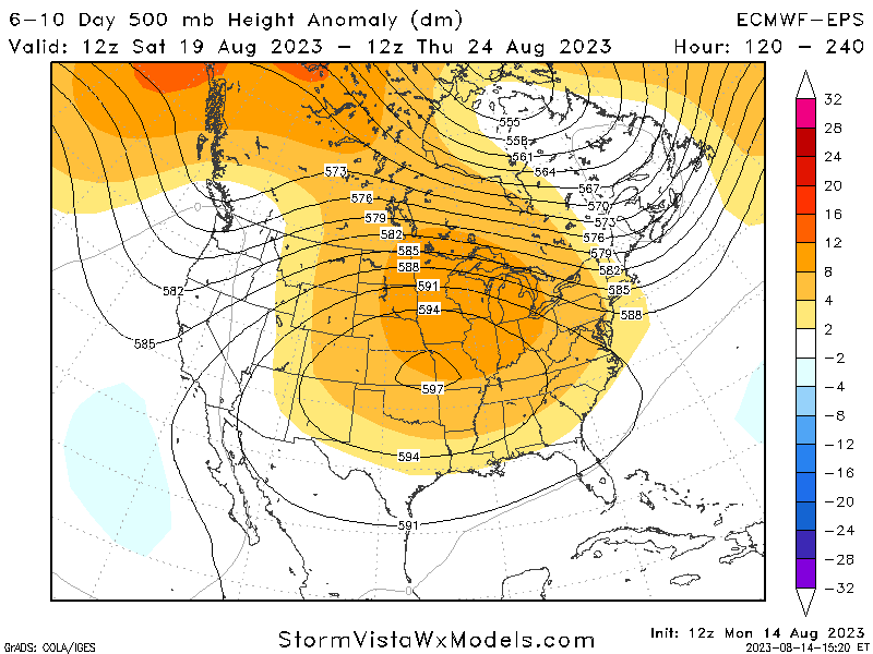
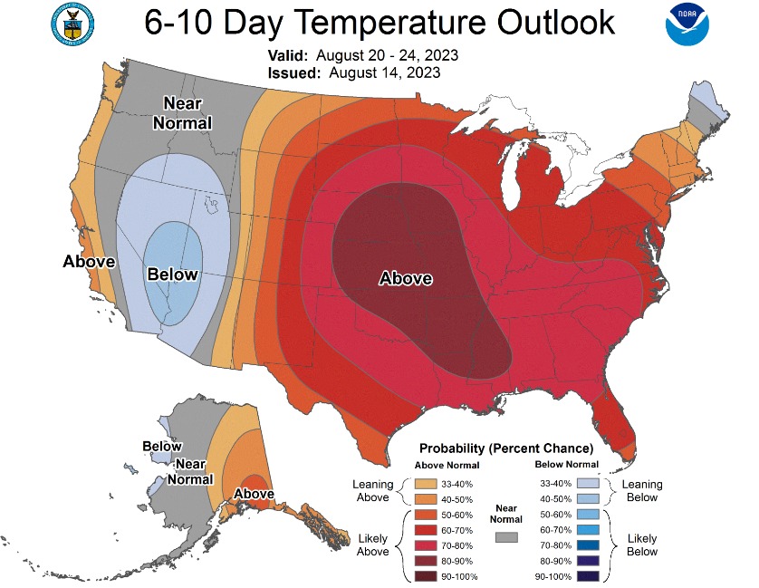
This relief looks to be largely short-lived though, as a rather potent high-pressure system will sit over the central US and bring us back to the scorching temperatures we have been accustomed to up to this point.
[wpcode id=”41149″]
Short-Term Outlook
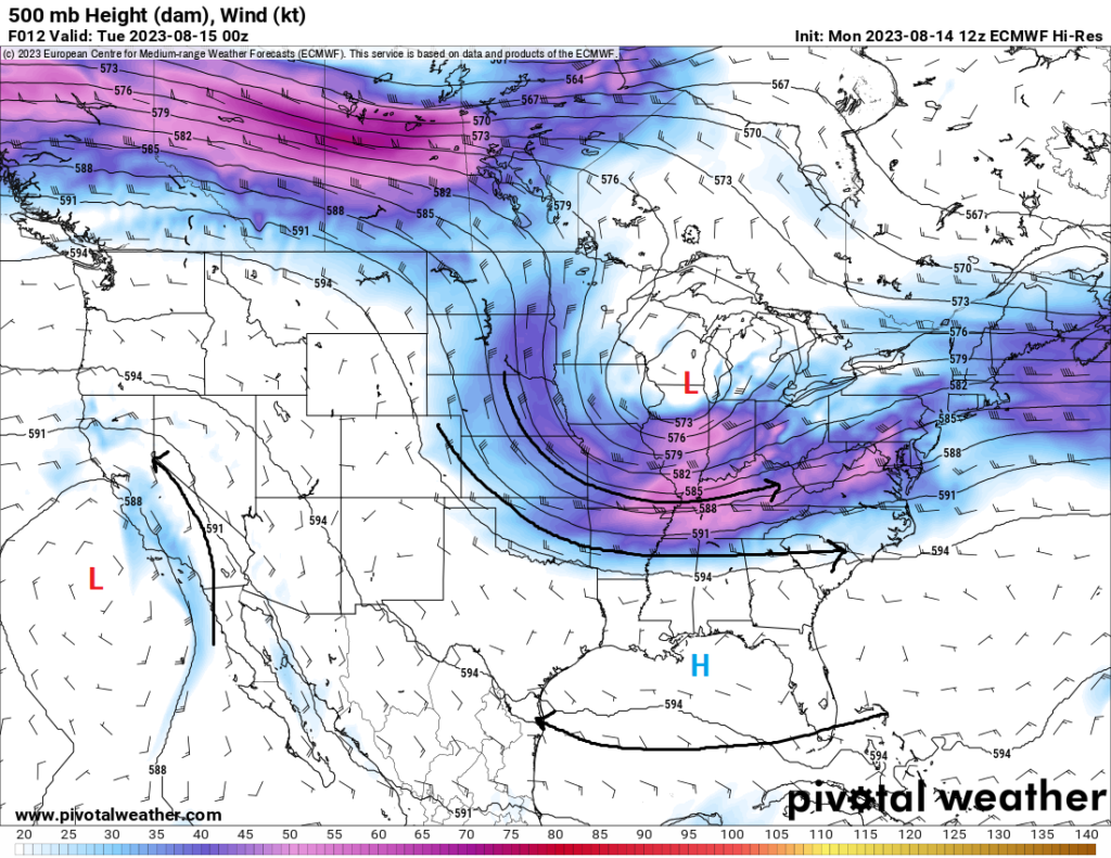
An incoming cold front will gradually sag its way southward throughout the day today before stalling out around the I-20 corridor by the afternoon. Temperatures north of the front will be in the upper 80s to low 90s, as well as noticeably drier air coming in, dropping dew point temperatures into the low to mid 50s. South of the front through, due to the compression of the air being rammed into by the front, temperatures will still be in the upper 90s to low 100s through the afternoon hours. Some relief may materialize in the form of isolated to somewhat scattered showers and thunderstorms, as the air reaches convective temperature and causes it to rise unabated.
By tomorrow, this same cold front will push down to the coast before falling apart. This will help bring that relatively cooler and drier air all the way down to the Gulf of Mexico, and as a result, will keep temperatures in the low to mid 90s across the area. This relief will be short-lived though, as high pressure will build back in by Thursday and cause our temperatures to rise once again back to near or above advisory levels.
[wpcode id=”41149″]
Extended Outlook
Main story over the end of the week and heading into next week will continue to be the heat. Multiple days of temperatures in the upper 90s to low 100s are anticipated as this high-pressure system sits over the central part of the country. Heat indices will regularly reach between 105°F-110°F during this time period and rainfall chances will remain minimal from the increased pressure. We will see if we can get some mesoscale accidents that’ll allow for some window of isolated thundershowers, but the prospect of that is unlikely at this time.
[wpcode id=”41149″]
REGIONAL DAY-TO-DAY FORECAST
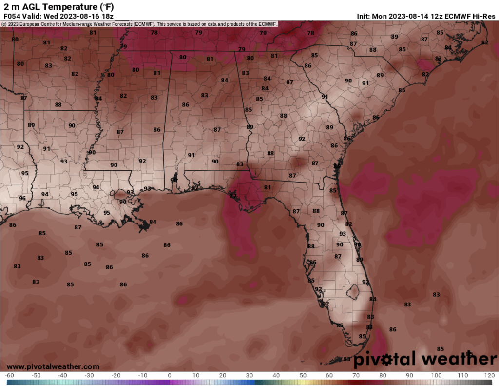
Today: Partly cloudy skies and hot, with a chance of showers and thunderstorms. High temperatures in the upper 90s to low 100s. Heat indices may reach up to 110°F. Chance of rain 30%.
Tonight: Mostly clear skies. Low temperatures in the low to upper 70s.
Wednesday: Mostly sunny skies. High temperatures in the low to mid 90s.
Wednesday night: Clear skies. Low temperatures in the low to mid 70s.
Thursday: Mostly sunny skies. High temperatures in the mid 90s.
Thursday night: Mostly clear skies. Low temperatures in the mid to upper 70s.
Friday: Mostly sunny skies and hot. High temperatures in the upper 90s to low 100s. Heat indices may reach up to 105°F.
Friday night: Partly cloudy skies. Low temperatures in the upper 70s to low 80s.
Saturday: Partly cloudy skies and hot. High temperatures in the upper 90s to low 100s. Heat indices may reach up to 105°F.
Saturday night: Mostly cloudy skies. Low temperatures in the upper 70s to low 80s.
Sunday: Mostly cloudy skies and hot. A stray shower or thunderstorm is possible. High temperatures in the upper 90s to low 100s. Heat indices may reach up to 110°F. Chance of rain 20%.
Sunday night: Partly cloudy skies. Low temperatures in the upper 70s to low 80s.
Monday: Partly cloudy skies and hot. High temperatures in the upper 90s to low 100s. Heat indices may reach up to 110°F.
Monday night: Mostly cloudy skies. Low temperatures in the upper 70s.


