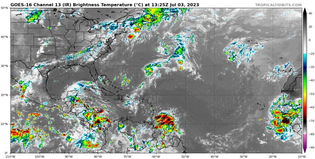
Happy Tuesday everyone! After a busy week of tracking Hurricane Adrian and Beatriz off the south coast of Mexico in the Pacific, the hurricane season is slowing down once again as little activity is expected over the next couple days. Over the next 48 hours, all basins of interest for us are looking to remain relatively calm as environmental conditions in the present are unfavorable for strong convection.
The Atlantic Basin
This week, we are not expecting much activity in the Atlantic Basin. Across the central Atlantic is a strong high pressure situated in an area of very dry air swirling off the Western coast of Africa. There are some areas of convection and storms scattered from tropical waves throughout the Atlantic but none of these organizations of storms will not develop into cyclones.

The Pacific Basin


After an exciting week of activity in the Eastern Pacific, we are looking at more possible development later this week along. With a low pressure system off the Southern coast of Mexico creating an area of organized convection over the next couple days, environmental conditions such as the wind shear and SSTs will be favorable for some cyclone development. We will continue to monitor this collection of storms to possibly develop within the week. Currently, the National Hurricane Center is expecting a 60% chance of formation over the next 7 days.
Meanwhile, the Central Pacific has continued to be uneventful this hurricane season with little development of any disturbances that could spark any cyclones this week.
Extended Outlook

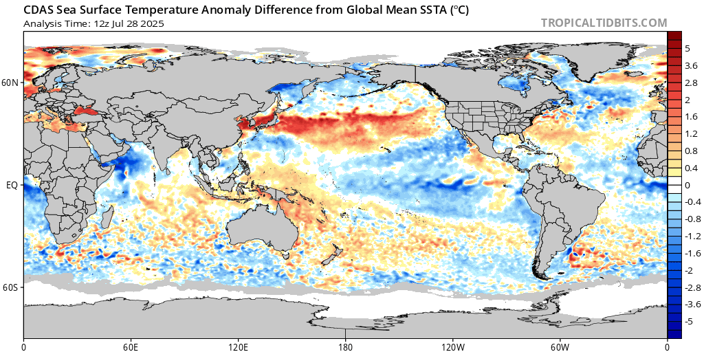
El Nino has been on a slight downward trend the past two weeks but is starting to continue warming up again as we are currently sitting at around 0.8 C above the 30-year average climatology. About half way into the 2nd week in June was the warmest anomaly we have seen so far at 1.0 C above average but we could see spikes up to 2.0 C. We are still seeing a large portion of cold water in the Eastern Pacific off the Western coast of the US however that will hinder any major hurricane development for any storms moving up the coast. The Atlantic Ocean is also remaining relatively warm for this season, especially in the East along the Western coast of Africa.
Conclusions
As of this week, the Eastern Pacific will be the basin to look out for in terms of tropical development for possible cyclones. While the Eastern Atlantic is expecting little chancr for development over the next week.


