In both the Eastern Pacific and Atlantic there are currently no named systems active. This downtime in the Atlantic has been welcomed while the Eastern Pacific has seen quite the number of storms so far.
Eastern Pacific
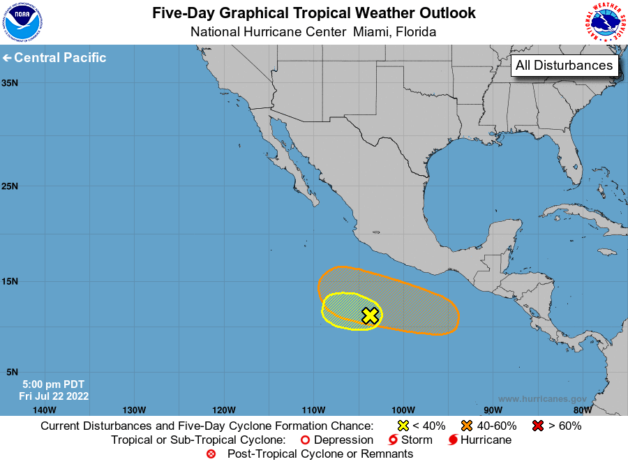
So far this season, the basin has seen Agatha through Estelle plus the Atlantic’s Bonnie for a total of six named storms. Five of the six storms have been hurricanes with two major hurricanes. So, the Eastern Pacific has been pretty active. Currently, the NHC is monitoring two areas of potential development. In the image below, the area highlighted in yellow has a low chance of development over the next five day. The area in orange has a higher chance for development at 40-percent over the next five days.
Atlantic
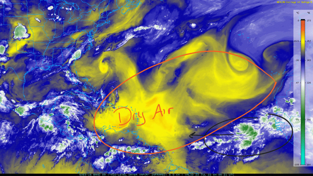
The Atlantic basin is still quiet with no areas of concern. From the NHC, no tropical systems are expected over the next five days. There is plenty of dry air in the Atlantic along with a decent amount of the Saharan Air Layer which is helping to prevent any deep convection. There are some clusters of thunderstorms near the Intertropical Convergence Zone west of the African Coast. These are not organized in any way and face that dry air ahead of it. No development from these are expected.
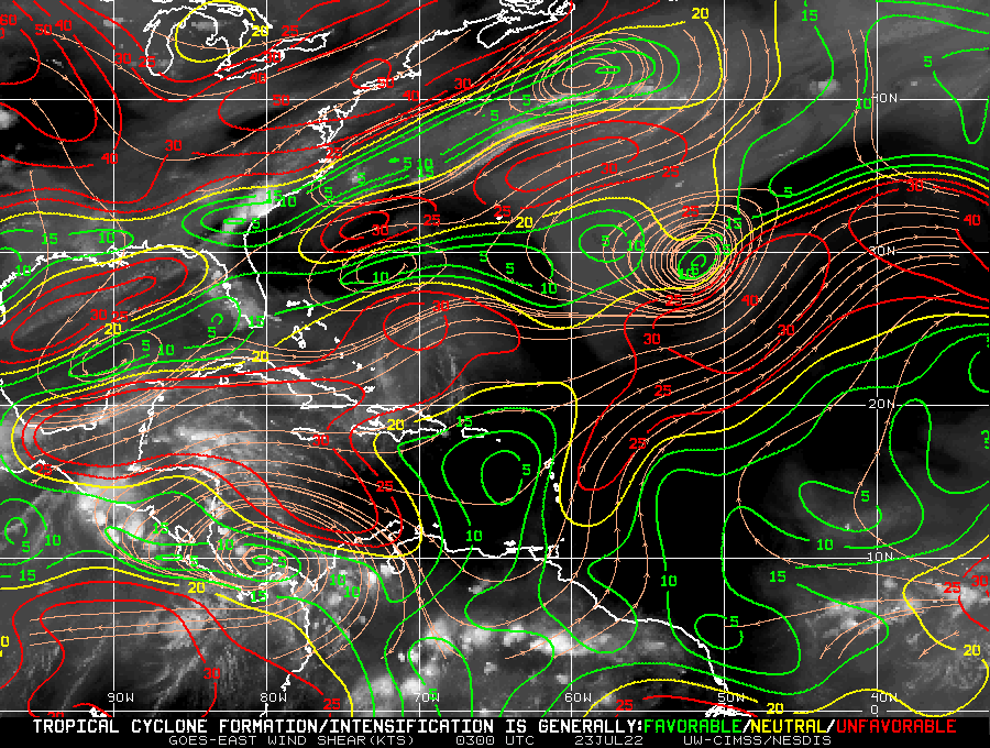
In addition to the dry air, there is still plenty of wind shear in the atmosphere. Strong wind shear will work to prevent any development of tropical systems as it helps to keep any convection disorganized. In the image below, there exists high shear in the Gulf of Mexico, the Caribbean, and the middle Atlantic.
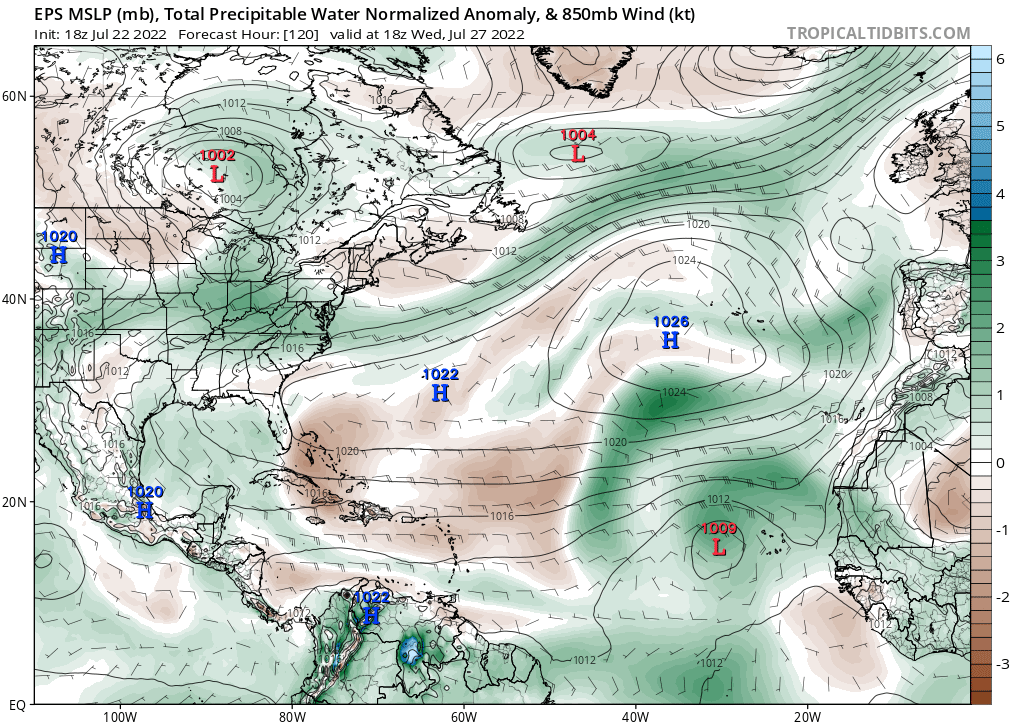
Into the middle of next week, some models are hinting a possible development of a weak system as a plume of moist air with high precipitable water values moves into the Eastern Atlantic. This could help cut through some of the Saharan dust that exists over most of the main development region. This increased moisture could favor increased convection enough for something to organize as wind shear may decrease a bit based on some models. Again, this is over 100 hours out, but it may be something to keep an eye on. There is nothing official from the NHC for the next five days though.
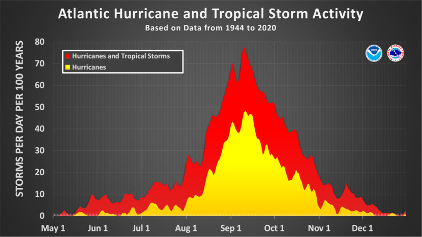
As for the bottom line, nothing to worry about for now from the Atlantic, so enjoy your weekend. However, make sure you have a plan in the event a tropical system threatens land where you live. Early preparation is the best thing you can do for you, your friends, and your family. Check out tips from the NWS on how to best prepare here. We are about to enter August soon when tropical activity begins to ramp up towards the peak of hurricane season.