Before I get going, I caught a snippet of the 5p forecast last night from Patrick, and it made me smile. Last time I was at WDAM, I didn’t get a chance to see Patrick since he was off. But I did get to see Rex, of course. And Rex mentioned how he still read my blog every day to get all caught up on the forecast. I was honored. Rex has been doing this a long time. To know he still trusts me made me smile. And when Patrick said the words “novelty flake” last night, I figure it had to be because he read my post yesterday where I had a whole section about novelty flurries. It warmed my heart. I’m glad to see he, too, still trusts my expertise on forecasting the local weather.
Anyway, I thought that was a fun moment that I wanted to share with everyone. Now on to the weather!
I thought things might change, and here we are. Changes. Nothing drastic or crazy. But the timeline has sped up a bit and it looks like the area of low pressure may deepen a bit quicker, too. So far, I haven’t heard reports that it is “over-performing” anywhere, to any extent, so that is good to know.
Okay… Buckle up!
Things start out like a pretty typical January storm system. Cold front on the horizon with a chance for showers and storms. But the direction this system is coming from is not very typical, it is sliding in from the northwest and developing on top of us.

That means, the potential for severe weather has always been predicated on where the low develops and how far inland the warm front can push before the cold front arrives. The farther west it develops, the farther inland the warm front makes it, and vice versa.
And the latest model guidance says the warm front may not make it very far inland at all as the low may not truly develop until the cold front is here.
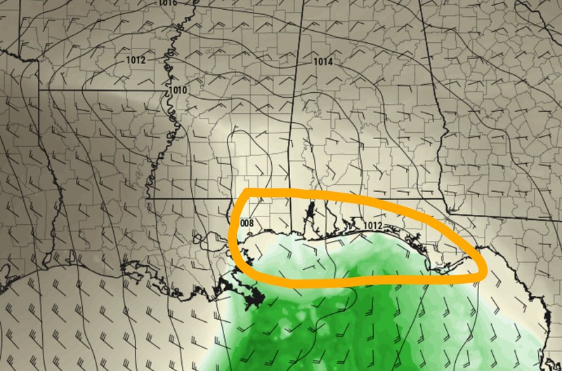
This is more easily seen on the Theta-e map. Without getting too into the eeds, what we want to see on there for severe weather is some of the deeper greens. Looking at the latest guidance, on the left, we barely have any light greens even along the coast. Where looking 48 hours ago, on the right, we had some that pushed all the way up to I-20.

So it does look like the potential for severe weather is diminishing a bit. Low level instability it still, barely, there so we may catch some rumbles of thunder and some gusty wind, but the potential for tornadoes is looking very, very low.
So what about the snow?
This is where things get a bit more difficult and interesting. I want to stress here that the likelihood of a December 2017 situation are nearly zero. Not zero, but pretty close. But I think there is an increasing chance that more places have a chance to actually see snow falling out of the clouds.
The difficult and interesting starts with the “lower” levels of the atmosphere. Between about 1,000 and 4,000ft.

As the system passes, there will be some moisture that wraps around the backside. But what will also be wrapping around the backside is the warmer Gulf of Mexico air. Because of the way areas of low pressure work, it pussl in air from teh south and pinwheels it around counter-clockwise.
The air will be cooling at it wraps around, but it will start out at 75F which means it may still be in the 40s – given all the adiabatic processes involved – by the time it gets up to 4,000ft and is on the back side of the area of low pressure.
As we all know, that is still too warm for snow.
Complicating factors is two pieces of dry air. One that is going to be pulled in from the southwest across the Gulf and the other from Physics because as you wrap air around an area of low pressure, once it gets to the southwestern side, it starts to dry out.
The Southern MS/AL/LA region will be on the SW side at this time. And at the same time, there may even be a thumb of warmer air at the surface poking into the area given all of this.

So! We have some wrap around moisture that is being dried out by two processes, while the air isn’t really cold enough for snow, juuuust before the really cold air gets here.
So, given this, there won’t be a very wide window in time for snow to occur.
BUT! I think as the secondary cold front arrives, that may provide just enough ‘umph’ to get precipitation moving again. Particularly closer to I-20.
Looking at the Forecast Sounding for the southern half of the area, it just isn’t a very favorable set up for full on snow.

The leftover forcing (the omega, the circle on the left side of the chart above) is all in the lower levels (this makes sense with the surface front) and that forcing is happening in a place where temperatures are all above freezing.
So any precip that would be falling would be liquid.
To the north! Things are a bit different. The forcing is a bit higher up in the sky. And in fact, the forcing is happening where it is below freezing.

On the chart above, you can see the Omega is actually in the Dendritic Growth Zone. That means we are going to be actively building snowflakes. Real snowflakes. And those flakes would then fall through an atmosphere that is below freezing until about 1,000ft off the ground.
And then we play the game of, how many snowflakes melt before they reach the ground and how many stay as snowflakes.
ALL OF THAT BEING SAID!
Recall the post I made yesterday where I talked about model biases. The HRRR computer model is generally biased a bit too warm and too moist. So it may be over-doing the potential for snow in the north and under-doing it in the south.
The NAM computer weather model has a similar problem, where it will over-produce precip and exaggerate the precip type. So if there is a slight chance for snow, it pastes, like, six inches of the stuff. Or if there is a chance for rain, it says severe weather.
So, we have to talk a fine line here. Where I think there is a better chance for many places to see physical snowflakes falling from the sky – even mixed with rain at times – but the likelihood of sticking snow accumulating is still very low.
Timeline & Threats
The transition from storms to possible rain/snow mix to snow will happen from Saturday afternoon to Sunday morning. Aside from the typical wet roads and breezy conditions, travel isn’t anticipated to be impacted by frozen precip.
Saturday 1p – 7p: Showers and storms likely. Severe weather is less likely. Heavy rain, thunder and gusty wind possible
Saturday 7p – Sunday 1a: Showers ending, a brief period of drier weather with the breeze starting to pick up a bit. Cooler, too.
Sunday 1a – 7a: Wrapped around cold (very cold) rain showers and some rain/snow mix will develop and move through. By sunrise Sunday, some places may make a change-over to full snow. And most places that do, novelty flurries will be the most likely scenario. A few folks, particularly closer to I-20 will see a better chance for a few full blown snow showers.
Sunday 7a – 1p: Lingering light snow showers ending by 10a. Drier, cooler, breezy.

Some spots that see mainly rain, may also see some snow. And some spots that see “some falling snow” may also see rain.
Reminder: For folks living near or south of I-20…. Despite the potential for a wintry mix or flurries or snow showers, travel should not be affected much. That said, we all know how people get when these types of events occur. I recall many times seeing people in the ditch with just wet roads. So please be careful while you’re driving around.
Day to Day Forecast
Today
Sunny. Highs in the mid 60s.
Tonight
Partly cloudy. Lows in the mid 40s.
Saturday
Cloudy with showers and storms possible after 11a. Highs in the mid 60s. South winds 5 to 10 mph, gusting to 20mph. The chance of rain 80-percent.
Saturday Night
Cloudy, colder. Rain may mix with snow at times, or turn completely to snow closer to I-20. Lows in the mid 30s. West winds 10 to 15 mph turning northwest overnight, gusting up to 20mph. The chance of rain 40-percent.
Sunday
Mostly cloudy with lingering showers possible before noon. Some of these showers may fall as wintry mix to the north. Much colder. Highs around 40. Northwest winds 10 to 15 mph, gusting to 25mph.
Sunday Night
Mostly clear. Lows in the lower 30s.
Martin Luther King Jr Day
Sunny, warmer. Highs in the mid 50s.
Monday Night
Mostly clear. Lows in the lower 30s.
Tuesday
Sunny. Highs in the lower 60s.
Tuesday Night
Partly cloudy. Warmer. Lows in the lower 40s.
Wednesday
Partly cloudy with a 30 percent chance of showers. Highs in the upper 60s.
Wednesday Night
A 40 percent chance of showers. Partly cloudy in the evening then becoming cloudy. Lows in the mid 40s.
Thursday
Mostly cloudy with a 30-percent chance of showers. Cooler. Highs in the upper 50s.


