
Today, we will still see a chance for some scattered showers and thunderstorms, but that should be the last widespread chance for the next while as the jet that has been overhead finally lifts north and allows for some ridging to build. This pattern will showcase heat and isolate convection as being the primary hazards as opposed to the widespread convections we have been seeing these past few weeks. Let’s dive into the details below!
[wpcode id=”41149″]
Short Term Outlook
This morning, there is a large cluster of showers and storms across parts of southern Arkansas and northern Louisiana. These storms are likely to move southeast and into parts of the area later this morning and into the afternoon. Model guidance is a bit split on how to handle these storms, and there is some uncertainty about how storms progress.
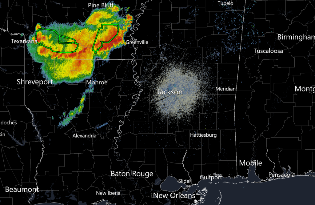
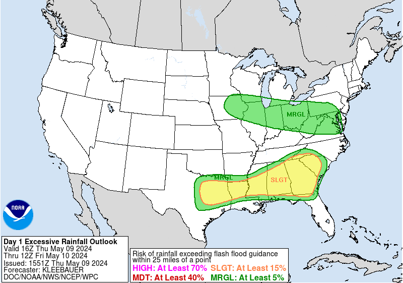
However, with the WPC highlighting the area with a Slight Risk for excessive rainfall, please keep the radar close by today and keep tabs on the weather. Should these storms hold together and drift over your neighborhood, it could lead to localized flooding.
Aside from that cluster of storms, today, we shall see some scattered convection once again ignite over the region as the jet aloft helps aid in divergence and the daytime heating leads to a build up of instability. These storms should remain mostly sub-severe, but will have the potential for some flooding due to saturated soils and slow storm motion of about 12 knots. Thursday, storm chances drop and we begin to heat up and dry out as some ridging works its way into the region.
[wpcode id=”41149″]
Extended Outlook
Looking ahead into the next week or so, storm chances appear to be on the downtrend as the jet that is positioned over the south lifts north. As this jet lifts north, the region will see some ridging develop which will promote sinking air aloft. This will lead to clear skies, but hot temperatures allowing for dangerous heat conditions to develop. Temperatures will reach into the mid 90s with heat indices could easily reach the 105 – 110 range. The only relief you may find is along the coast where storm chances will be slightly higher due to the effects of the sea breeze. Those who work outdoors or plan to spend some time outdoors should take additional precautions as it won’t take much to create dangerous conditions for heat related illnesses.

[wpcode id=”41149″]
REGIONAL DAY-TO-DAY FORECAST
Today: Mostly sunny, with a slight chance of showers and thunderstorms. High temperatures in the low to mid 90s. Heat indices may reach up to 105°F. Chance of rain 40%.
Tomorrow: Partly cloudy. Low temperatures in the upper 70s to low 80s.
Thursday: Partly cloudy, with a stray shower or thunderstorm possible. High temperatures in the low to mid 90s. Heat indices may reach up to 105°F. Chance of rain 20%.
Thursday night: Partly cloudy, with a stray shower or thunderstorm possible. Low temperatures in the upper 70s to low 80s. Chance of rain 20%.
Friday: Mostly cloudy, with a stray shower or thunderstorm possible. High temperatures in the low to mid 90s. Heat indices may reach up to 105°F. Chance of rain 20%.
Friday night: Partly cloudy. Low temperatures in the upper 70s to low 80s.
Saturday: Partly cloudy. High temperatures in the low to mid 90s. Heat indices may reach up to 110°F.
Saturday night: Partly cloudy. Low temperatures in the upper 70s to low 80s.
Sunday: Mostly sunny. High temperatures in the low to mid 90s. Heat indices may reach up to 110°F.
Sunday night: Mostly clear. Low temperatures in the upper 70s to low 80s.
Monday: Partly cloudy. High temperatures in the low to mid 90s. Heat indices may reach up to 105°F.
Monday night: Partly cloudy. Low temperatures in the mid 70s to low 80s.
Tuesday: Partly Cloud. High temperatures in the low to mid 90s. Heat indices may reach up to 105°F.
Tuesday Night: Partly Cloud. Low temperatures in the mid 70s to low 80s.


