The short-term period should see more scattered showers and thunderstorm chances for virtually all places in the Southern LA/MS/AL area, before perhaps a change of pace entering the latter half of the weekend and early next week. During this late week/early next week timeframe, the probability for widespread precipitation looks to decrease and the heat will instead be the main focus for us. Caution will need to be taken, as these temperatures may pose some heat-related concerns, with heat indices easily clearing the century mark. Let us take a look throughout the week ahead and see what we can expect weather-wise across the area!
[wpcode id=”41149″]
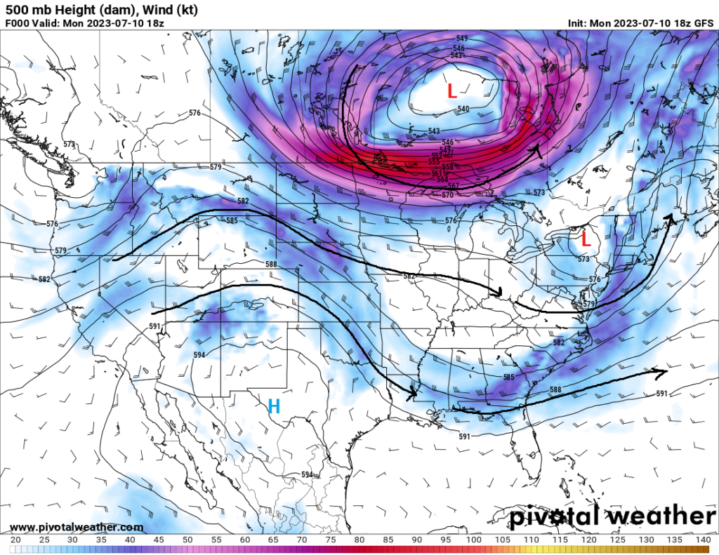
Short-Term Outlook
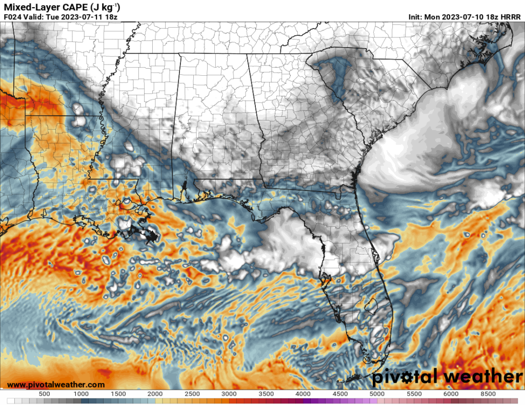
Scattered thunderstorms, some locally severe, may be possible throughout the day today, as scattered showers and thunderstorms moving in from the northwest in the morning and afternoon. A decaying cluster of thunderstorms from southeast Oklahoma/eastern Texas will help spur more scattered development throughout southern LA/MS/AL. These storms will interact with a very unstable airmass, with ML CAPE reaching 2500-3500 J/kg and modest lapse rates reaching between 6-8 C/km, although horizontal and vertical wind shear will be minimal. Nonetheless, small hail and locally damaging winds may be possible with these storms. The best chance for these scattered thunderstorms will be as follows for these major cities:
Jackson – 4am to 2pm
Hattiesburg – 7am to 5pm
New Orleans – 11am to 10pm
Gulfport – 9am to 7pm
Mobile – 8am to 7pm.
By tomorrow, scattered showers and thunderstorms will be possible again throughout the area in the morning and early afternoon hours, however coverage of these storms look to be less than what is to be expected today. Places along the coast will have the best chance at seeing precipitation from the interaction of today’s outflow boundaries and sea-breeze fronts. In general, these storms should remain below severe limits, although isolated hail and damaging winds events may occur with the strongest of storms.
[wpcode id=”41149″]
Extended Outlook
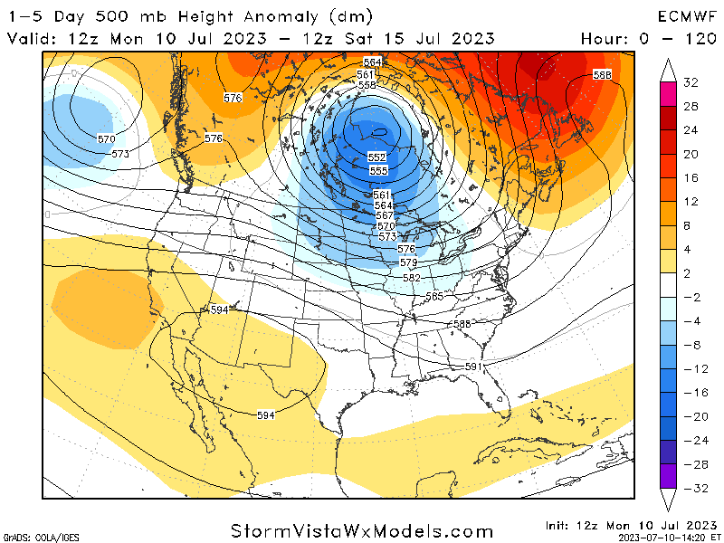
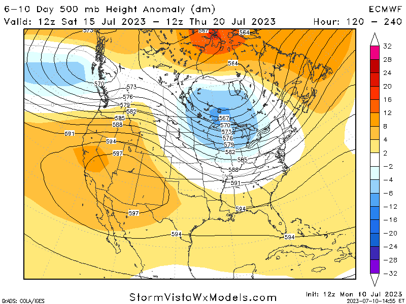
By tomorrow and going through into next week, upper-level ridging will really begin to build over the Southeast United States. This will have the effect of lowering, but not completely eliminating, overall precipitation chances, as well as raising our high temperatures, with daily highs peaking in the mid to upper 90s and heat indices reaching and exceeding 100°. Safety precautions to protect and mitigate the effects of this kind of heat will be needed, such as staying well hydrated, taking plenty of breaks when doing outside activities, and having access to air-conditioned spaces if possible.
[wpcode id=”41149″]
REGIONAL DAY-TO-DAY FORECAST
Today: Mostly cloudy, with a chance of scattered showers and thunderstorms. High temperatures in the upper 80s to low 90s. Chance of rain 50%.
Tonight: Mostly cloudy, with a stray shower or thunderstorm possible. Low temperatures in the mid to upper 70s. Chance of rain 20%.
Wednesday: Mostly sunny, with a slight chance of showers and thunderstorms. High temperatures in the low to mid 90s. Heat indices may reach up to 105°F. Chance of rain 30%.
Wednesday night: Partly cloudy. Low temperatures in the upper 70s to low 80s.
Thursday: Partly cloudy, with a stray shower or thunderstorm possible. High temperatures in the low to mid 90s. Heat indices may reach up to 105°F. Chance of rain 20%.
Thursday night: Partly cloudy, with a stray shower or thunderstorm possible. Low temperatures in the upper 70s to low 80s. Chance of rain 20%.
Friday: Mostly cloudy, with a stray shower or thunderstorm possible. High temperatures in the low to mid 90s. Heat indices may reach up to 105°F. Chance of rain 20%.
Friday night: Partly cloudy. Low temperatures in the upper 70s to low 80s.
Saturday: Partly cloudy. High temperatures in the low to mid 90s. Heat indices may reach up to 110°F.
Saturday night: Partly cloudy. Low temperatures in the upper 70s to low 80s.
Sunday: Mostly sunny. High temperatures in the low to mid 90s. Heat indices may reach up to 110°F.
Sunday night: Mostly clear. Low temperatures in the upper 70s to low 80s.
Monday: Partly cloudy. High temperatures in the low to mid 90s. Heat indices may reach up to 105°F.
Monday night: Partly cloudy. Low temperatures in the mid 70s to lower 80s.


