
Hello everyone; I hope you have had a great start to the work week. We have plenty to discuss in today’s forecast, so let’s begin. Looking at the general picture, there are three primary weather threats that I want to talk about. The first is the above-average temperatures in the Desert Southwest. It’s quite a different picture in the Northeast, where record rainfall has left the region with severe flooding issues. The country’s Central region is expected to see severe weather tomorrow afternoon, with hail, high winds, and a possible tornado.
[wpcode id=”41149″]
The Heat Persists
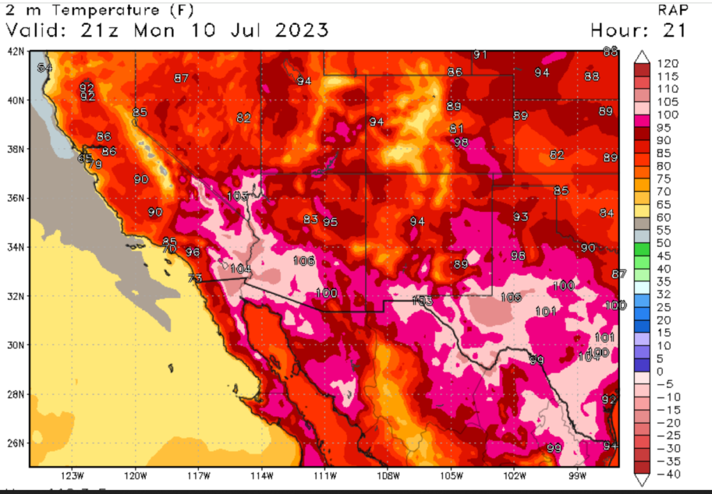
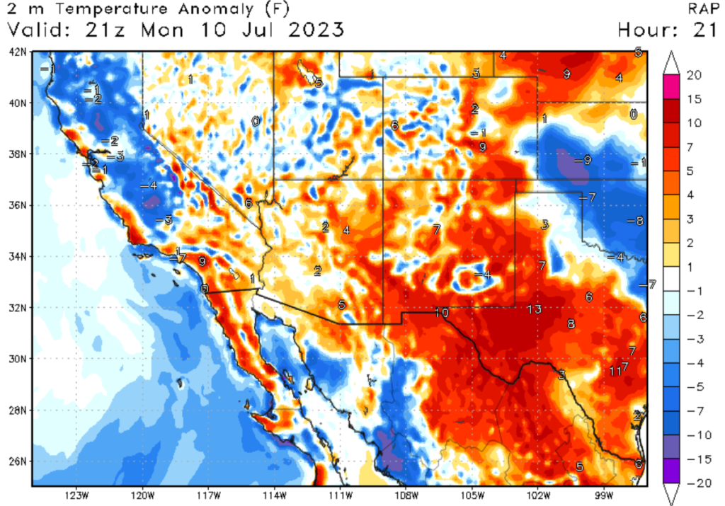
If you haven’t heard, the Earth broke three heat records last week, with some of the highest average temperatures recorded in 125,000 years—the heat in the Southwestern U.S. has certainly not helped in this case. For the last several days now, the Southwest has been experiencing above-average temperatures. This is caused by a persistent high pressure system centered over the Four Corners region. This system of high pressure has moved hot air from the tropics, bringing dangerously high temperatures to the area. The city of Phoenix, Arizona, has recorded high temperatures of at least 110 degrees Fahrenheit (43 degrees Celsius) for the last 10 days. Overnight temperatures will provide little relief, with lows in Phoenix expected only to reach the low 90s. Areas of Texas have experienced some of the hottest weather in years, putting strain on the power grid. Please practice proper heat precautions if spending time outside.
[wpcode id=”41149″]
A Soaked Northeast
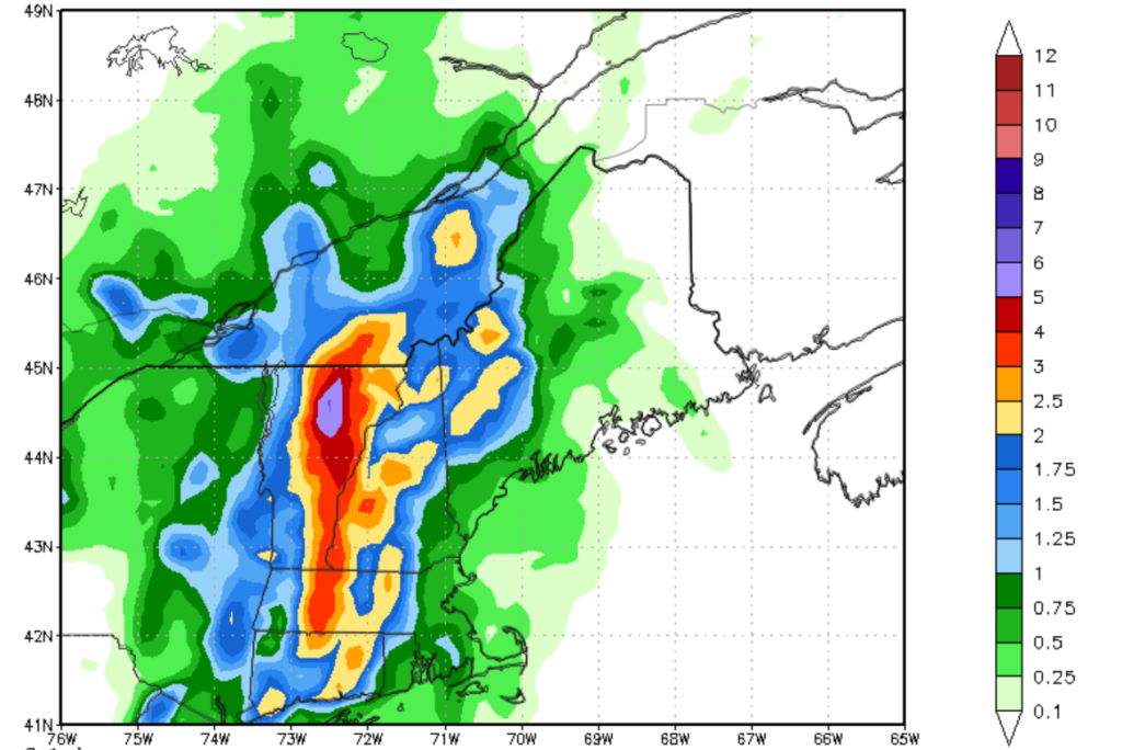
It’s quite a different story across the country, with recorded rainfall in parts of the Northeast. Some call it a 1 in 1,000-year flood for Vermont and parts of Upstate New York. These areas have seen some of the highest total rainfalls on record. This panorama is being caused by what is called a Greenland Block. This is when a center of high pressure is stuck over central Greenland, which causes a center of low pressure to remain over the Northeastern U.S. Any storm system that passes through the Northeast is slowed down significantly by this center of low pressure. This is the main reason why the Northeast has had this extreme rainfall. Not only has the rain been persistent, but it’s also been heavy, with some areas picking up 7 inches of rainfall in 3 hours. Please remember to take proper flooding precautions and never drive through flooded roadways.
[wpcode id=”41149″]
More Severe Weather Expected
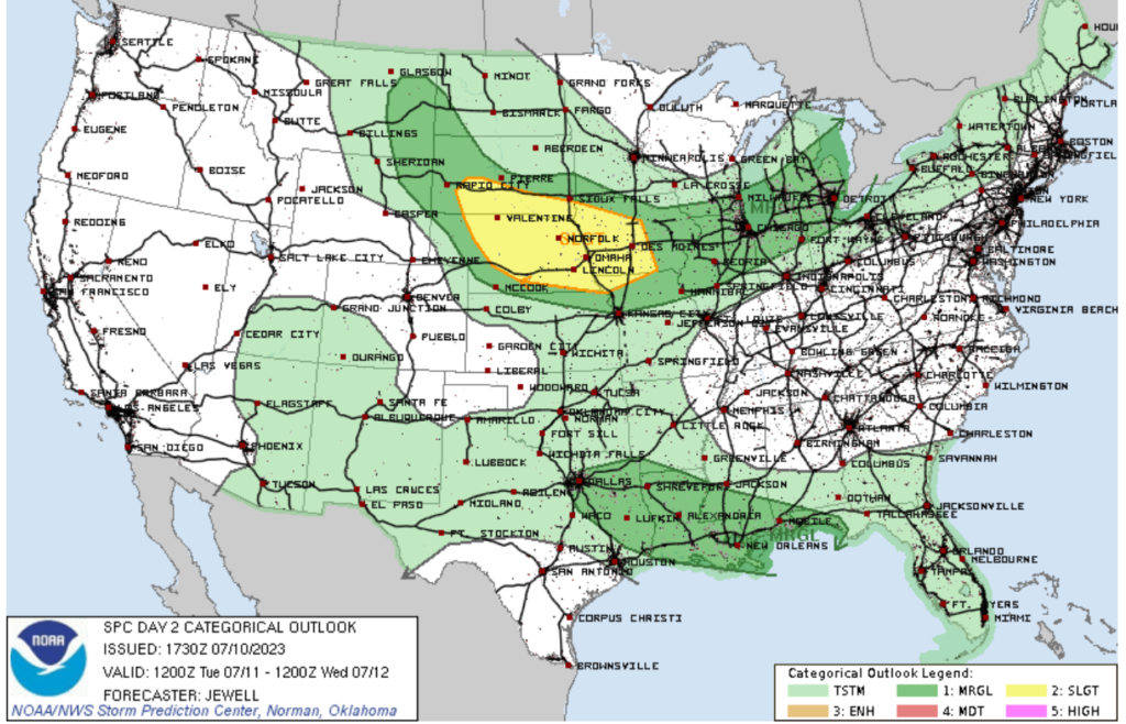
It’s been quite the year for severe weather, with 850 confirmed tornadoes in the U.S. so far this year. We may add more today, with more severe weather expected in the American Heartland. A cold front is expected to move through the Mid West, bringing thunderstorm activity to parts of South Dakota, Nebraska, and Iowa. The primary threats from these storms will be damaging winds and large hail, but one can’t rule out an isolated tornado or two. Remember that other factors such as heavy rain, deadly lighting, and flooding are associated with severe thunderstorms.
[wpcode id=”41149″]
Travel Impacts for July 11th, 2023
Those who plan to fly tomorrow may see delays in areas of the Northeast and Mid West due to heavy rainfall. Those who plan to fly in or out of the Southwest may see delays due to the heat. Even if you are flying out of an airport with calm weather, weather delays can still happen if bad weather occurs at other airports, which messes up the air system. Those who plan to drive tomorrow may want to watch out for severe weather in the Mid West and flooding in the Northeast. Remember to turn around and don’t drown.
[wpcode id=”41149″]
Extended Outlook
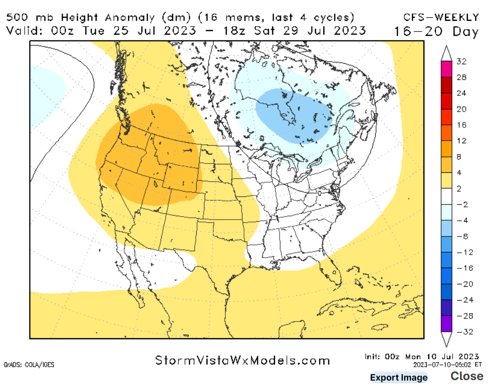
Looking at our extended outlook, one thing is catching my eye. That is the ridge of high pressure in the western U.S. As I explained earlier, a ridge of high pressure in the Western U.S. causing hot and dry conditions in that region. Unfortunately I am forecasting this ridge to stick around the area for the time being. This is concerning because the Western U.S. had a very wet Winter and Spring, which has caused high plant growth. If this pattern sticks around for an extended period, severe wildfires could break out later this year. Luckily, the Monsoon season is expected to start soon in the Southwest, which could cause an end to this persistent high pressure system. Looking at the Northeast, rainfall should start to slacken off as the low pressure system begins to weaken; however, people in the area should expect to see some additional rain this week.
[wpcode id=”41149″]
Conclusion
It has certainly been a crazy last couple of days in terms of weather in the United States, and I am forecasting that the current weather patterns should stick around for the next couple of days. This means the heat will stick around in the Southwest and wet weather in the Northeast.


