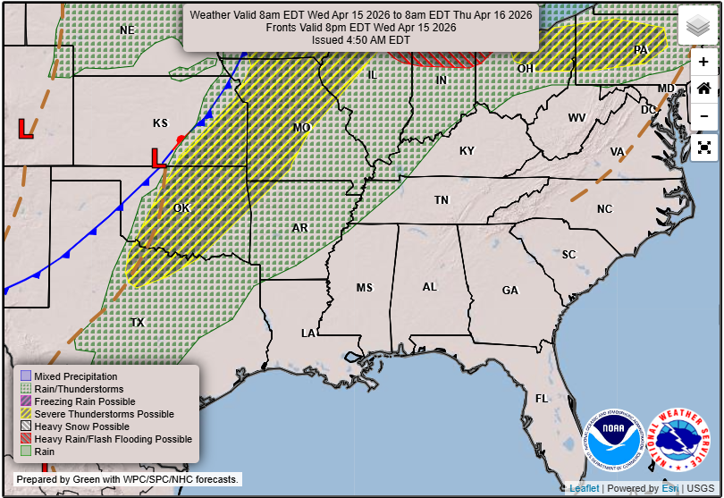
Hey everyone! We have been stuck in a hot and dry pattern recently, thanks to a large ridge of high pressure stationed over the east, which has redirected the storm track from Texas to the Central Plains and Upper Midwest, and keeping us dry.
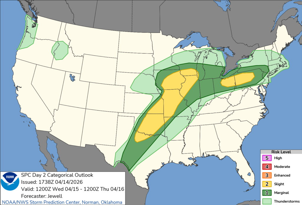
There’s been an active severe weather threat for those regions as all of the ingredients needed for severe weather exist there, including tomorrow which will bring the risk of all hazards for those yellow and green colored areas above. This pattern is expected to shift as the high pressure shifts off the Atlantic coast and allows more storm systems to pass through our region, which I will touch on more down below.

Tonight’s Forecast
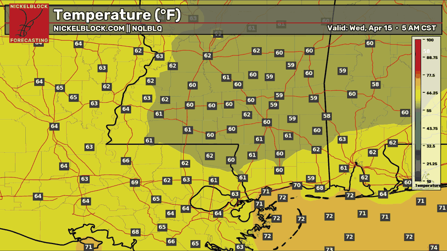
We’ll see a clear night tonight with temperatures near 60. Some patchy fog is possible in the late night into the morning hours, so be cautious during your morning commute.

Tomorrow’s Forecast: Wednesday, April 15th
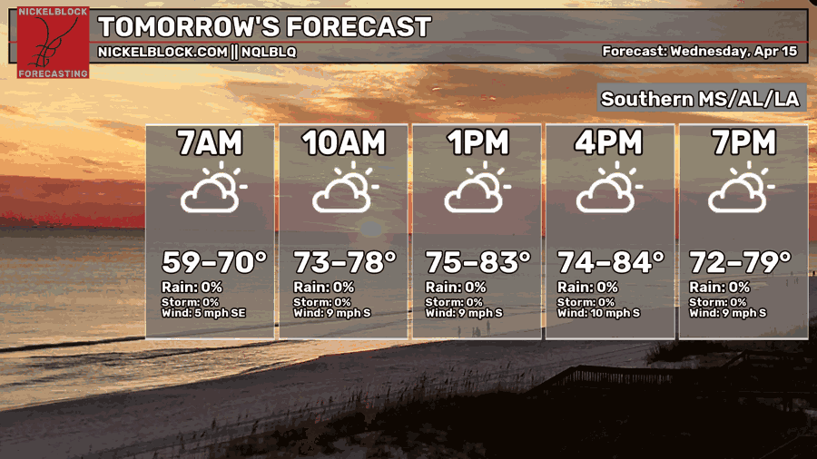
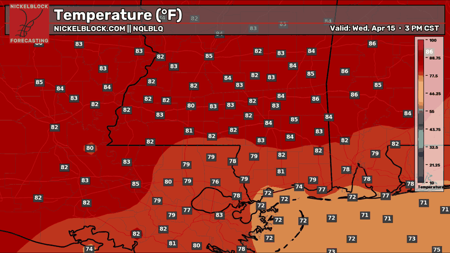
For tomorrow, there will be a mix of sun and clouds, and we will stay mostly dry. There’s a chance that some onshore showers sneak in along the southerly flow, but the majority of us will stay dry. Temperatures will be hot and feeling humid once again, with low-to-mid 80s as a high, slightly cooler by the shore. Stay hydrated!
Thursday’s Forecast: April 16th
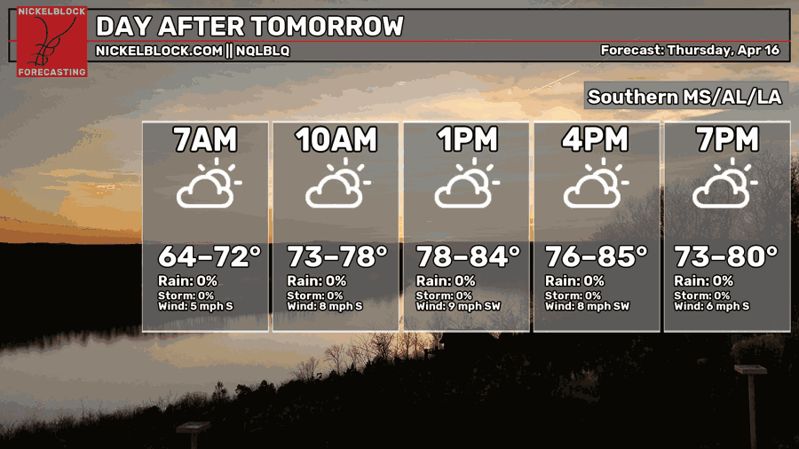
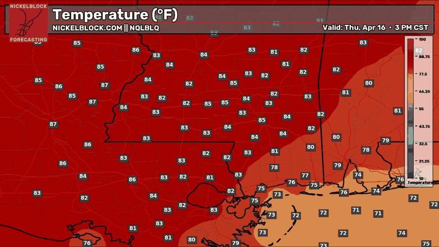
Even more widespread mid 80s for Thursday with moderate to high humidity, making it feel like the mid 90s! Expect mostly sunny skies, with another slight chance of an isolated afternoon shower or thunderstorm. Looking forward to some rain? – take a look down below!

Extended Local Outlook
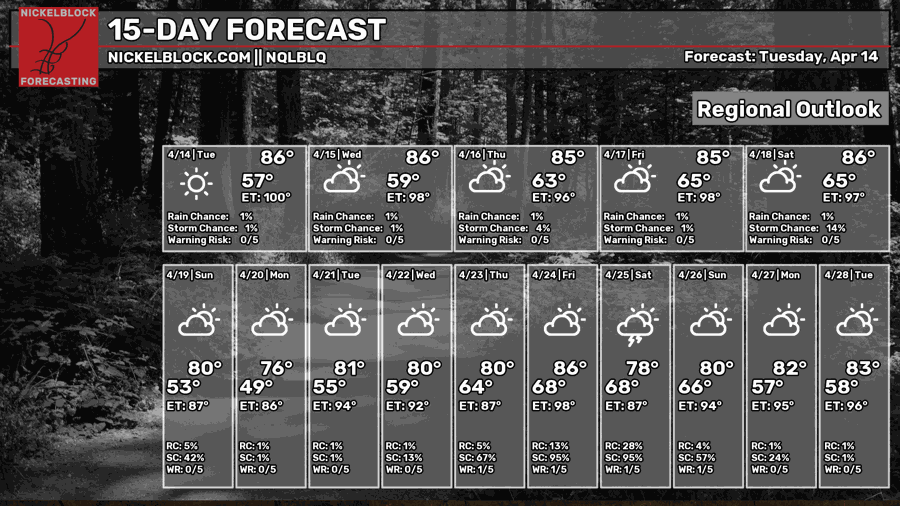
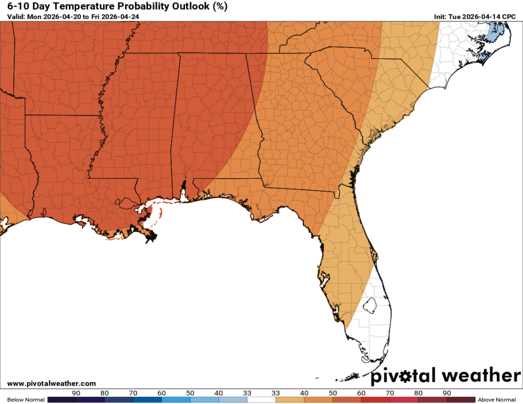
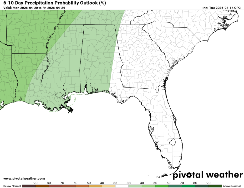
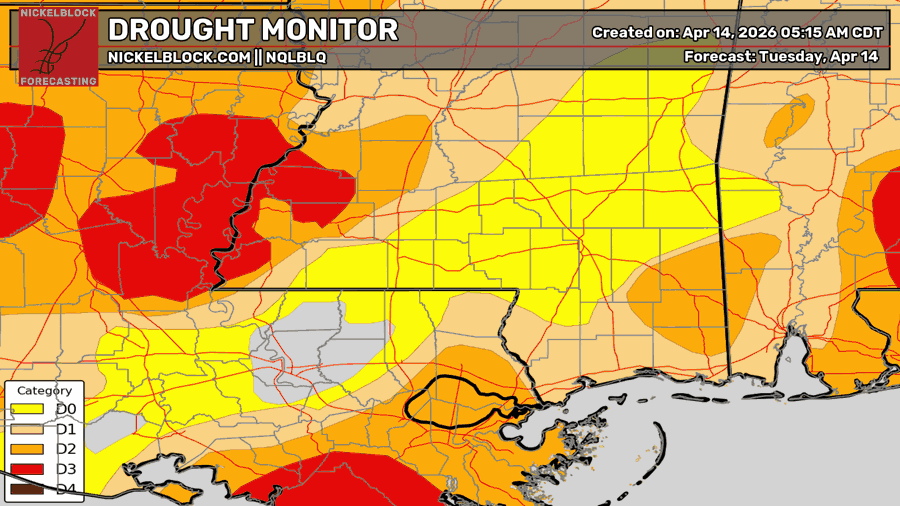
Looking ahead, we will be continuing with the above-average temperatures for the 6-10 day timeframe, and 8-14 day timeframe. What will likely change, though, is our rainfall probabilities, which is expected to be on the rise for the near future, since our storm track will become more active with the high pressure moving east. Our next chance of rain looks to be Saturday night into Sunday morning, which seems to be a trend in our region. We could use the rain, not everyone, but there are scattered areas in a moderate-to-severe drought.


Thanks for the detailed forecast!