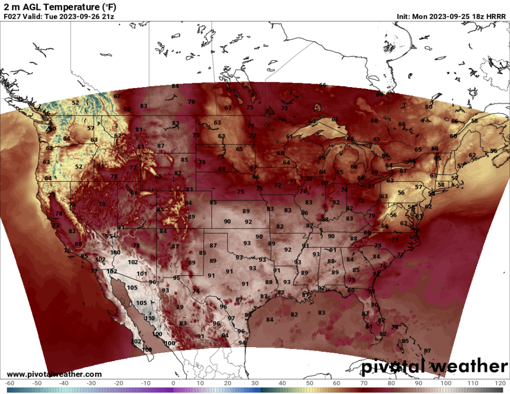
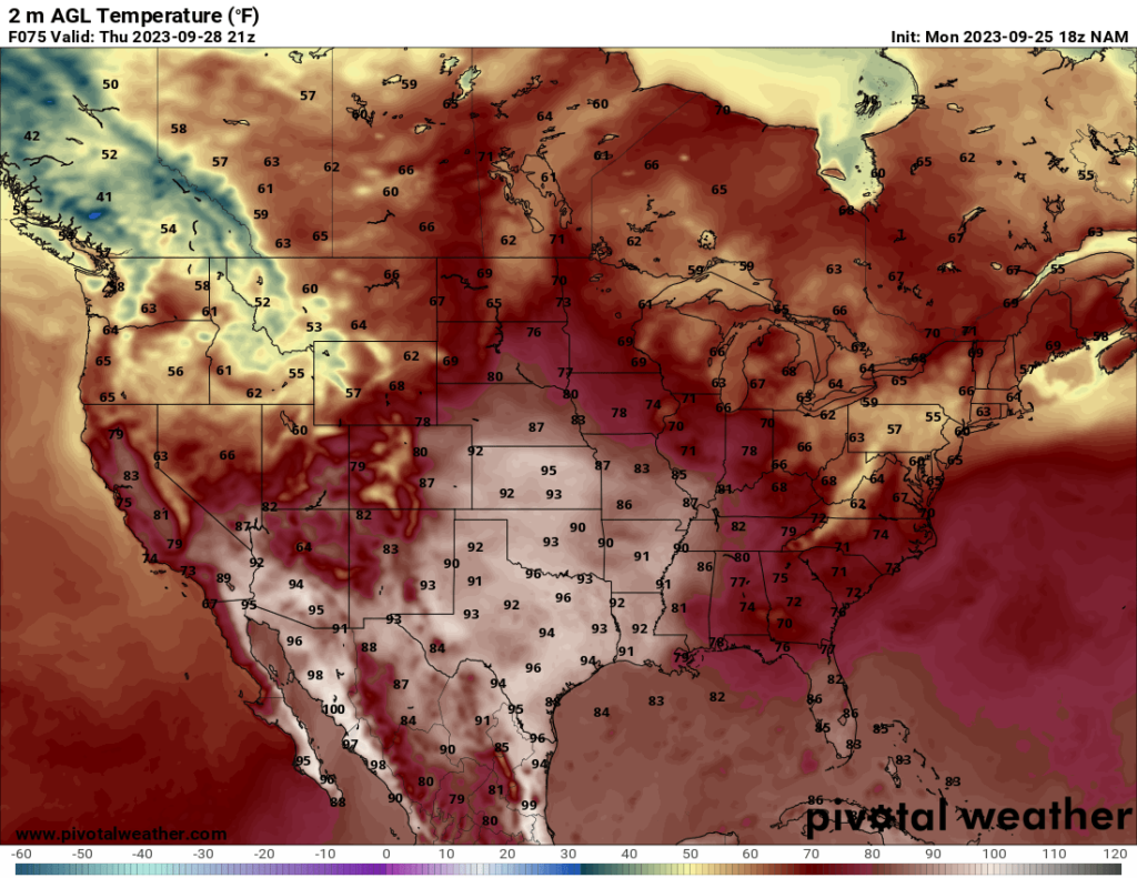
The autumnal equinox has passed, and most of the country is feeling fall temperatures. Parts of the south will still see hot temperatures, especially the southern Plains (anything new, Texas?), but even these hot temperatures are cooler than the 100+ high temperatures the area experienced during much of the summer. Most of the US should feel pleasant temperatures over the next few days.
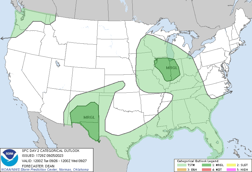
In terms of severe weather, we have a few Marginal Risk areas to watch for on Tuesday. Moderate CAPE values of above 1000 will support an isolated severe threat in southern New Mexico and far west Texas, but low shear values should limit the threat. For the threat in the Midwest, the areas with the best CAPE also do not have significant shear, but an upper level trough should provide a bit of extra lift on the east side of the trough to support a marginal severe threat. The tornado threat appears low at this time, and isolated wind and hail events should be the primary threat.
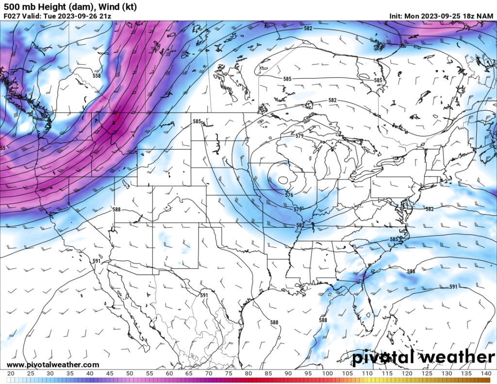
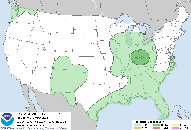
On Wednesday, the upper level trough continues east over the Midwest, and the east side of the trough should see another severe threat. So far, the shear looks a bit better for this one, so there is a chance the SPC may upgrade the risk to Slight in a future update. However, I think there is too much uncertainty to say for sure, as the storms also look more linear in the NAMNEST model than supercellular. Once the HRRR model updates tonight, perhaps we’ll have a better idea.
The severe risk on Thursday is low, according to the SPC. Most likely, any severe storms Tuesday through Thursday will be isolated, and I do not anticipate any widespread severe weather during this time.


