The rainy-ish pattern continues as the very humid airmass continues to hang around. And while things aren’;t quite as humid this morning as they were yesterday, it is still more humid than average. Much more.
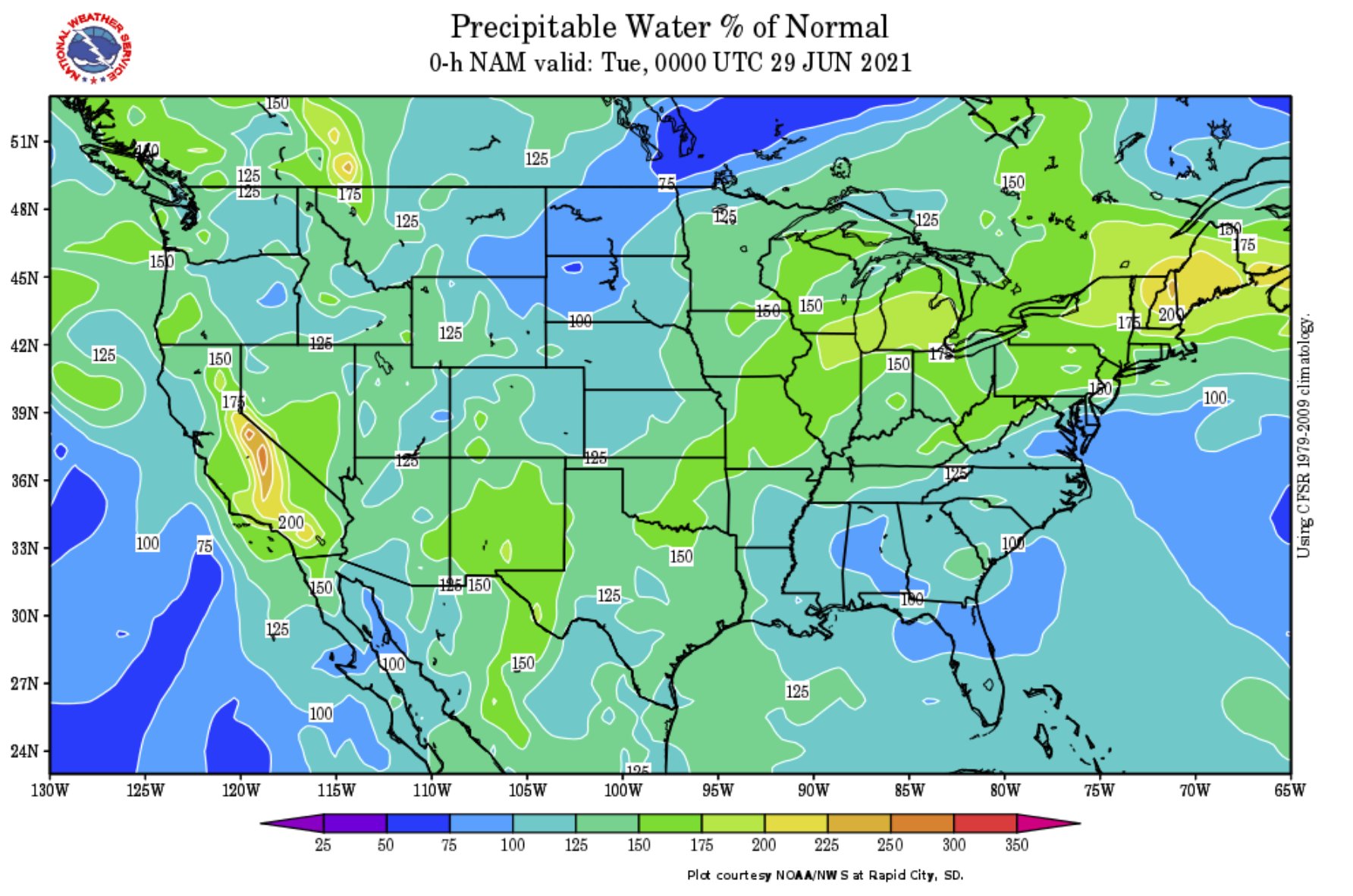
South Mississippi is sitting about 110-percent of normal. That is a lot better than where we were 24- to 36-hours ago. And more relief is on the way, it just won’t likely make it all the way to South Mississippi.
You can see on the graphic above that the purple (very humid) air is knocked back across northern Mississippi and Alabama eventually. But for the rest of the region, no dice.
And while the humid air is in place, the chance for afternoon storms will continue. And those afternoon storms will be able to drop even more rainfall, too.
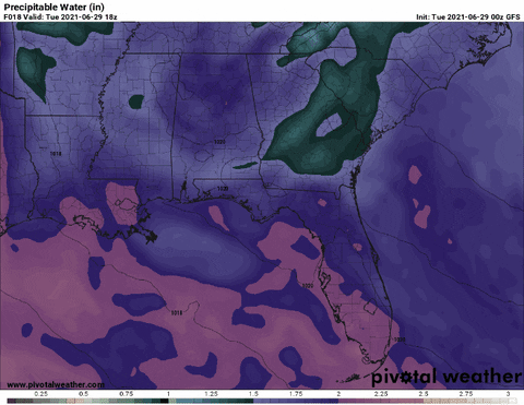
For those asking, “What gives?! Why is it so rainy?” The area is stuck in a humid pattern where some pretty juicy air has been funneled up from deeper in the tropics. And historically, this more-humid-than-normal-air would be mixed out with drier air aloft as there was daytime heating or afternoon convection.
But right now, even the air aloft is humid. So there is no help.
Day-to-Day Forecast
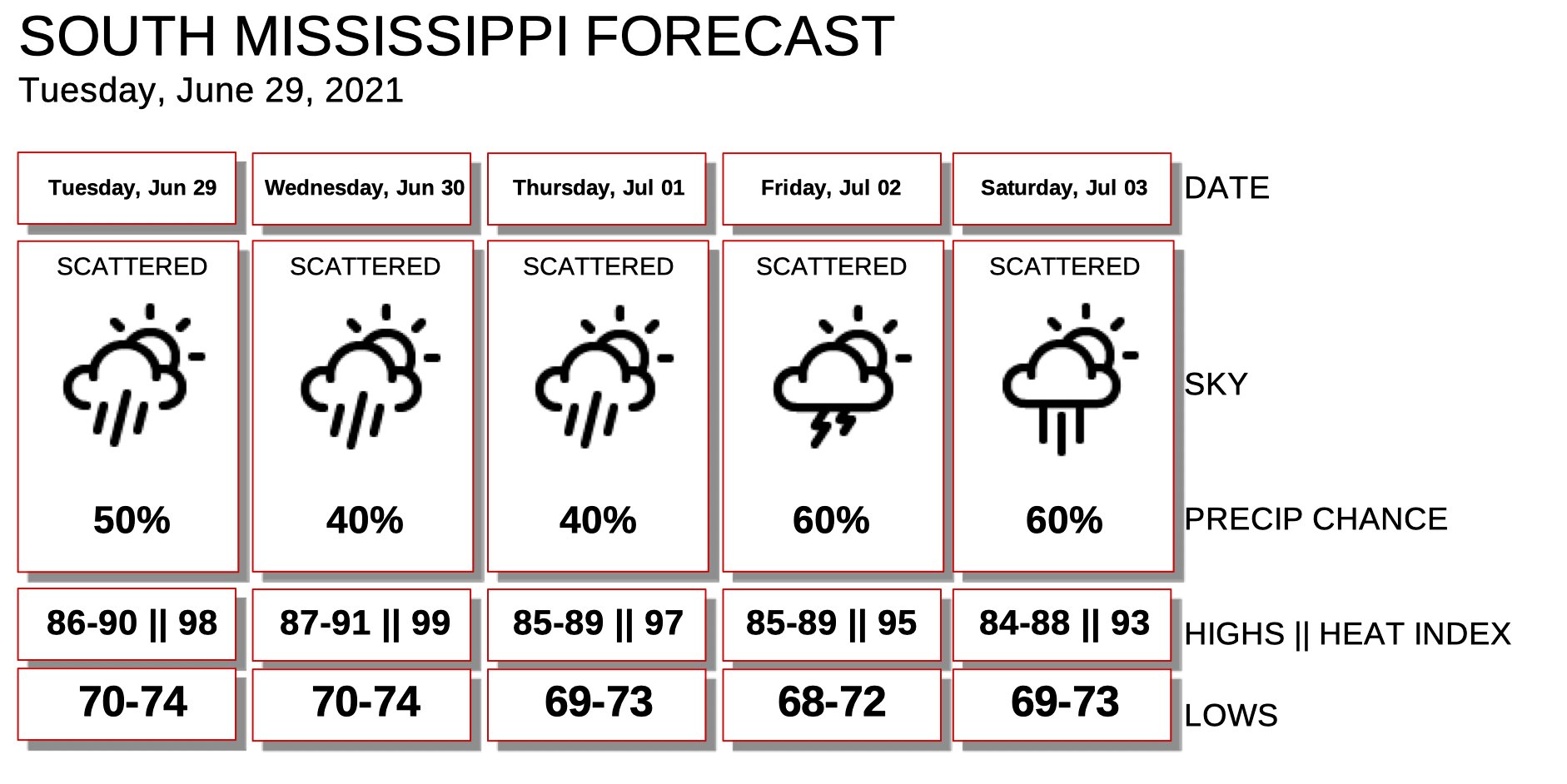
Today
Partly cloudy with a 50-percent chance for an afternoon storm. Highs around 90.
Tonight
Partly cloudy. Lows around 70.
Wednesday
Passing clouds with a 40-percent chance for afternoon storms. Highs in the upper 80s.
Wednesday Night
Partly cloudy. Lows in the lower 70s.
Thursday
Partly cloudy ith a 40-percent chance for storms. Highs in the upper 80s.
Thursday Night
Partly cloudy with a 20 percent chance for rai before midnight. Lows in the lower 70s.
Friday
Mostly cloudy with a 60-percent chance for rain. Highs in the upper 80s.
Friday Night
Rain ending by midnight. Clouds stick around through the early morning hours. Lows around 70.
Saturday
Passing clouds with a 60-percent chance for storms. Highs in the mid 80s.
Saturday Night
Partly cloudy. Lows around 70.
Independence Day
Mostly cloudy with afternoon storms possible. Rain ending by 8pm. Highs in the mid 80s. The chance of rain 50-percent.
Sunday Night
Partly cloudy with some patchy fog. Lows around 70.
Monday
Partly cloudy with afternoon storms possible. Highs in the mid to upper 80s. The chance of rain 40-percent.
Graphical Forecast


Why say there is relief on the way and then say it won’t make it all the way ‘here’? Why call it relief if it’s not coming?
‘Why is it so rainy’, you ask? My response is ‘When has it NOT been so rainy’?