Things are still looking humid and rainy. No change there. The late-season front that will try to get to the Gulf Coast is unlikely to survive all the way down. So far it looks like data suggests it will wash out somewhere between I-40 and I-20 as it is barreling south.
Is there a chance it gets to I-10? Sure. There is a chance. But the air will be heavily modified by then.
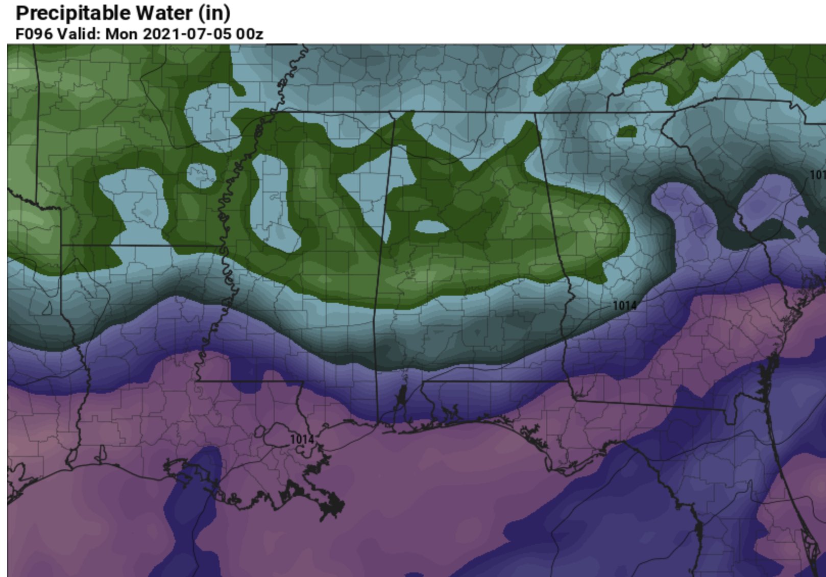
Looking at the data for Saturday evening across four different forecast models, most have the drier air (in green) hang up north of I-20 while the very humid air (purple) is shunted back to about I-10.
By Sunday, Independence Day, with enough sunshine and vertical mixing, there is a chance that if you live closer to I-20 you are able to get some relief.
But I wouldn’t bet the farm. These late-season fronts rarely have enough ‘umph’ to make a serious dent. We saw one of these last year around this time. And it was great! But getting one on back-to-back years is like predicting a 6″ snowfall in South Mississippi on back-to-back years – and you won’t ever see me do that.
Oh, and Tropical Storm Elsa is now a thing.

I’ll have more on this and the potential for local impacts coming up a bit later.
Today
Partly cloudy with a 40-percent chance for storms. Highs around 90.
Tonight
Clearing skies. Lows in the lower 70s.
Friday
Mostly cloudy in the afternoon with storms passing through after 1pm. Highs in the upper 80s. The chance of rain 80-percent.
Friday Night
Mostly cloudy with lingering showers ending after midnight. Lows in the lower 70s.
Saturday
Passing clouds with a 60-percent chance for storms. Highs in the mid 80s.
Saturday Night
Partly cloudy. Lows in the upper 60s.
Independence Day
Partly to mostly cloudy with passing showers and storms in the afternoon possible. Highs in the mid 80s. The chance of rain 50-percent.
Sunday Night
Partly cloudy with rain ending by 9pm. Lows around 70.
Monday
Partly cloudy with afternoon storms possible. Highs in the mid 80s. The chance of rain 40-percent.
Monday Night
Mostly cloudy with patch fog possible. Lows in the lower 70s.
Tuesday
Passing clouds with a 40-percent chance for afternoon storms. Highs in the upper 80s.
Tuesday Night
Partly cloudy. Lows in the lower 70s.
Wednesday
A few clouds with a few storms. Generally drier. Highs in the around 90. The chance of rain 30-percent.
Graphical Froecast


As I indicated yesterday, you may want to confer with your former co-workers at WDAM. They’re still showing, as of this morning, the front making it all the way to the coast … showing just a 30% chance of precip on Sunday instead of 50 or 60 percent. It will be interesting to see what measures out.
Yeah, I mean, there is data to support such an outcome. But I would rather be wrong by not forecasting a once-in-a-30-year event to happen… As opposed to forecasting a once-in-a-30-year event to happen, and then it doesn’t happen.
Just a difference in forecasting style, I suppose.
And I’ve been wrong before and I will be wrong again. But experience has taught me to be very skeptical of these types of events.
I don’t remember you being wrong very many times.