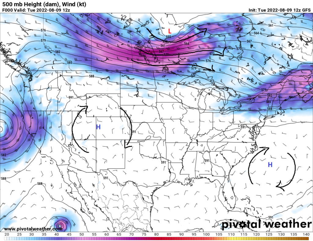
In contrast from the traditional pop-up showers and thunderstorms we’ve been accustomed to for this time of year, more widespread chances for rainfall will be around through much of the week and weekend. The high pressure ridge will begin to be pushed off to the west today as a trough ejects through the eastern US. This will bring us under northwesterly flow aloft and help to push in a disturbance in from the north by late this week. Immediately following the passage of this disturbance, rain chances may dip somewhat with the introduction of dry air behind it, but this should not last long as tropical air will begin to lift northward again by early next week and reintroduce better chances for showers and thunderstorms.
For the middle and latter part of the week, showers and thunderstorms will remain a likely occurrence. A weak surface low down by the Mississippi River Delta will serve as the main initiator for showers and thunderstorms as it interacts with the deep, rich moisture streaming in from the gulf. Heavy rainfall will be an issue, with PW values in the range of 1.75 to 2.5 inches, which will help to promote very efficient rainfall as well as localized flooding concerns.
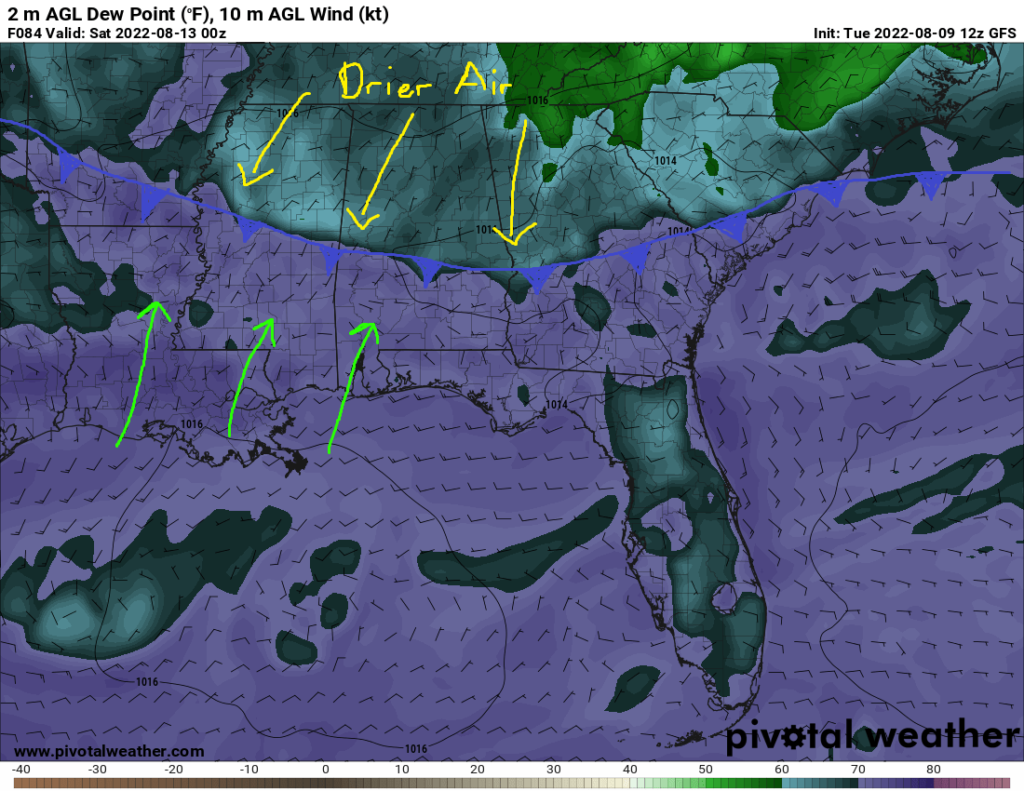
By the end of the week and into a weekend, a cold front will begin to punch in from the north, being mainly helped along by the northwest upper air flow aloft. Widespread showers and thunderstorms will be likely as this airmass collides with the very moist, tropical-like airmass in place across a majority of the area. After the front passes this weekend, drier air will come in behind it and help to taper rain chances somewhat, although the convective mechanisms conducive for storm development will not be completely suppressed, leading to rain chances continuing through the weekend.
The moist airmass should then make a return by the beginning of next week and raise rain chances once again to what we have been seeing for the good majority of the summer.
Temperatures look to remain fairly mild as far as summer is concerned. We can expect temperatures in the mid to upper 80s across the area for the week and weekend. Even with the passage of the cold front, temperatures aren’t expected to have a noticeable change. By next week, temperatures may slowly try to climb back into the low 90s as the high pressure ridge attempts to move back east somewhat.
Day to Day Forecast
Wednesday
Mostly cloudy skies, with showers and thunderstorms likely. High temperatures in the mid to upper 80s. Low temperatures in the low to mid 70s. Chance of rain 90%.
Thursday
Mostly cloudy skies, with showers and thunderstorms likely. High temperatures in the low to mid 80s. Low temperatures in the low to mid 70s. Chance of rain 90%.
Friday
Partly cloudy skies, with showers and thunderstorms likely. High temperatures in the mid 80s. Low temperatures in the low 70s. Chance of rain 70%.
Saturday
Mostly cloudy skies, with a stray shower or thunderstorm possible. High temperatures in the upper 80s. Low temperatures in the low to mid 70s. Chance of rain 30%.
Sunday
Partly cloudy skies, with a stray shower or thunderstorm possible. High temperatures in the upper 80s. Low temperatures in the mid 70s. Chance of rain 20%.
Monday
Partly cloudy skies, with a stray shower or thunderstorm possible. High temperatures in the upper 80s to low 90s. Low temperatures in the mid 70s. Chance of rain 30%.
Tuesday
Partly cloudy skies, with a stray shower or thunderstorm possible. High temperatures in the upper 80s to low 90s. Low temperatures in the mid 70s. Chance of rain 30%.


