More of the same typical August weather continues with hot and humid conditions coupled with afternoon thunderstorms. The area is stuck in between two upper-level highs that allows for an upper-level low pressure center to form near the Gulf Coast. This feature will aid in increased rain and storm coverage as convergence increases to help initiate convection.
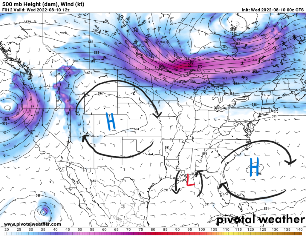
Near the surface, southerly flow is bringing in more tropical moisture keeping the dewpoints in the 70s and precipitable water values around 2″. Safe to say that the atmosphere will have plenty of moisture. Thunderstorms will form from daytime heating and outflow boundaries as they drift inland. Weak flow aloft as a result from being between the two highs will allow for some storms to move slowly increasing the risk of flooding. With enough moisture, some storms will produce locally heavy rainfall to exacerbate the flood risk.
Daytime heating with higher dewpoints will lead to more instability in the atmosphere for a few storms to be on the stronger side with gusty winds and heavy rains. As widespread scattered storms are expected, increased cloud coverage will be associated. This will lead to daytime highs below 90F in the upper 80s in most places.
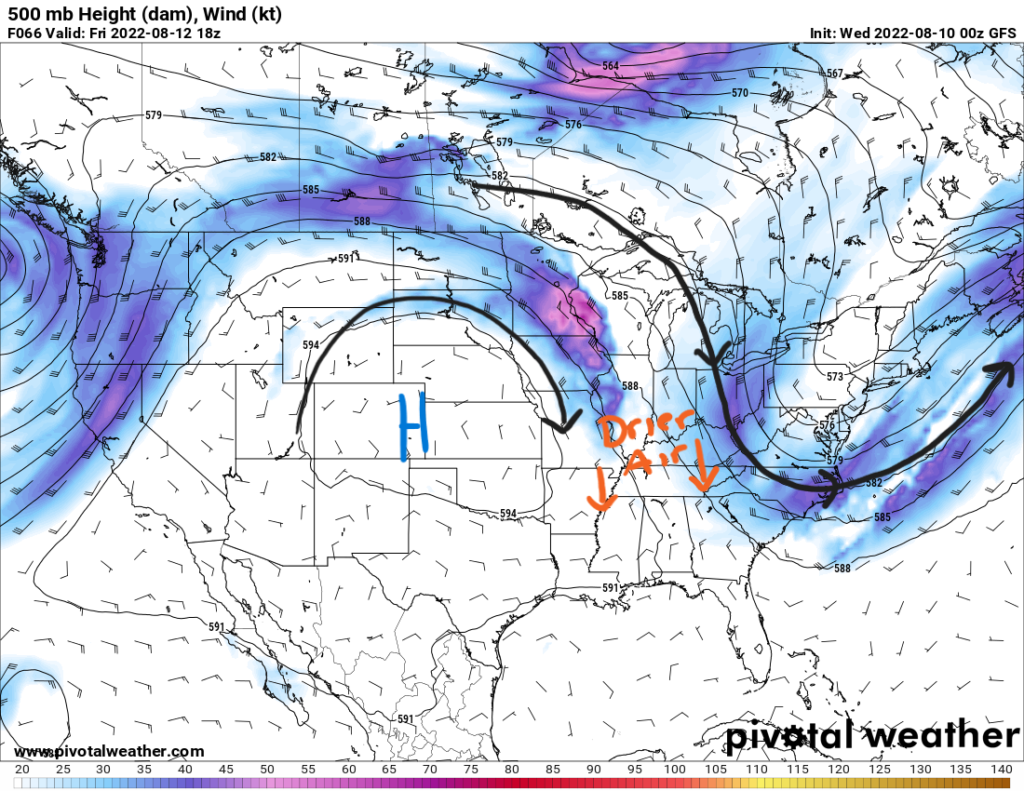
This pattern will persist for awhile before a shift towards the weekend. An upper-level trough will dig into the Southeast by Friday into Saturday. This will bring a front into the area by Saturday that will drop drier air down south and decrease the dewpoints into the 50s and low 60s. This will be a great relief from the humidity although diurnally driven showers and storms will still be possible but will not be as widespread.
Day-to-Day Forecast
Wednesday
Cloudy and humid with a 80-percent chance of widespread thunderstorms beginning in the afternoon. Highs in the upper 80s. Lows in the low 70s.
Thursday
Cloudy with a 80-percent chance of scattered thunderstorms beginning in the afternoon. Highs in the mid 80s. Lows in the low 70s.
Friday
Partly cloudy with a 70-percent chance of thunderstorms beginning in the afternoon. Highs in the upper 80s with heat indices reaching 95F. Lows in the low 70s.
Saturday
Mostly sunny with a 50-percent chance of precipitation. Highs in the upper 80s with heat indices reaching the low 90s. Lows in the low 70s.
Sunday
Mostly sunny with a 30-percent chance of precipitation. Highs in the upper 80s with heat indices reaching the low 90s. Lows in the low 70s.
Monday
Mostly sunny with a 30-percent chance of precipitation. Highs in the upper 80s and low 90s with heat indices in the low-to-mid 90s. Lows in the low 70s.
Tuesday
Mostly sunny with a 30-percent chance of precipitation. Highs in the low 90s with heat indices in the low-to-mid 90s. Lows in the low 70s.


