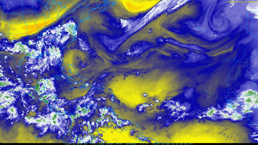
The main features of this water vapor imagery map are an invest in the middle Atlantic over the tropics, a high pressure system northwest of the system, a low pressure system off the west coast of Portugal, a high pressure system off the east coast of Virginia and New Jersey, and a low pressure system about 500 miles east of Bermuda. There is also a tropical wave entering the Atlantic off the west coast of Africa.
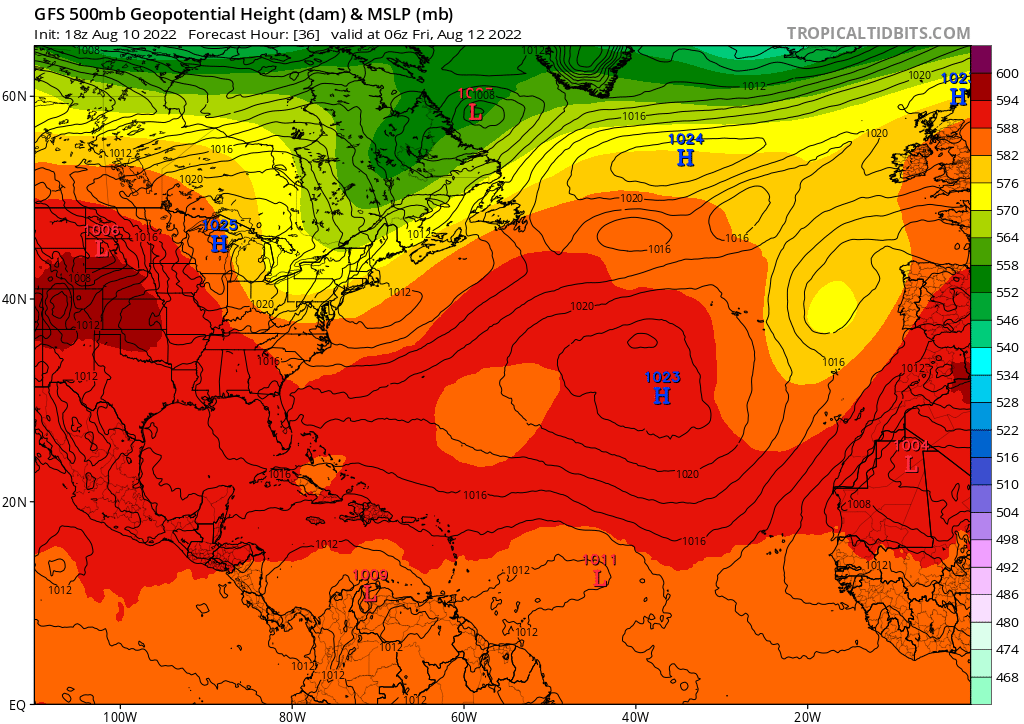
The 500 mb height map shows a small area of lower heights (lower upper level pressure) southeast of Bermuda. Tropical systems are steered toward low pressure, so this will likely give the system a turn toward the northwest. Later in the forecast period, the low pressure in the middle Atlantic dissipates, but a new area of lower pressure forms off the east coast of the south Atlantic states, which should continue to nudge the system in a northwest direction.
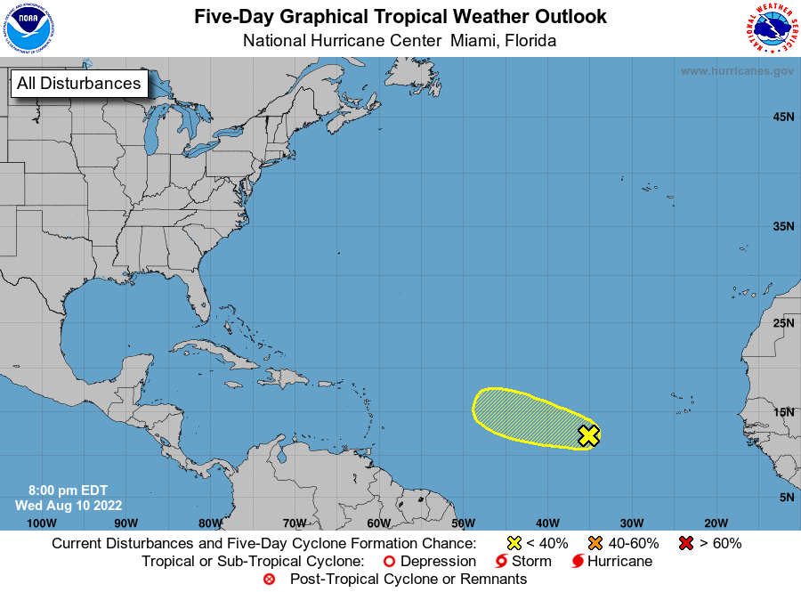
Now that we know the general direction of the system, how favorable is tropical development for it?
The biggest obstacle to the invest is low humidity in the storm’s path. As you can see from the map below, there is an area of low humidity to the northwest of the invest, which is in the current path of the system.
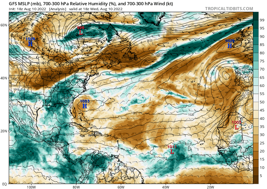
Wind shear is a bit more favorable in the system’s path for the next few days, which is probably why the National Hurricane Center still gives the system a chance of development. The system should experience low wind shear for the next few days. However, as it moves northwest, it may encounter stronger wind shear next week, if the current GFS model’s predictions are accurate. This will hinder development.
Given these facts, I agree with the National Hurricane Center’s forecast for low chances of development for the system.