Following the recent gloomy days, rain has returned across portions of southern Mississippi, Alabama, and Louisiana, but this time, the bigger concern is not just showers, but localized flooding.

TONIGHT
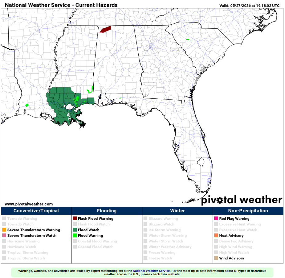
Scattered showers across the region bring the risk for localized flooding in the Southeastern Louisiana/Southern Mississippi area. A more severe risk is in the Slidell to Poplarville area up Hwy 59 where residents have seen significant rainfall over the past few days. Up to 10 inches in some spots! Definitely helping to relieve the drought we have been dealing with, although now we have very wet soil, which is not ideal for the torrential rains that have been moving in this afternoon.
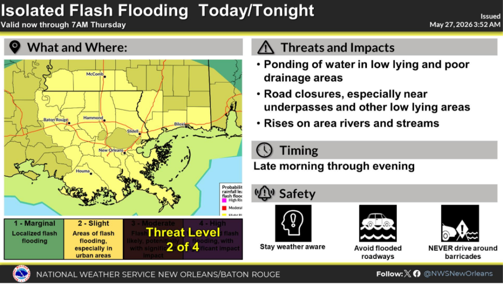
The risk of isolated flash flooding expands beyond that area and even into parts of Western Alabama where residents still have wet front yards from storms earlier this week.
Flooding Impacts:
-Urban and poor drainage flooding is possible in low-lying and urbanized areas
-Minor creek and small stream rises expected where heavier rain persists
-Road ponding and slick conditions likely during peak rainfall periods
-Higher flash flooding risk increases if storms repeatedly track over the same area
TOMORROW
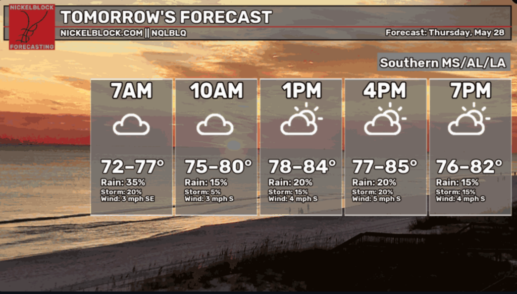
The general consensus across the models is for a cloudier, slightly cooler day than the upcoming week. With that being said, it is officially summer, and there are always those afternoon thunderstorms sneaking in, so be on the lookout for those as well. The rule for tomorrow:
Gulf moisture + daytime heating = instability.
Which means once we hit peak heating, the atmosphere becomes primed for scattered storms to develop. Safe to say, anywhere in our Southern area is fair game for some afternoon showers tomorrow.

TRAVEL
Hopefully, no one made beach plans! If you are travelling down to the Emerald Coast, you might want to pack your umbrella for the end of this week. This area has received LOTS of rain lately, which has ruined many people’s holiday plans, mine included. As for the rest of the Southeast, a good little coating of rain to aid the ongoing drought will bring in a gorgeous Saturday across much of the area.

EXTENDED OUTLOOK
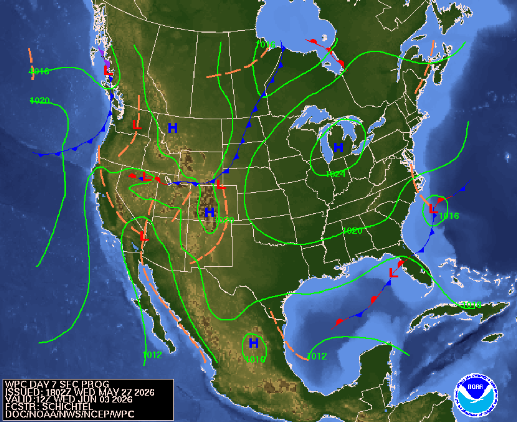
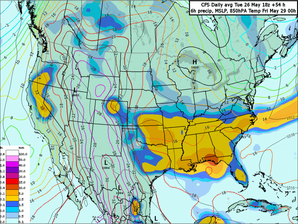
For our extended forecast, we can see on the above graphic from the Weather Prediction Center a high-pressure zone over the Great Lakes region, bringing calmer, more stable weather to that area. We see there are low-pressure zones off the coast of the Carolinas, in the Gulf, and one in the Rocky Mountains, which will impact our weather down south. We have a stationary front (the red and blue line) over Florida, which brings constant, slow-moving storms and rain to the Florida Peninsula.
What this means for the Gulf Coast:
This is the typical early summer setup with plenty of gulf moisture, likely bringing in daily afternoon thunderstorms (Remember the formula from earlier)! Only issues for us would be from these afternoon thunderstorms saturating already soaked areas, which could lead to localized flooding in low-lying areas. In other words, this is good news and nothing more than the normal summer weather that we are used to.
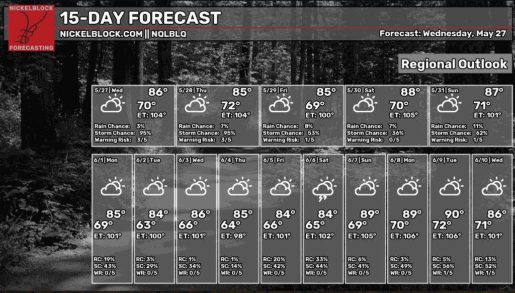
For our 15-day NickelBlock forecast, we see low warning risks and low rain chances, along with warmer weather coming in towards Monday, the 8th. Overall, a pretty solid forecast with nothing too crazy to worry about. Enjoy the hot weather ahead!


