Hello everyone, another good day that there will be no Atlantic Ocean tropical development going on to hit United States and the Caribbean anytime soon. Almost two months has passed by of no tropical development, but the hurricane season is getting closer to peak of the season around August, September and October. Even though the eastern pacific hurricane season still remains active in the last two months. There is going to be more disturbances starting to develop from the tropical waves near the Southern American coast.
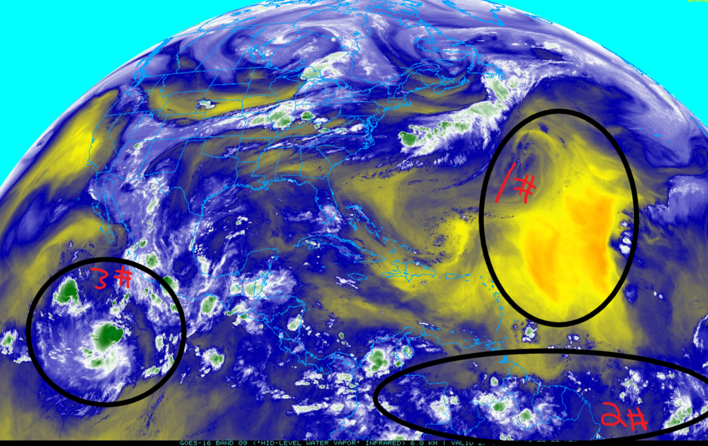
First, The Saharan Air Layer in the middle of the Atlantic Ocean still remain strong to deny any more moisture to any tropical waves that want to form into a tropical storm in the Atlantic Ocean.
Second, there still a train of tropical waves from the western coast of Africa trying to travel to the Pacific Ocean to develop into something stronger.
Third, the Invest 97E has quickly evolved into a tropical storm in the eastern Pacific Ocean. Tropical Storm Frank will continue to be stronger in the next few days as it is traveling deeper to Pacific Ocean.
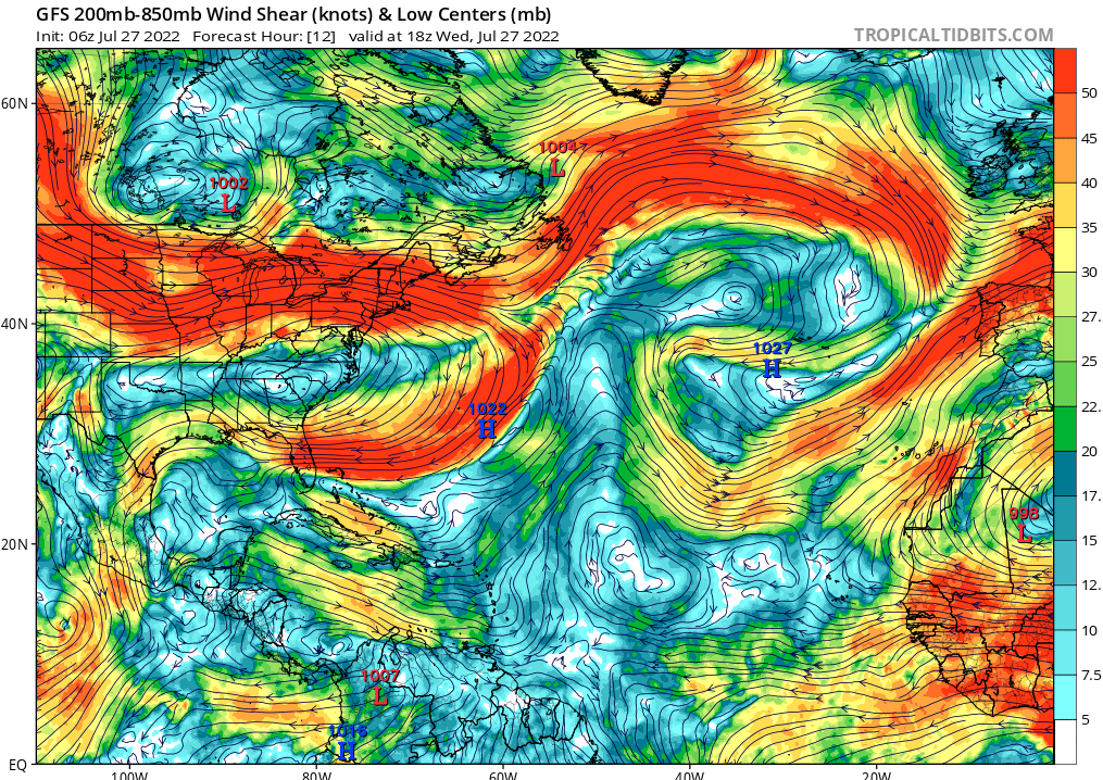
It seems like the wind shear starting to clear up and less abundant of the wind shear throughout the Atlantic Ocean. There will still some strong wind shear surrounding United States and the Caribbean to try preventing anything coming closer to those countries, unless they get weaken from the wind shear.
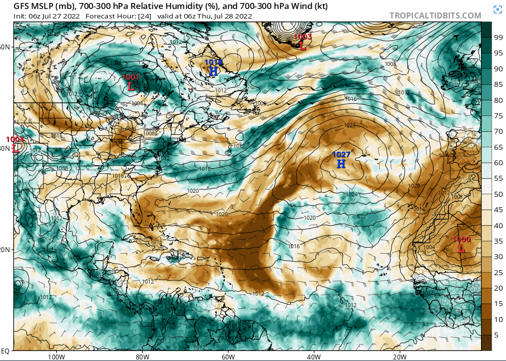
Onto the next factor of the quite tropical development in the Atlantic Ocean will be the Low Relative humidity. It seems like there will be a high-pressure system forming in the Atlantic Ocean to suppress any storms to form or get weaken by the high-pressure system.
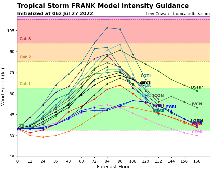
For Tropical storm Frank, there are multiple models that Frank can be strong as a Category three or two in the eastern Pacific Ocean. There are a lot of favorable factors for tropical Storm Frank with a high Relative Humidity, High Sea surface temperatures, and somewhat low wind shear.
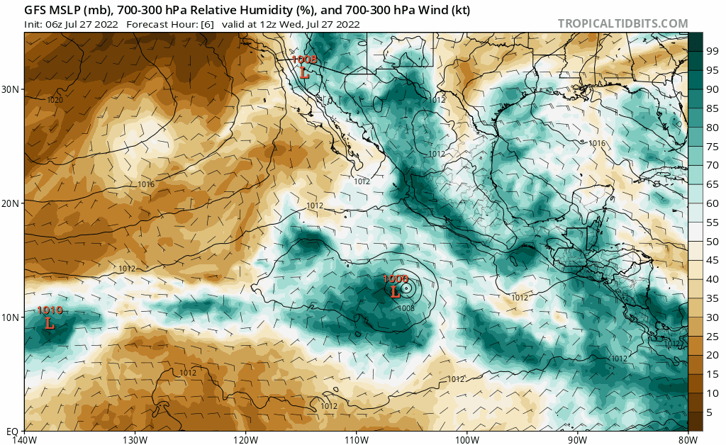
Meanwhile, Tropical storm Frank has encountering a lot of relative humidity and it is gathering more from it surrounding areas. This gif shows his predicted path and the strength of Tropical storm Frank. In the next few days, it will encounter a very dry air mass in the Northern Pacific Ocean that will weaken Tropical storm Frank like other hurricanes and tropical storms that met the same fate.


