Howdy!
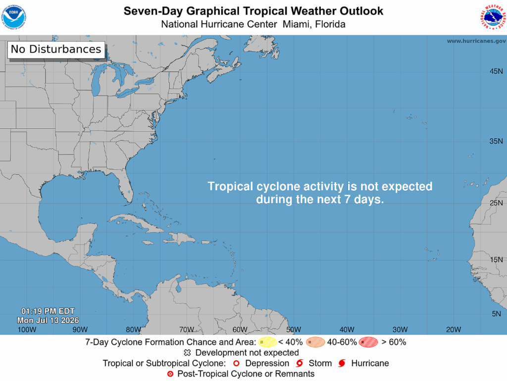
The National Hurricane Center is not expecting any tropical cyclone activity in the next 7 days!
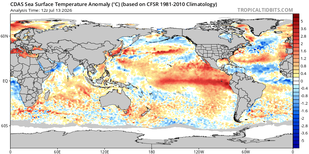
This is on track for the below average season, and we can see below on the sea surface temperature anomaly graph, the ocean temperature in the far eastern Atlantic (where storms are initiated) is a lot cooler than the average (based off of 1981-2010). Also, in the Caribbean Sea, it is much cooler. The cooler ocean temperatures will not provide the needed fuel for any meaningful storm to form and eventually turn into a hurricane.
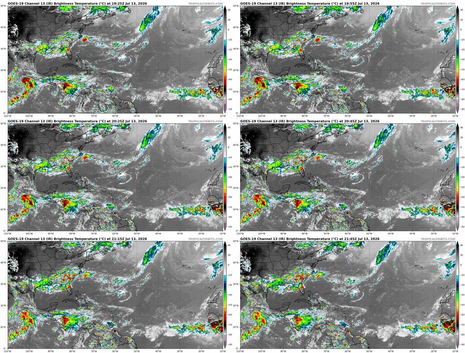
Below in the Longwave IR satellite image, the red/darker colors represent areas with cooler cloud tops and areas of possible convection. Some tropical waves are triggering this convection, out off the coast of Mexico is an example of this. There is also a bit of convection along the ITCZ, but nothing will form into a storm.
It is still early on into the season as the peak for hurricane activity is in September (around the 10th). Even with no hurricane or tropical storms, tropical moisture can still play a role in the local weather. For example, in southeastern Texas, deep tropical moisture had flown into the area these past few days and has aided in producing heavy rainfall and thunderstorms. It is still important to keep up to date on the weather and to have a plan in place just in case a tropical storm/hurricane does impact your area.
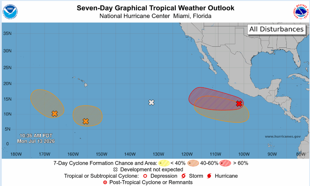
While the Atlantic is quiet, the Pacific is firing up and is seeing several different possibilities of tropical cyclone development. Unlike the Atlantic, the Pacific is forecasted to have an above average hurricane season as El Nino shapes ocean and weather patterns.
As things are relatively quiet for the Atlantic, there is not much to worry about! I encourage you to keep checking in on these tropical forecasts and be updated on the weather in general. Thank you and have a good rest of your Monday!


