Hello, I hope you are having a great week so far. We have much to discuss in this forecast, so let’s get started. We currently have two named storms, one in the Atlantic and one in the Pacific. The Atlantic storm is named Tropical Storm Don and is in the middle of the Atlantic. The Pacific storm is named Tropical Storm Calvin and is located off the coast of Hawaii.
The Atlantic Basin:

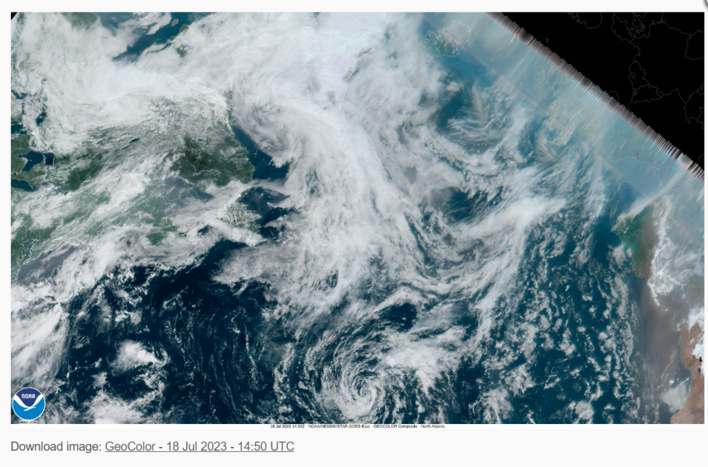
Starting with the Atlantic Basin, we currently have one named storm. The storm in question is Tropical Storm Don. Don originated from an area of low pressure in the Atlantic near Bermuda. Due to a blocking ridge to the north, Don strengthened into a tropical cyclone. As of 3 PM GMT on July 18th, the storm was located at latitude 35.6 North, longitude 39.3 West, and is moving southeast at 9 mph (8knots). The minimal central pressure last observed was 1006 MB (29.71 inHg), and current winds are 40 mph. The current forecast has this system moving northwest later this week while remaining a tropical storm. Cold Waters and unfavorable conditions are preventing this storm from gaining strength. As of this forecast, no area of land should see impacts from this storm, but the Provident of Newfoundland and Labrador may see impacts from this storm; however, it’s too early to be sure.
The Pacific Basin:

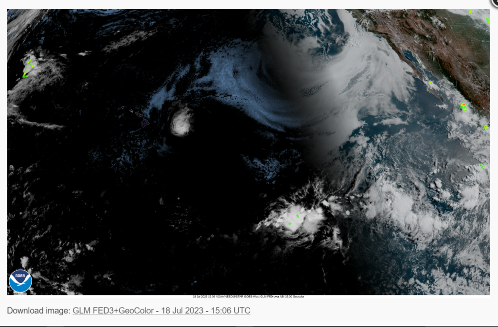
Looking at the Pacific Basin, we have one named storm. The storm in question is Tropical Storm Calvin. Calvin originated off the coast of Mexico and rapidly strengthened due to the El Nino conditions present in the Pacific. Moving westwards from low-level trade winds, Calvin rapidly weakened to a tropical storm due to cooler waters. As of 5 AM Hawaiian Alution time, the storm was located at latitude. 17.5 north, longitude 149.5 west, or about 500 miles from Hilo, Hawaii, moving west at 22 mph (19 knots). The minimum central pressure last observed was 1002 mb (29.59 inHg), and current winds are 45 mph. The storm is expected to pass just south of the Island of Hawaii (Big Island), with continued weakening as the system moves west of the islands. Primary impacts from Calvin will be high surf of 15 feet, heavy rains of up to 10 inches on the island’s windward side, and gusty winds of up to 60 mph. Those on the Island of Hawaii should avoid ocean activities and be prepared for high winds and heavy rains. Make sure to stock up on food and water and have a battery-powered radio with you during the duration of the storm.
Extended Outlook
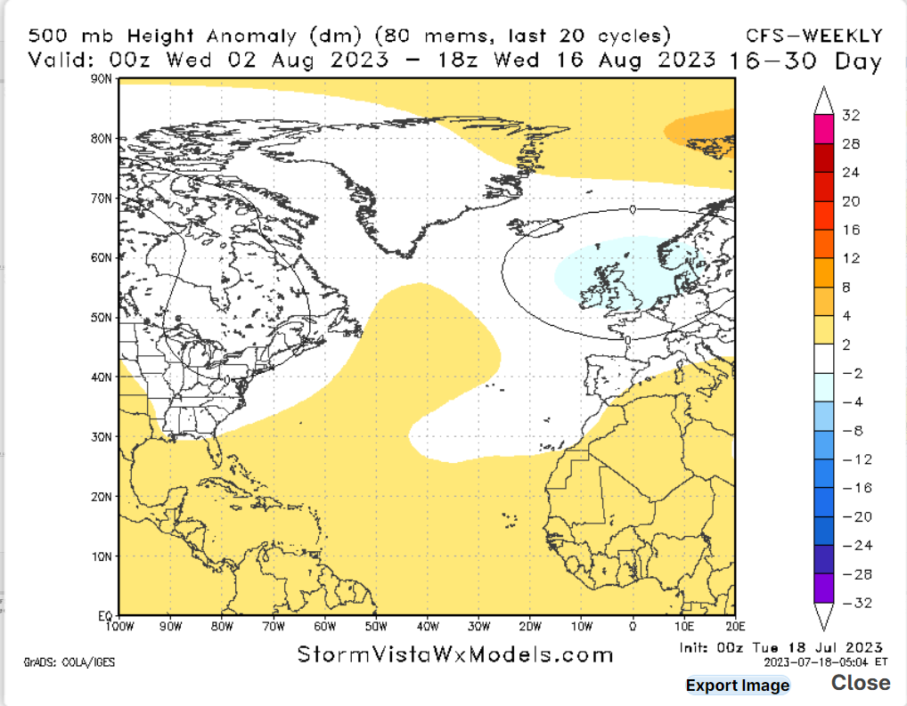
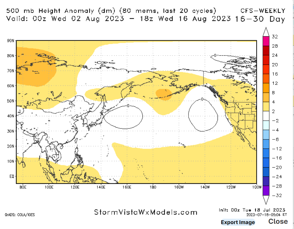
Looking at the extended outlook, one thing becomes apparent; the warmer-than-average sea surface temperatures. Combine this with low wind shear, and you have an active ocean basin suitable for tropical cyclone development. Like many other meteorologists, I am forecasting this will be an above-average hurricane season for both the Atlantic and Pacific Basins. After a triple La Nina event and three years of below-average hurricane seasons in the Pacific, this year looks like an active year, so please remember and review your hurricane plan.
Conclusions
Looking at Tropical Storm Don, not much is expected out of this storm at the moment, but always remember to keep an eye on the system as it starts to move northwest. As for Calvin, continued weakening is expected as it passes the Hawaiian Islands. Heavy rain, high surf, and gusty winds will be the primary threats from this system.


