Howdy!
As we near the Atlantic Hurricane season starting officially on June 1, it is important to keep updated on what is going on in the tropics. NOAA has released their outlook for the 2026 hurricane season, indicating it will be relatively quiet and below average. However, even in the quieter seasons it is important to note that a devastating storm can still occur, so be on the lookout and keep informed!
On that note, nothing much going on now! We most likely won’t see any significant development until later in the season, with the peak in September.
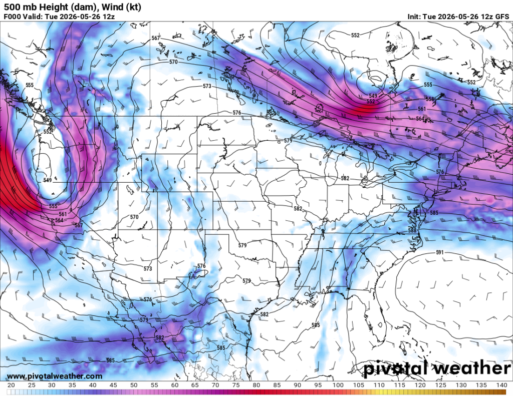
Sea surface temperatures are relatively cool and looking above we can see the subtropical ridge is displaced, a dominant trough over the eastern U.S. that increases upper-level winds over the Gulf and western Atlantic, which is keeping tropical development limited.
Looking now, though, we can see a bit of convection built up in the Gulf in the infrared satellite imagery, those colder cloud tops denoted in the yellow/red colors indicating areas of storm development.
This convection is due to the upper-level trough paired with lots of tropical moisture in the region. Scattered showers and thunderstorms in the central/eastern gulf will be present for the next couple days.
Looking at the total precipitable water below, it is clear there is repeated moisture being brought to the Gulf Coast into local regions in Louisiana, Mississippi, Alabama, and the Florida Panhandle, contributing to that rainfall we have been seeing lately.
For those that don’t know, total precipitable water represents the total moisture in a column of air above a particular location. So if I were to squeeze out all the moisture in the atmosphere at that location, that’s how much liquid water I would get.
Again, no significant tropical development, just those showers/thunderstorms in the Gulf and that repeated onshore flow of moisture. Keep checking back for updates on all things tropical weather!


