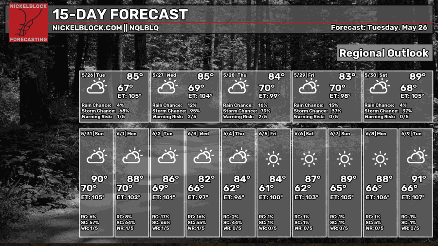
There seems to be a pattern over the last week of precipitation and thunderstorms in our area. With us near a lingering boundary and winds coming out of the southeast, the showers will continue. We will experience excessive rainfall and chances for flash flooding and nuisance flooding.

Ironic how we have been in a drought and now the rain won’t leave us alone!

Today
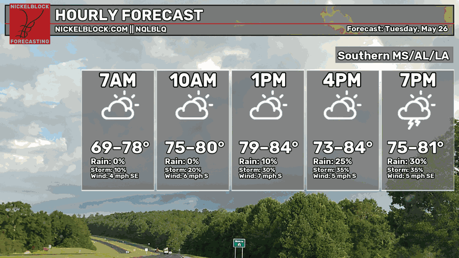
Going to be another hot and humid day here in the South. We’re looking at highs of mid-80s today. In most of our area, the air really feels like we’re in the lower to mid-90s! The chances for showers and storms will increase as we go about our day. Winds coming out of the South-southeast will fuel the showers and thunderstorms along with the lingering front toward Northwest MS.
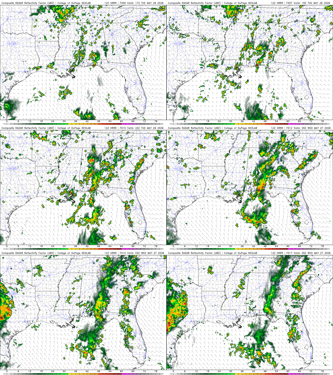
As this is being written, there are scattered showers and thunderstorms across Southern MS and AL moving northeast. Even isolated thunderstorms just off the coast of Southern LA. During the afternoon hours, these thunderstorms will begin to strengthen and continue to move northeast slowly. Thunderstorms will develop south of LA and move through South LA until around 8 pm. For the rest of the day, into the evening and nighttime hours, Southern MS and AL will see pop-ups of showers and thunderstorms.
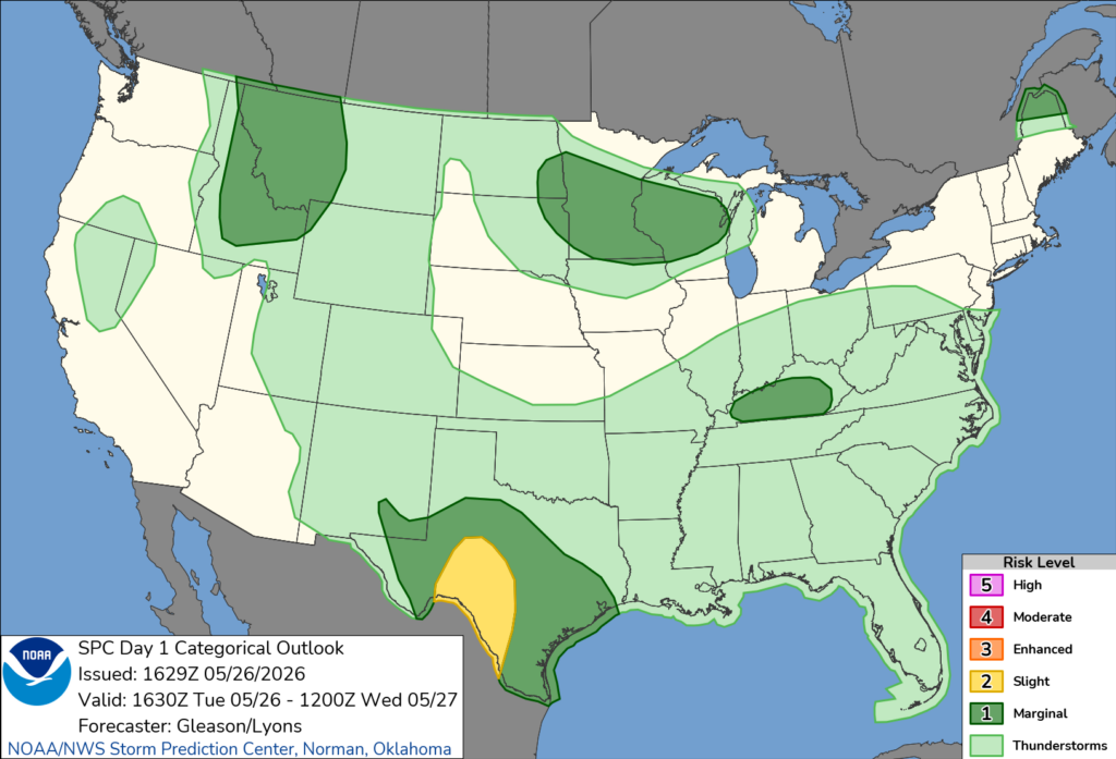
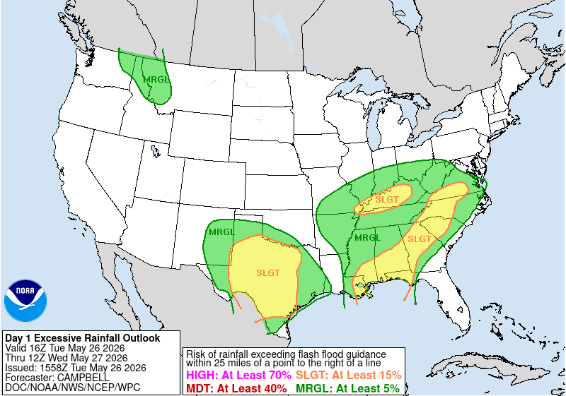
The SPC has our area under a general thunderstorm risk into Wednesday morning. As for rainfall, our entire area is at risk of excessive rainfall. The main concern here is flash flooding and flooding. Make sure to keep an eye out for active alerts in your area.

Tomorrow
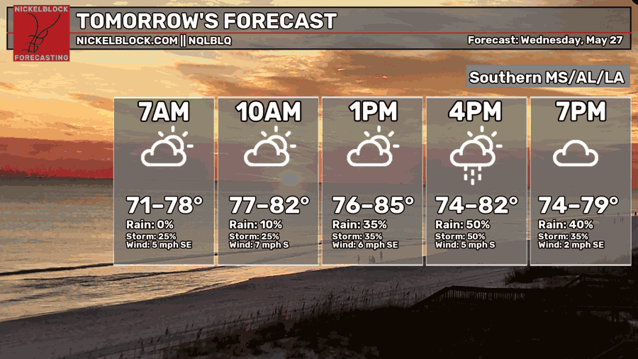
Still going to be hot and humid with highs in the mid-80s. Our chances of rain and thunderstorms will continue. Who would have thought?!
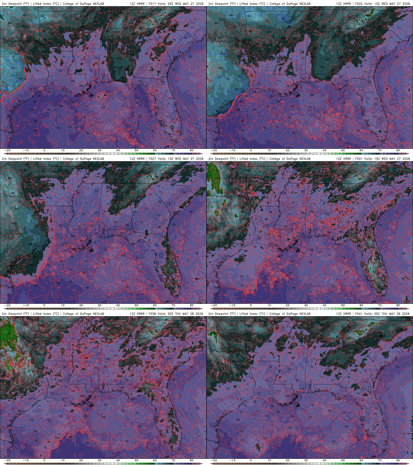
The dewpoint values are very high in our area. The purple color is highlighting the warm, tropical moisture. The red lines are the contours of the negative lifting index (LI). What does this mean exactly? Well, if you put these two variables together, tropical moisture and negative LI, the more unstable the atmosphere will be. More warm air will rise the more unstable the atmosphere is. This is the recipe for thunderstorms and precipitation, possibly supporting severe weather.
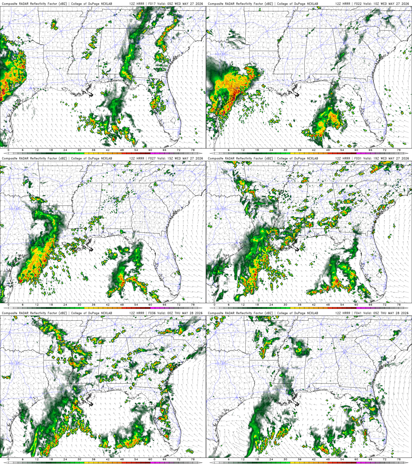
Southern LA will start to see scattered thunderstorms and rain around 8 am, but things will begin to pick up around the early afternoon, especially in LA. The storms are pushing east-northeast. Looks like Southern MS and AL will start to dry up around the late evening. Again, our area has been getting tons of rain the past week, and flash flooding and flooding are very possible. Keep yourself posted with any alerts that come out in your area.
Thursday
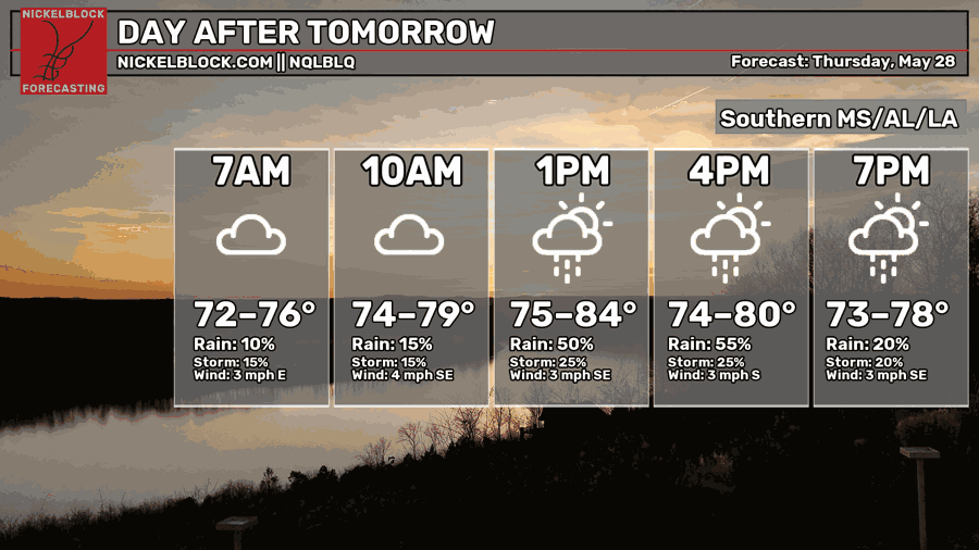
The warm and humid pattern will remain with highs in the mid-80s. Showers and thunderstorms are here to stay. I just want a good beach day. Anyone else?
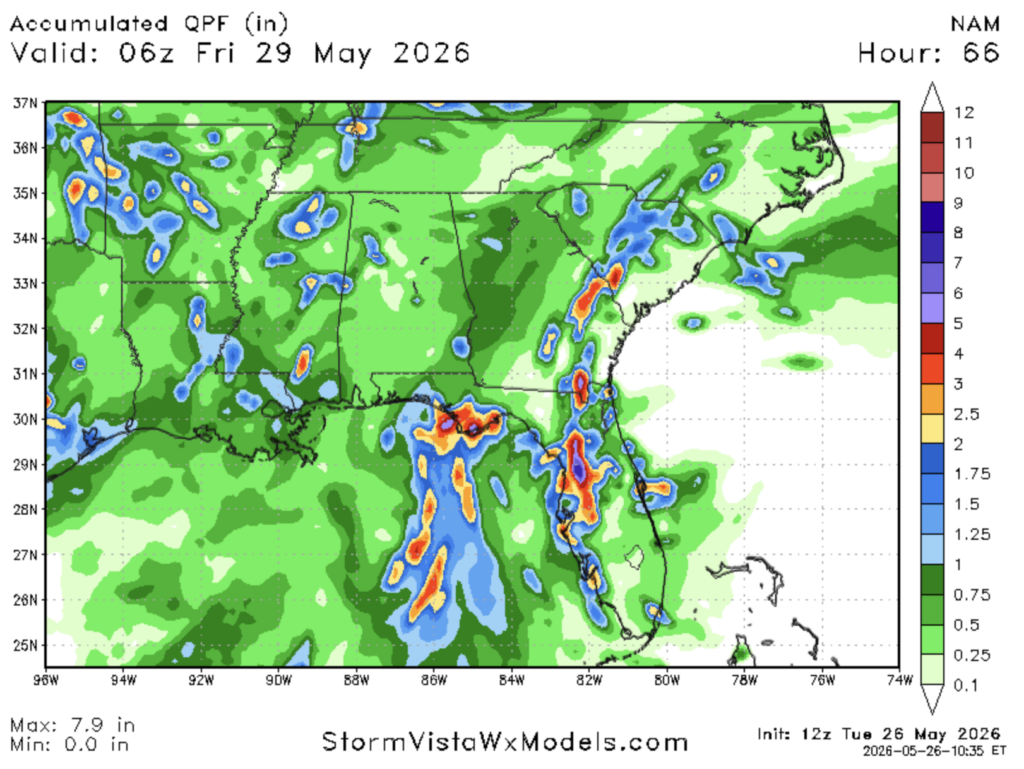
We will pile on more rain over the next few days. This shows the amount of precipitation from Tuesday at 9 am till Friday at 1 am. While just above an inch may not seem like a lot, with all the rain we’ve been receiving the past week, along with areas that have had flash flooding, it will definitely continue to affect our area.

Extended Forecast
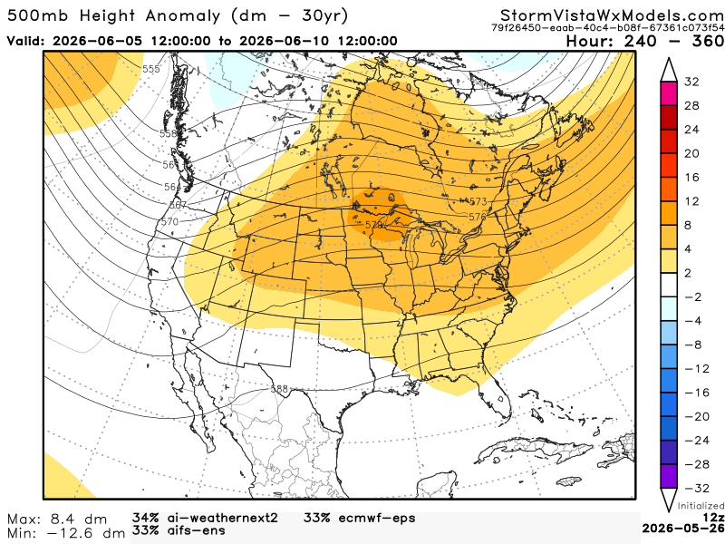
If we look into the future, we might be seeing a new pattern in our weather. At the end of next week, you seem to see our area in a slight ridging pattern, possibly more neutral (zonal). It would be somewhere between Texas and the Bahamas. Below is a graphic with 3 different possibilities blended into one outcome.
Below, we have two different scenarios of a high-pressure system in the Gulf and in Texas.
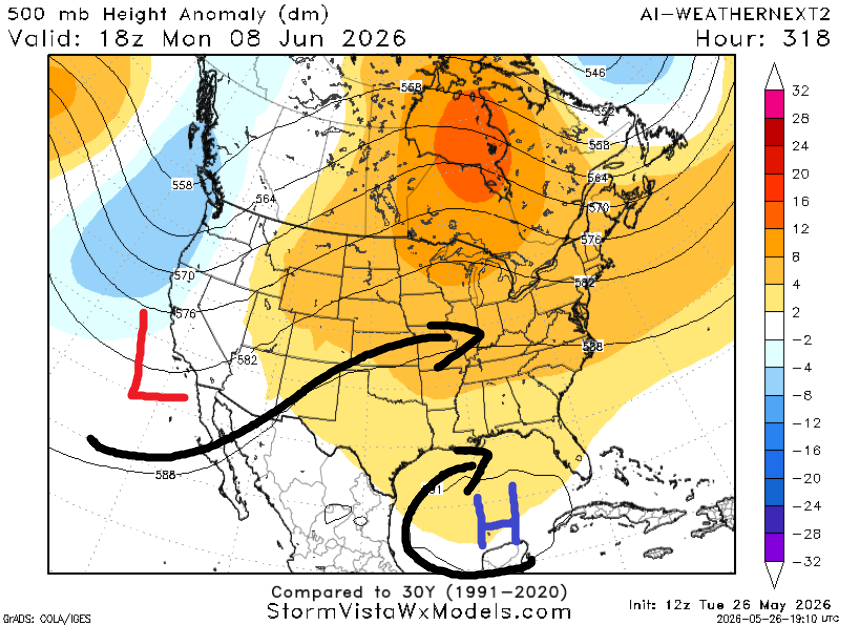
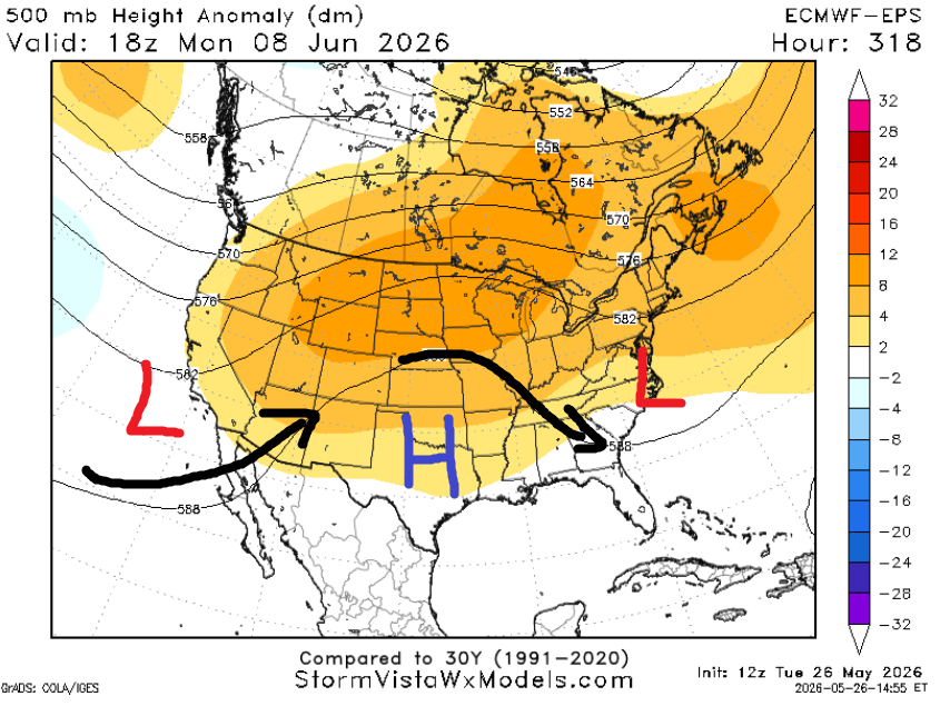
What does this mean for us? Well, we are looking at a few options: warmer and drier, warmer and humid, or we stay the same. After looking over the past week of the model accuracy per model, the warmer and drier outcome has a higher chance than the other three.


The CPC outlook has our area with temperatures below normal with above normal precipitation. While we would like a drier trend to take over eventually, the CPC still has us cooler and wetter. Looks like we have plenty to watch out for in the coming days.
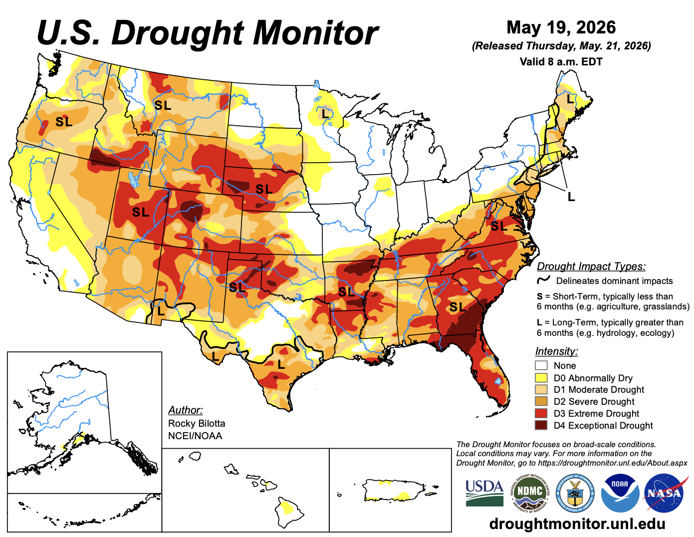
As of last week, we were still looking at being in a drought in the area. With all this precipitation we’ve been getting recently, we’ll start seeing our area slowly but surely leave the drought conditions.