Hello, I hope that you are having a great week. We have some developing hurricane information in both the Pacific and Atlantic. Looking at the Atlantic, we have one system of disturbance located in the Central Atlantic. Looking at the Pacific, we have quite a bit more action with a system that has just developed in the last couple of hours. Due to the strong El Nino in both the Pacific and the Atlantic, this has been quite an active start to the hurricane season.
The Atlantic Outlook

So far, this has been a fairly active start to the Atlantic hurricane season, with multiple named storms. This trend may continue with a new system that has started to show some signs of development. An area of low pressure located in the central Atlantic has been producing disorganized showers and thunderstorms 200 miles north of Bermuda. Moderately conducive environmental conditions have allowed this low pressure system to show some signs of organization. A tropical system has a 30% chance of developing in the next several days and is forecasted to move in a northerly direction. Because of the location of the low pressure system, cooler waters will limit the strength and organization of the system. Those who live in the Northeast should not worry about this storm as it’s forecasted to move away from the U.S.
The Pacific Outlook


Things are quite a bit more active in the Pacific, not only as of today but as a season as a whole. Due to the extreme El Nino conditions off the coast of South America, hurricane activity has been above normal. This trend is expected to continue with another system that has recently developed. This new system (Tropical Depression Three) has just formed off the coast of Mexico. Current winds are 35 mph (30 knots), and a minimal central pressure of 1007 mb (29.74 inches). Current forecasting trends put this storm in a westerly direction away from Mexico and towards Hawaii. Those who are in Hawaii should not be concerned at the moment as this storm is forecasted to weaken before impacting Hawaii.
Extended Outlook
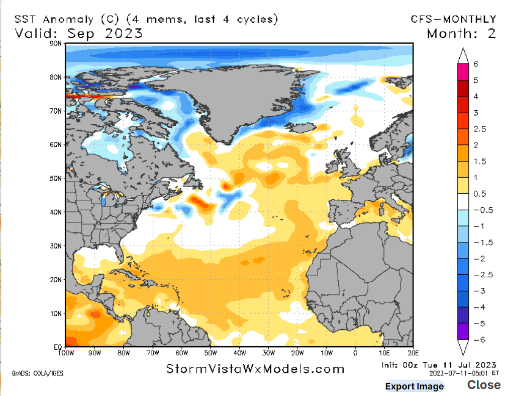
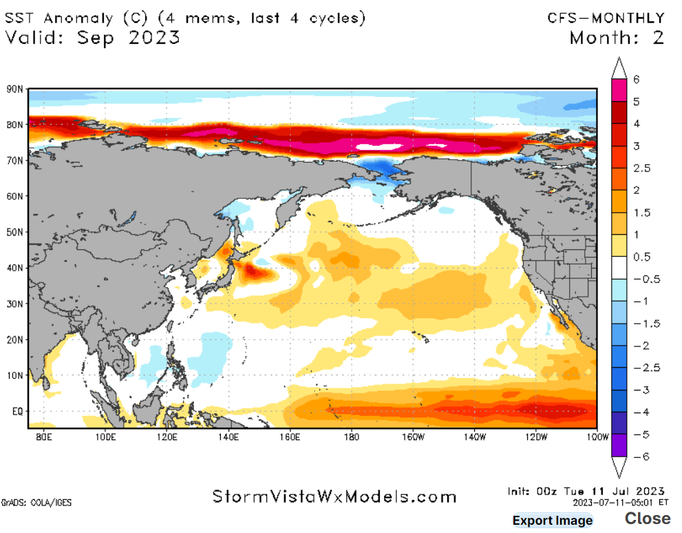
Looking at our extended outlook, I would expect that this above average activity will continue throughout the rest of the hurricane season. Sea surface temperatures are well above average, which, if you don’t know, warm waters are the fuel for hurricanes. Not only will the Pacific see above average temperatures, but it’s looking like the Atlantic will also see above average sea surface temperatures. If you live in a hurricane-prone area, please take this time to prepare your hurricane survival kit and make sure you have a plan in action in case of evacuation.
Conclusion
It has been quite an active start to the hurricane season in both oceans. This trend is expected to continue primarily due to warmer-than-normal water temperatures. Please be prepared this hurricane season and remember to check NickelBlock Forcasing for the latest in hurricane information.


