The main feature in the tropics, Tropical Storm Bonnie, is heading towards the Pacific while the rest of the Atlantic is mostly quiet for now. Invest 95L off of the Gulf Coast moved inland. It never gained a name, but brought some rainfall to the northeast coast of Texas and southern Louisiana. Most of the heavy rain remained offshore, but some rainfall totals reached 2.3″ in Galveston, 1.5″ in Beaumont, and only 0.5″ in Houston and Lake Charles from Thursday morning to Friday morning.
Across the Atlantic, the Bermuda high is keeping the easterly flow near the intertropical convergence zone (ITCZ) just north of the Equator helping to guide any waves westward. Looking to what is active now, three areas are being monitored by the National Hurricane Center (NHC). Tropical Storm Bonnie looks to bring heavy rainfall to Nicaragua and Costa Rica while Invest 96L subtly spins of the Carolina coast. Another area to watch is a tropical wave southwest of Puerto Rico over the Windward Islands.
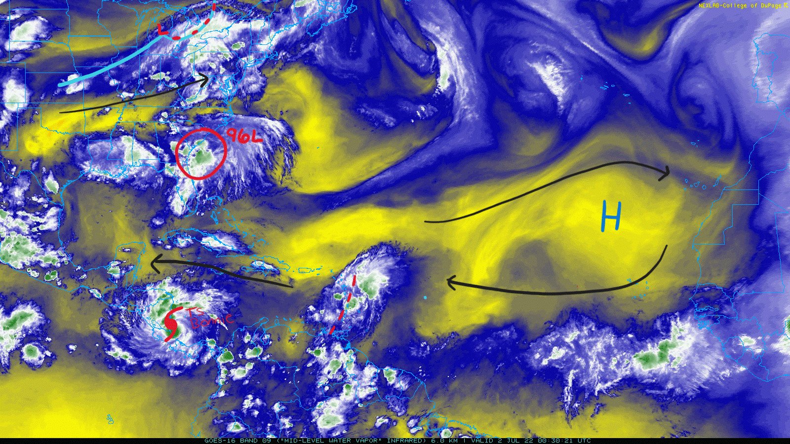
Tropical Storm Bonnie
The Hurricane Hunters invested the storm and found a closed center of circulation that prompted the NHC to declare the storm a tropical storm with sustained winds of 45mph on the 11 am EDT advisory Friday morning. Recon is in the storm again as of 9:30 pm EDT on Friday still finding that closed circulation as well as flight level winds of 55+mph.

Bonnie’s satellite presentation has improved from the past couple days. Convection is more organized around the center and an anticyclone is present in the upper-levels where flow is clockwise. Healthy, mature tropical cyclones will have the counterclockwise low pressure center near the surface, and increasing with height, the low weakens and becomes a high pressure center with clockwise flow. Bonnie is also seeing plenty of bursts of convection.
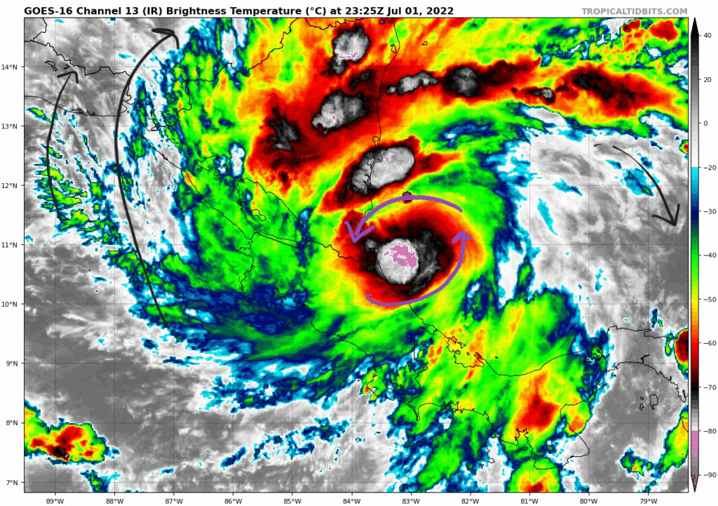
Tropical Storm Bonnie made landfall overnight Friday near the Nicaragua and Costa Rica border. Tropical storm warnings are in place for the western and eastern coasts. As the storm moves across, heavy rainfall in the area will pose the risk for flash flooding and mudslides. Some weakening is expected as the storm moves over land; however, once it crosses into the Pacific, there exists a favorable environment with low shear and warm water to allow intensification. The NHC is seeing intensification to hurricane status in the beginning of next week.

Invest 96L
Off of the coast of the Carolinas is an area of rain and thunderstorms associated with a low pressure system. This convection has lasted over a 6 to 12 hour period to aid in tropical storm force winds being sustained over water. The NHC gives this a 60-percent chance of development over the next 48 hours in response to observations of tropical storm conditions. Regardless of development, this system will bring heavy rainfall to parts of the coast of Georgia into the Carolinas.
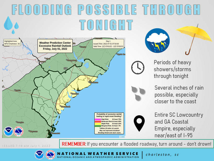
Invest 96L features a low-level circulation and winds of 34mph in places, but remains nameless. Places along the coast could see tropical storm conditions with strong wind gusts and heavy rain. Surface observations and analysis show the counterclockwise center of circulation; however, the low’s minimum pressure at the center is still relatively high at 1015mb.

This system is forecasted to move northeastward alongside the coast during the next few days with intensification being slow. Flash flooding will be a risk for areas that receive heavy rain for along period of time.

Tropical Wave
The last area of interest is a tropical wave over the Windward Islands. Robust showers and thunderstorms exists over the wave, but are disorganized in nature.
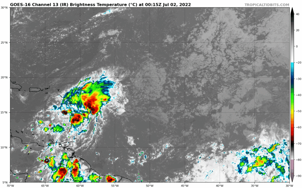
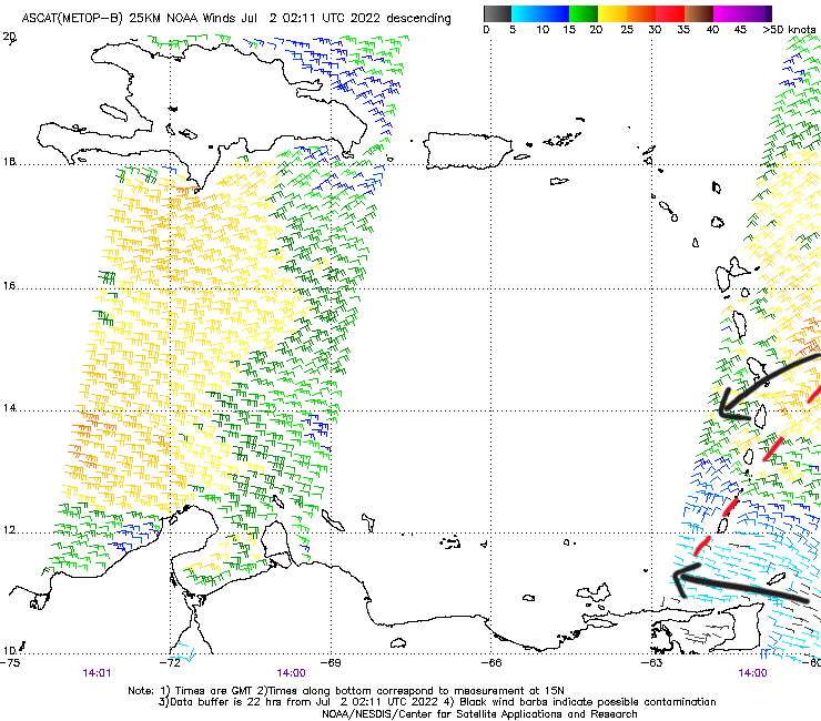
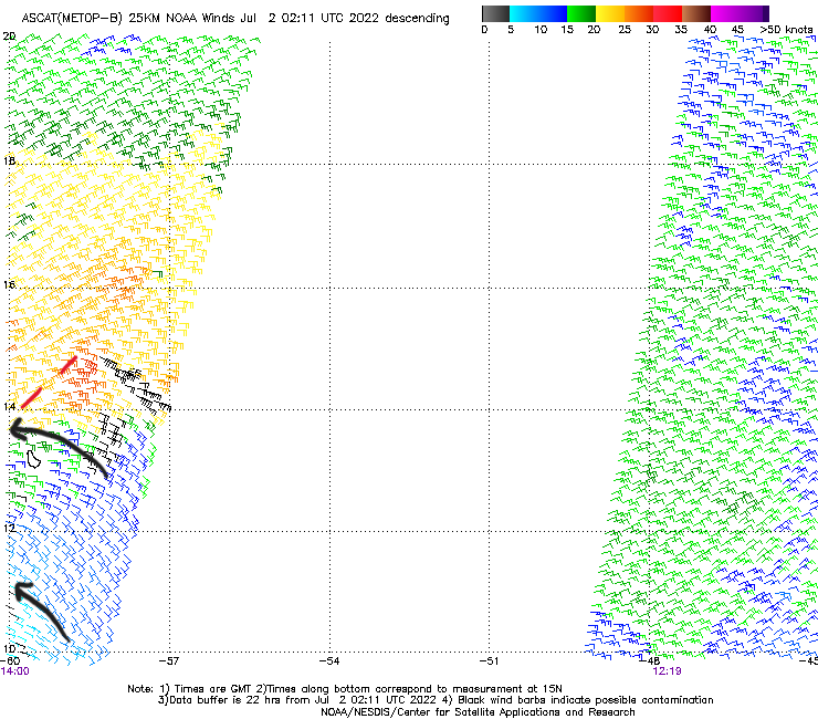
The latest ASCAT (Advanced Scatterometer) pass shows the well defined wave, but no center of circulation. A scatterometer is a satellite that estimates surface winds from the backscatter of light from waves on the ocean’s surface. Winds of 25+kts can be seen as the red wind barbs in the image below. The NHC gives this system a 10-percent chance of development over the next 48 hours and 5 days. It will move towards the west in an unfavorable environment with drier air and high wind shear.