Our second named tropical storm is well underway in the Atlantic Ocean, with Tropical Storm Bret slowly making its way westward towards the Caribbean Sea. Activity in the Atlantic does not look to be limited to just Bret in the near-term, as we got another tropical low behind Bret that is very likely to organize into another tropical depression. Out west in the Eastern Pacific, while conditions are relatively quiet and will be over the next couple of days, another area off the Mexican coast has our attention for organized tropical development over the next week or so. Both of these basins will have to be watched carefully as we start to get deeper into the 2023 Hurricane Season. With that said, let us take a more detailed look into what is currently happening and what current thinking is over the next couple of weeks.
[wpcode id=”41149″]
Current Tropical Conditions
Activity in the central Atlantic basin is becoming busier through the last couple weeks of June. At the top of the priority list, we have our latest tropical storm in Tropical Storm Bret. As of the 7pm CDT, Tropical Storm Bret is located about 300 miles east of Barbados, moving to the west at 15 mph, with peak sustained winds of 65 mph and a central pressure of 1000 mb. Current track of Bret has it staying on a westward course towards the Lesser Antilles, arriving by late Thursday night to early Friday morning. In tandem with this, a Tropical Storm Warning is in effect for St. Lucia and Martinique as well as a Tropical Storm Watch for Barbados and Dominica, with the potential for further advisories or upgrades possible. As it stands currently,
Bret is expected to maintain tropical storm intensity before weakening into a depression by the end of the weekend. A couple main reasons for this is, while SSTs in the Atlantic Ocean are very warm (at 25°C to 30°C), considerable wind shear aloft between 5,000 ft and 39,000 ft will offer plenty of destructive interference for this storm, as well as very dry air getting ingested in front of the system. Both of these factors will keep Bret at tropical storm intensity at this time. Nonetheless, some hazards posed by Bret will be heavy rains and high winds for the Lesser Antilles.

Behind Bret, we are watching another area with a high likelihood of becoming organized over the coming days. This area, Invest 93L, is slated to move into more favorable atmospheric conditions over the next couple days that will allow it to organize into at least a tropical depression. Should it later become a tropical storm, this would be named Cindy.
Current guidance has this cluster of storms taking a west-northwesterly track and becoming organized over the next few days, before running into the same destructive dynamics at play that will cause Bret to weaken. This is, of course, always a dynamic situation and changes in track and intensity will be closely monitored.

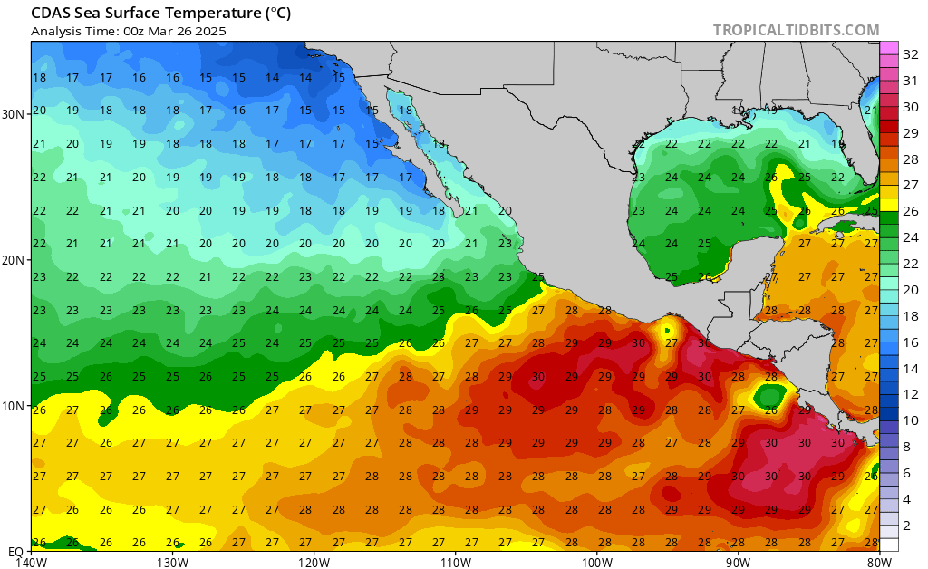
Shifting to the Eastern Pacific Ocean, clusters of thunderstorms off the Mexican coast look to get their act together over the next week. A big limiting factor right now preventing further confidence in these storms organizing is the relatively narrow area of favorability confined along the western coast of Mexico. Too far north or south and these storms encounter moderate to heavy wind shear. Attention will have to be had to this region in the long-term for organization and development.

[wpcode id=”41149″]
Looking Ahead
Over the next couple weeks, the Pacific basin looks to be the main frontrunner for tropical development currently. Overall upper-air conditions are more favorable in this corner of the world, as well as the presence of extremely warm SSTs (30°+ C). GEFS ensemble members are picking up on this increased favorability too and hinting at increased tropical activity off the western Mexican coast. Contrastingly, the Atlantic basin looks to be more muted over the next two weeks.
One big limiting factor is the placement and intensification of the subtropical jet over the main region where we expect tropical systems to develop. This in large part is due to the strengthening El Nino conditions in the Pacific, leading to a more vigorous subtropical jet and overall unfavorable upper-air conditions to support tropical cyclones. But as always, the oceans and atmosphere are a dynamic and changing environment and sudden changes to conditions or patterns are always possible.
[wpcode id=”41149″]
Conclusion
Tropical Storm Bret continues to slowly make its way westward in the Central Atlantic, heading towards the Lesser Antilles. Tropical Storm Watches are already in effect for these islands and further updates will come out in the coming days. Watching immediately behind Bret, we have another area likely to develop into at least a tropical depression over the next few days.
Out in the Pacific, things are keeping quiet for the next couple of days before we look for organization of storms coming off of Mexico over the next week. This basin looks to be the most active as of right now in the long run, with more favorable conditions for tropical systems evident, as compared to the Atlantic, where the subtropical jet will keep things more muted.


