
As a stationary front stays in our area today some showers are possible early this morning. It could leave some scattered rain storms throughout the day along the coastal region. Some flash flooding from the previous storms is still likely. With many low pressure systems circulating nearby it’s hard to say whether or not the chance of storms is low.
Our area is currently stuck between two ridges so movement of these lows is limited. Stormy patterns are being shown around the area but as of now most are along the coast. The coastal area is more likely to see some more rain and flash flooding associated with any new rainfall.
Looking at the SPC outlook we see only a marginal risk to the east and back to the west, with “general thunder” for the next few days which means some lingering rain showers are possible. The coastal regions have the highest chance at some stronger storms and heavy rainfall. The chance of flash flooding is possible along the coastal counties so be aware. As this stationary front moves from our area some clear weather should be behind it into next week.
On the radar we can see some small chances of showers over the course of the next week or so. These storms will be closer to the coastal communities. However it will mostly be dry in the more central and northern areas of Mississippi and Alabama. A chance of afternoon storms is always possible with the high humidity and temperatures across the region so always be alert. This weekend looks pretty clear with some areas under a scattered thunderstorm chance. Next Monday afternoon is our best chance of widespread showers due to the many low pressure systems around the area.
Many slight changes in weather patterns is possible due to the upper level lows in the region. If one or both ridges change position we can see drastic changes to our forecast ahead. As of now the forecast doesn’t look very active with only some small rain showers forecasted and they are very scattered. Flooding warnings will most likely be in affect until tonight but if we see a pattern shift in the next few days the chances of flooding can occur again. However, if the ridging builds we will see clear weather which is what is predicted for now for most of the area.
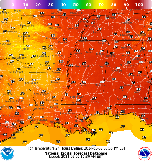
Today and many of the upcoming days are going to be hot with many temperatures in the area getting into the 90s. Over the next week we will see these hotter days. Fortunately most nights will be cooler in the mid to low 70s. Coastal counties will see less drastic heat during the day with temperatures not varying much from day to day.
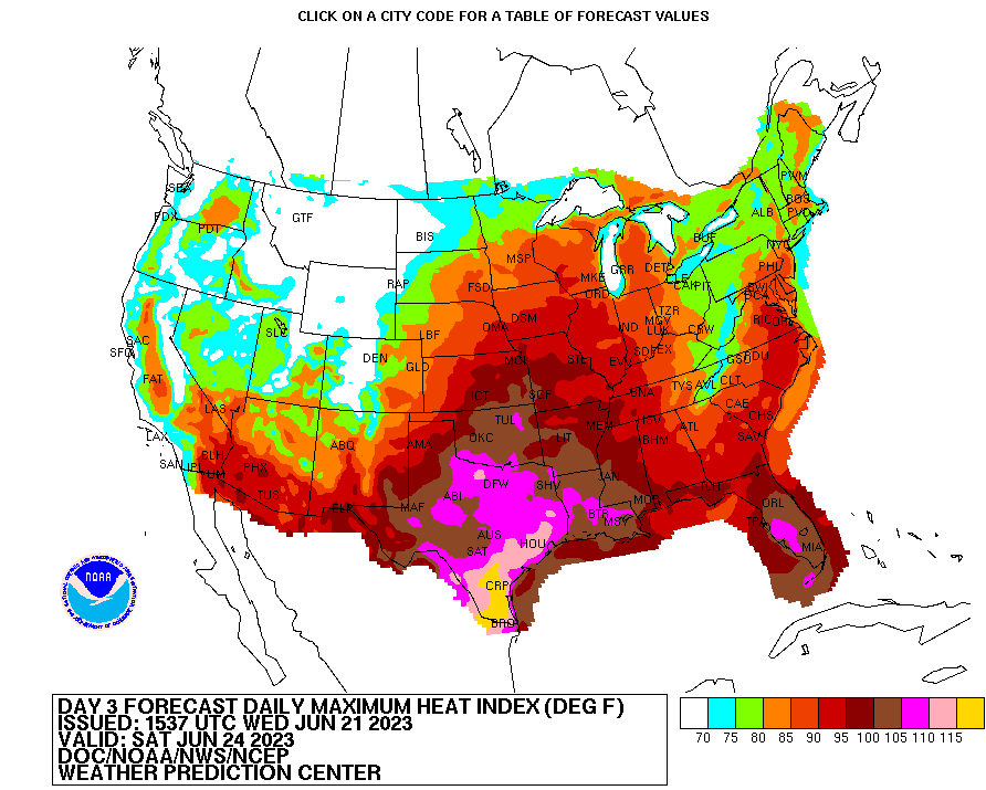
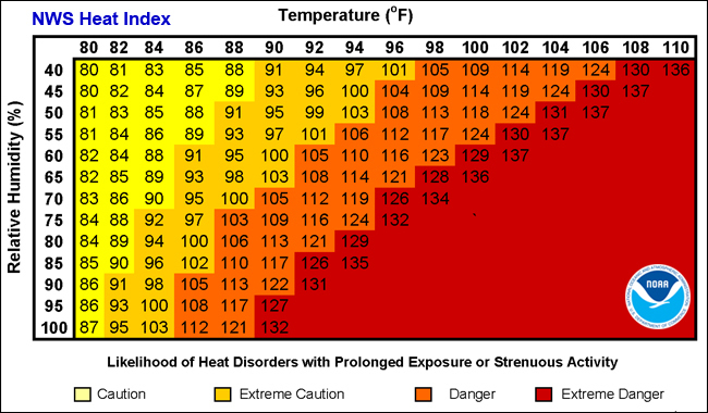
Be precarious as we head into the summer with the heat starting to rise in our area. Especially during peak sun hours long term exposure outside can be very dangerous. Be sure to hydrate and cool down indoors periodically. Over the next week we can see some heat indices reaching over 100. Make sure you are properly prepared to enjoy the outdoors safely.
[wpcode id=”41149″]
REGIONAL DAY-TO-DAY FORECAST
Today: Mostly sunny. High temperatures in the upper 80s to low 90s. Winds north, northeast around 5 mph. Chance of rain 30%.
Tonight: Mostly clear. Low temperatures in the high 60s to low 70s. Winds north, northeast around 5 mph. Chance of rain 20%.
Friday: Sunny. Chance of showers and thunderstorms in the afternoon. High temperatures in the upper 80s to low 90s. Winds north, northeast around 5 mph. Chance of rain 40%.
Friday Night: Mostly clear. Low temperatures in the high 60s to low 70s. Winds north around 5 mph. Chance of rain 10%.
Saturday: Mostly sunny. Chance of showers and thunderstorms in the afternoon. High temperatures in the mid to upper 90s. Winds southwest around 5 mph. Chance of rain 40%.
Saturday Night: Mostly clear. Low temperatures in the low to mid 70s. Winds south at 5 to 10 mph.
Sunday: Mostly sunny. Chance of showers and thunderstorms in the afternoon. High temperatures in the mid to upper 90s. Winds southwest around 10 mph. Chance of rain 20%.
Sunday Night: Partly cloudy. Low temperatures in the mid to upper 70s. Winds south, southwest at 10 to 15 mph, with gusts as high as 20 mph. Chance of rain 10%.
Monday: Mostly sunny. Slight chance of showers and thunderstorms. High temperatures in the mid to upper 90s. Winds southwest at 10 to 15 mph. Chance of rain 20%.
Monday Night: Mostly clear. Slight chance of showers and thunderstorms. Low temperatures in the low to mid 70s. Winds southwest at 10 to 15 mph. Chance of rain 10%.
Tuesday: Sunny. Slight chance of showers and thunderstorms. High temperatures in the mid to upper 90s. Winds west around 10 mph. Chance of rain 20%.
Tuesday Night: Mostly clear. Low temperatures in the mid 70s. Winds southwest becoming northwest around 10 mph.
Wednesday: Sunny. High temperatures in the mid to upper 90s. Winds northwest at 5 to 10 mph.


