
Our general stormy pattern should continue this week as a cutoff Low over Alabama churns over the South. While storms in our area are not expected to be severe, high rainfall totals are to be expected across the region that has already found itself to be saturated from previous storms. Let’s take a look at what the weather looks like in our area!
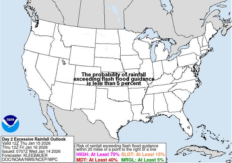
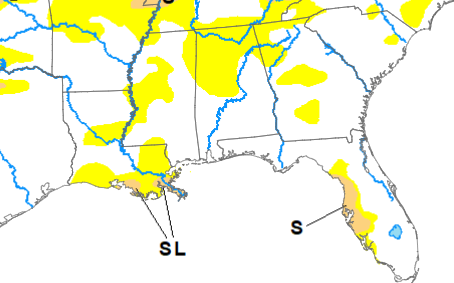
The main headline for stormy weather this week is the ever present stationary front combining with an upper level low providing lift across the region. While most of this stormy pattern will be displaced to our east, Our coastal county friends are highlighted with a marginal risk for rainfall to exceed flash flooding guidance within 25 miles of their location. It will be ever easier for certain regions to flood if they have received rainfall recently such as our friends in Mobile Bay.
This upper low won’t be moving much as it finds itself stuck in-between ridges with no where to move too. The good news, is severe weather isn’t expected with these conditions as conditions won’t be right for that type of development. Additionally, this rainfall should work to combat the abnormally dry conditions that have developed across the region in recent weeks. A welcomed relief to to crispy lawns everywhere I am sure!
Our largest concerns these next few days will be flooding, especially along our coastal communities and heat in the regions the rain misses. With a ridge just to our west heat can quickly build in areas not under the effects of the upper low. With our area being in-between these features a little slide either direction could dramatically change the weather we expect to happen overhead!
In our extend forecast, this stormy and active pattern will continue as the low barely moves and the stationary fronts along the coasts shift slightly north. Flooding concerns will continue for the foreseeable future as different mechanisms for forcing act to keep storms within the area. Heat will also be a concern as the ridge to our west puts more influence over the regions. The good news is if the ridge builds more into our neck of the woods then we can expect storms (and thus the flood threat) to drop, but if that doesn’t happen this stormy pattern will continue.

[wpcode id=”41149″]
REGIONAL DAY-TO-DAY FORECAST
Today: Mostly cloudy. Chance of scattered showers and thunderstorms in the morning with an additional round expected in the afternoon to evening hours. High temperatures in the upper 80s to low 90s. Winds out of the Northwest at 5 to 10 mph. Chance of rain 50%
Tonight: Mostly cloudy. Chance of a thunderstorm or two before midnight. Low temperatures in the low 70s. Winds out of the Northwest at 5 to 10 mph. Chance of rain 40%.
Thursday: Mostly cloudy. High temperatures in the upper 80s to low 90s. Heat indices may reach up to 100 degrees. Winds out of the Northwest at 5 to 10 mph. Chance of rain 40%.
Thursday night: Partly cloudy. Chance of scattered showers and thunderstorms in the evening. Low temperatures in the mid to upper 70s. Winds Northwest 5 to 10 mph. Chance of rain 50%.
Friday: Partly Sunny. Showers and thunderstorms likely throughout the afternoon. High temperatures in the upper 80s to low 90s. Heat indices in the upper 90s to 100s possible. Winds out of the northwest at 5 to 10 mph. Chance of rain 50%.
Friday night: Mostly cloudy. Chance of showers and thunderstorms before midnight. Low temperatures in the low 70s. Winds northwest 5 to 10 mph. Chance of rain 40%.
Saturday: Partly sunny. Chance of showers and thunderstorms throughout the day. High temperatures in the mid to upper 90s. Heat indices may reach up to 105 degrees. Winds are south 5 to 10 mph. Chance of rain 40%.
Saturday night: Mostly cloudy. Chance of thunderstorms throughout the overnight hours. Low temperatures in the low to mid 70s. Winds are south 5 to 10 mph. Chance of rain 40%.
Sunday: Mostly sunny. Chance of showers and thunderstorms throughout the day. High temperatures in the mid to upper 90s. Heat indices may reach up to 105 degrees. Winds are south 5 to 10 mph. Chance of rain 40%.
Sunday night: Partly cloudy. Slight chance of showers and thunderstorms overnight. Low temperatures in the upper 70s. Winds are south 5 to 10mph. Chance of rain 40%.
Monday: Partly cloudy. Showers or thunderstorm are possible. High temperatures in the upper 90s. Heat indices may reach up to 105 degrees. Winds are south 5 to 10mph . Chance of rain 40%.
Monday night: Partly cloudy. Low temperatures in the mid to upper 70s. Winds are south 5 to 10mph. Chance of rain 40%


‘Today: Mostly cloudy. Chance of scattered showers and thunderstorms in the morning with an additional round expected in the afternoon to evening hours.’ … Not quite sure where your forecast is for??