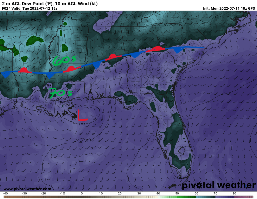
Rain chances increase throughout this week as upper-level troughing digs into the area by mid-week. Two surface boundaries will enter as well to produce showers and thunderstorms. On Tuesday, the stalled frontal boundary is evident by the moisture gradient between dewpoints in the 60s and 70s. Northern counties will not see much precipitation as the drier air will inhibit any deep convection. Southern counties in the more moist air mass could see some scattered pop up showers or storms once daytime heating kicks in.
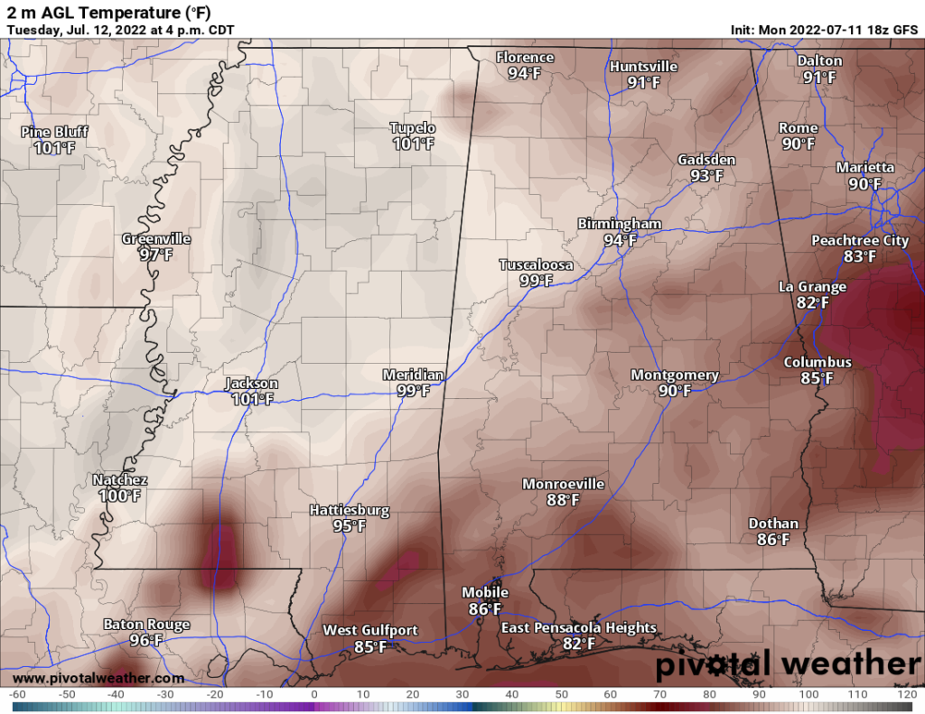
Tuesday will be rather hot before high temperatures start to decrease by Wednesday. Highs on Tuesday will be in the upper 90s. Some places might reach 100F as the day will be mostly sunny. Ample moisture is in place for heat index values to hit between 100F and 105F. This should be below criteria for any heat advisories or warnings. Where the rain chances are higher, temperatures will cool down from any rainfall. The GFS model below is suggesting a shower over Pike county by the temperature dropping to 76F.
With a higher chance of rainfall throughout the rest of the week and in turn, more cloud cover, high temperatures will cool down to the mid-to-upper 80s. Starting Wednesday, the possible low pressure system that will get spun up by the dying frontal boundary will slowly meander towards the coast. This will lead to more widespread coverage of storms throughout Wednesday into Thursday.
The upper-level trough will inch closer to the region bringing another frontal boundary on Thursday. The trough axis will be stretched from the northeast to southwest stuck between two upper-level ridges. The main ridge over the Southern Rockies and the Bermuda High reaching westward towards the East Coast will lead to weak flow aloft.
That weak upper-level flow will allow for slow moving storms that could produce localized heavy rainfall and flooding/flash flooding. Southern counties might see rainfall totals through the end of the week reaching 3″ while northern counties might see up to 1.5″.
Whether or not this low gets tropical cyclone status as a named storm, the impacts will be unchanged. Heavy, prolonged rainfall can be expected throughout the week as this system gets trapped by the boundary before slowly exiting the region by the end of the week. Gusty winds may accompany some of the stronger storms.
Day-to-Day Forecast
Tuesday
Mostly sunny with a 20-percent chance of showers in the northern counties. Southern counties will see a 40-percent chance of rain and storms by the afternoon/evening hours. Highs will be in the mid-to-upper 90s with heat index values up to 105F. Lows will be in the mid 70s.
Wednesday
Partly cloudy with a 70-percent chance of showers and storms beginning in the afternoon hours. Highs will be in the low 90s with heat indices in the upper 90s. Lows will be in the low 70s.
Thursday
Mostly cloudy with a 60-percent chance of widespread showers and storms throughout the day. Highs will be in the low-to-mid 80s with heat indices only getting up to 90F. Lows will be in the low 70s.
Friday
Mostly cloudy with a 40-percent chance of precipitation. Highs in the mid 80s and lows in the low 70s.
Saturday
Partly cloudy with a 40-percent chance of precipitation. Highs in the upper 80s with heat indices up to 95F. Lows in the low 70s.
Sunday
Partly cloudy with a 40-percent chance of precipitation. Highs in the upper 80s with heat indices in the upper 90s. Lows in the low 70s.
Monday
Partly cloudy with a 40-percent chance of precipitation. High in the low 90s with heat indices in the upper 90s. Lows in the low 70s.


