The National Hurricane Center continues to monitor a cluster of storms in the Gulf of Mexico for potential development during the next five days.

From the NHC:
A broad trough of low pressure currently located over the northern Gulf of Mexico is producing a large area of disorganized showers and thunderstorms. Gradual development of this system is possible if it can remain offshore while it meanders near the northern Gulf of Mexico coast through the end of the week. Regardless of development, heavy rains will be possible along portions of the northern Gulf coast from Louisiana to the Florida Panhandle over the next several days. For more information about the potential for heavy rain, please see products issued by your local National Weather Service office and the Weather Prediction Center.
— Formation chance through 48 hours…low…10 percent.
— Formation chance through 5 days…low…30 percent.
Model guidance, like usual, is struggling to nail down specifics because there is no center of the system yet. That means the guidance tries to “build” the system in the forecast. And sometimes weird things can happen. Like the HRRR model below. It splits the system into two centers. Which one is the ‘real’ center?
Probably neither.
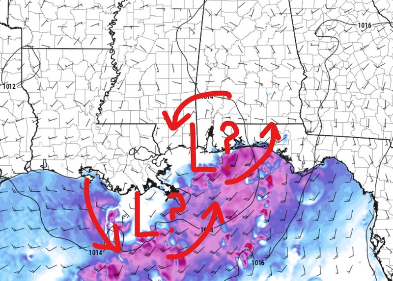
But it highlights a problem for us meteorologists and for you a regular person just trying to make plans for the week — we don’t know, specifically, what will happen with this thing yet.
But, I am starting to get an idea that this thing may decide to stick around for a few days. Looking below at the two 500mb maps from the GFS, it shows that the potential tropical depression moves inland and then, sort of, spins around for a few days, before finally moving out this weekend.

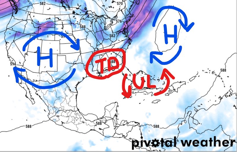
That is also shown on the animation below. It shows the centralized area of spin and lower pressure hanging around all the way through Sunday.
That would lead to a potential for a fair bit more rainfall. And something worth monitoring, for certain.


