It is shaping up to be an active week in terms of rainfall for the coastal counties. As the upper-level ridge stays to the west, upper-level flow from the north is helping bring down a frontal boundary. This boundary is going to trap tropical moisture near the coast as it becomes stationary into the work week. Precipitable water values will be near 2” providing ample amounts of moisture for rainfall.
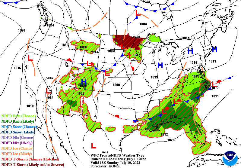
Sunday will see rainfall throughout the day stating near the coast and moving inland. Some of these storms could be slow movers due to weak winds aloft raising the potential for locally heavy rains and flooding concerns. Gusty winds could be associated with some of the storms that produce heavy rainfall. SPC has the western coastal counties under a marginal (1/5) risk for severe weather producing severe wind gusts (58+mph) from the stronger storms. However, thanks to the rainfall and cloud cover on Sunday, temperatures will be lower in the upper 80s and low-to-mid 90s. With lots of moisture in the atmosphere, heat indices will still be high in the upper 90s and maybe reaching 100F in some areas.

Monday will see additional showers and storms as the front moves closer. By Tuesday when the front begins to stall over the area, some model guidance suggests a weak surface low is spun up as a result of the front and the two upper-level ridges on either side of the area.
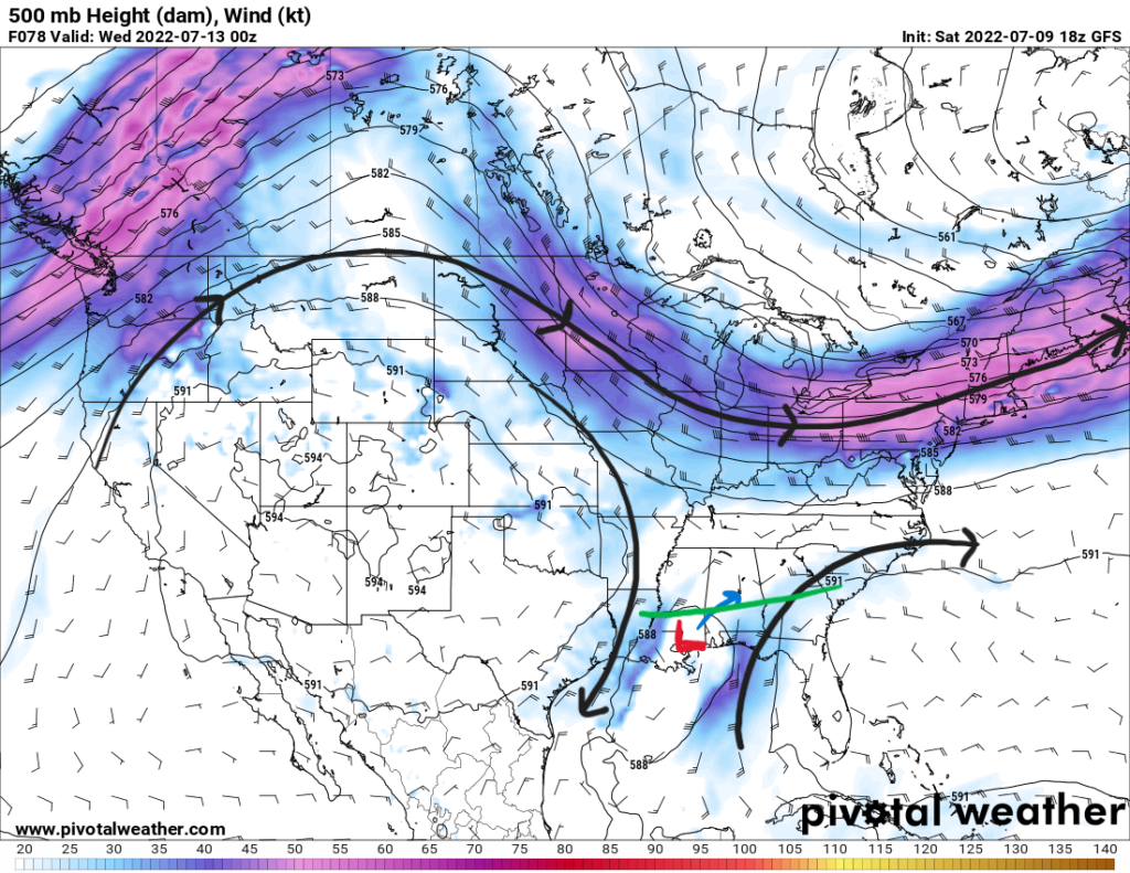
This surface low will aid in shower and storm development as it slowly makes its way northeastward and leaves the area by the end of the week. Most of the heaviest rain will remain offshore; however, high rainfall totals can be expected throughout the week. Coastal counties will receive the bulk of the rainfall with rainfall totals less over more inland counties. As this low moves inland, gusty winds will be associated with the storms as well.
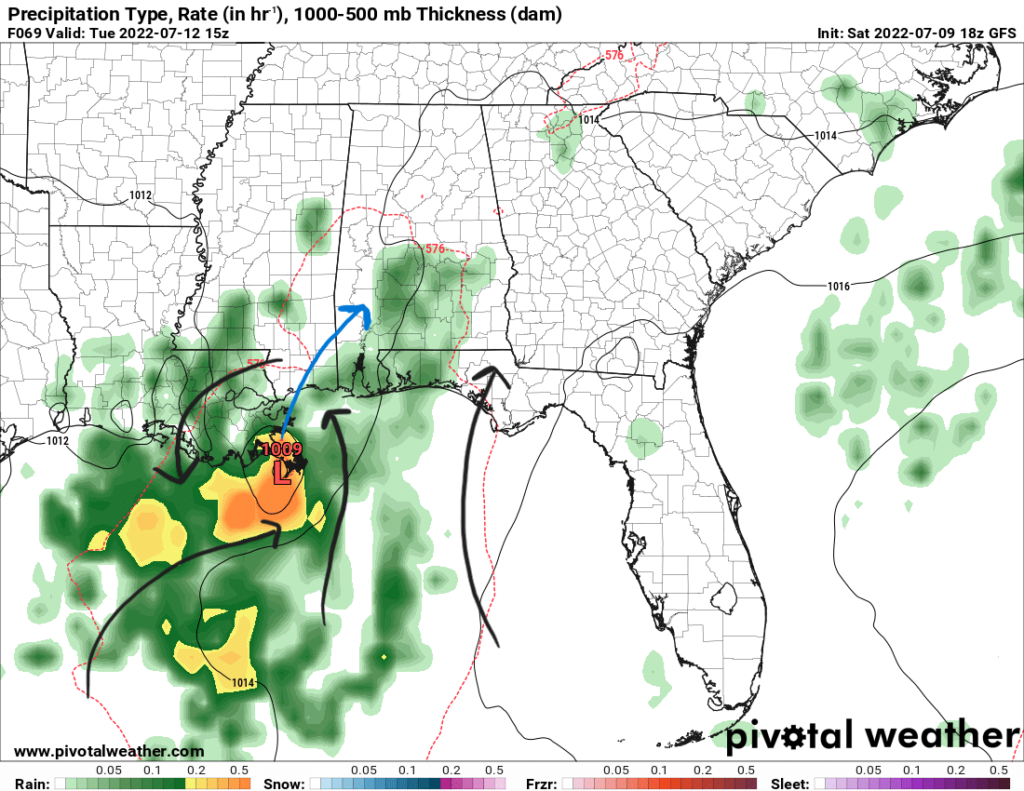
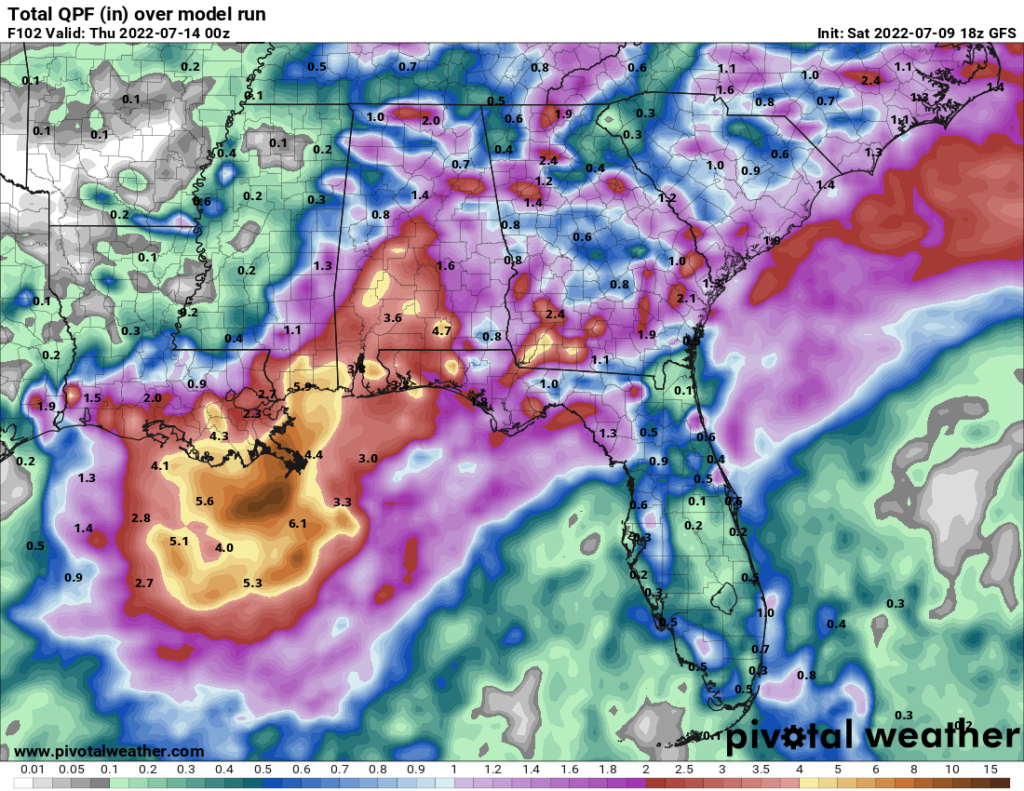
Rainfall rates of 2-3″ per hour could be possible with some of the slower moving storms to cause flooding to be a threat. With all of this rainfall comes plenty of cloud cover too associated with the frontal boundary. This will keep temperatures during the week down to the mid-to-upper 80s near the coast.
Day-to-Day Forecast
Sunday
Cloudy with an 80-percent chance of showers and storms beginning in the morning and lasting throughout the day. High temperatures in the upper 80s to low 90s with heat indices between 95F and 105F. Lows in the mid 70s.
Monday
Mostly cloudy with a 70-percent of showers and storms from the early afternoon to late evening hours. Highs in the upper 80s with heat indices in the mid 90s. Lows in the mid 70s.
Tuesday
Cloudy with an 80-percent of showers and storms beginning in the morning. Highs in the mid 80s and lows in the mid 70s.
Wednesday
Mostly cloudy with an 80-percent chance of precipitation beginning in the morning. Highs in the mid 80s and lows in the mid 70s.
Thursday
Mostly cloudy with an 80-percent chance of precipitation. Highs in the mid 80s and lows in the mid 70s.
Friday
Partly cloudy with a 70-percent chance of precipitation. Highs in the mid-to-upper 80s and lows in the mid 70s.
Saturday
Partly cloudy with a 70-percent chance of precipitation. Highs in the upper 80s and lows in the upper 70s.


