Currently across the South, we see a messy, slow moving clump of storms over Texas. This storm system has the potential to impact our region later tonight. Some models expect this storm to travel North/Northeast, pushing into Louisiana. Others show the storms dissipating throughout the afternoon and leaving our area dry. Let’s see what to expect as we move further into the afternoon.
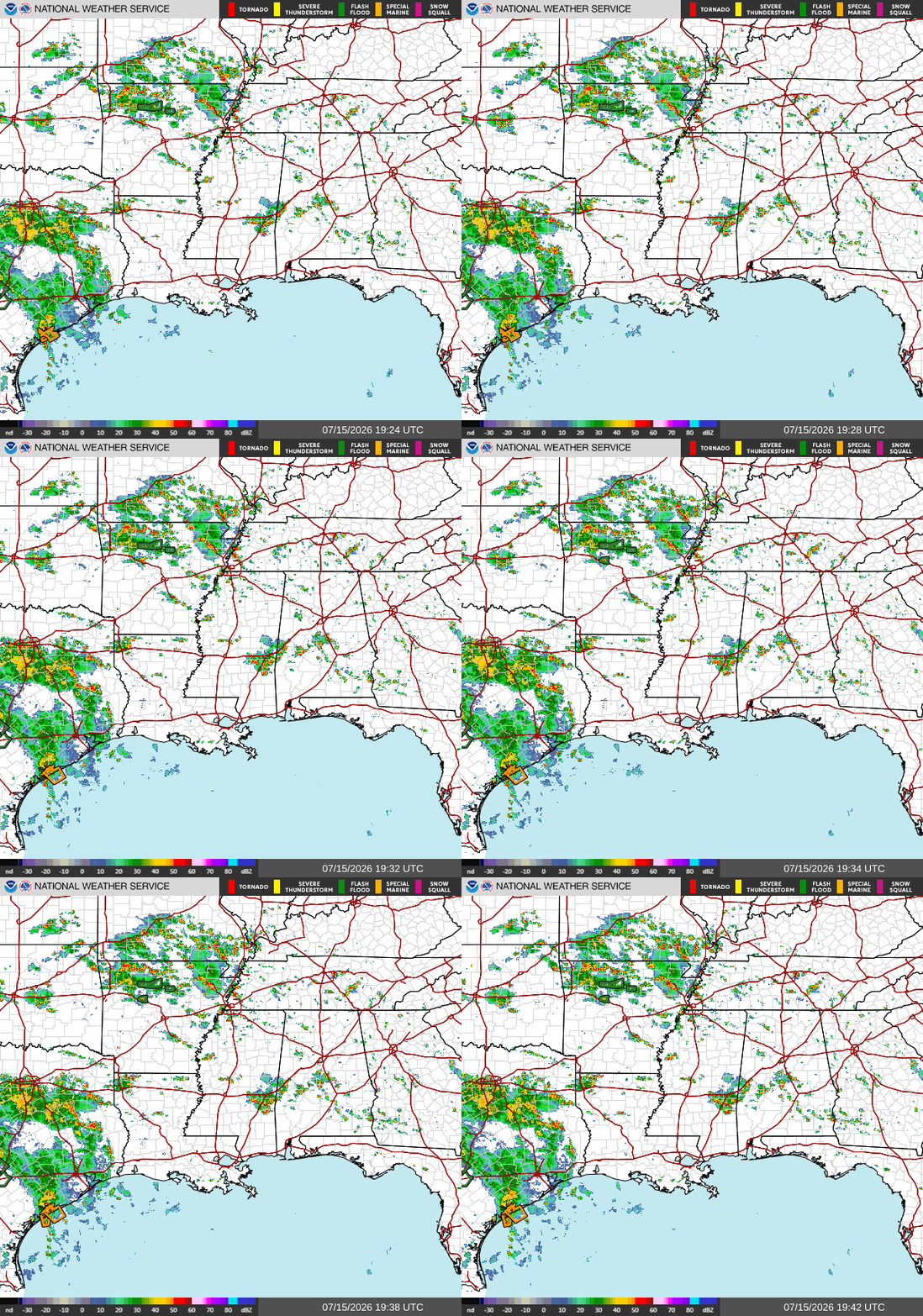
The above NWS radar shows just the next few minutes across the area, where we see the storms over Texas moving slightly North. We see that these storms are very slow-moving and will surely bring a lot of rainfall to impacted areas.
The Storm Vista radar below shows what we can expect into the overnight hours IF the remnants of this storm end up moving into and across our region. This shows bands of heavier thunderstorms moving across AL/MS/LA overnight. However, confidence in this model is lower because a ridge of high pressure centered over the lower Mississippi Valley, which should act as a barrier, encouraging the storms to weaken or shift farther north before reaching our area.
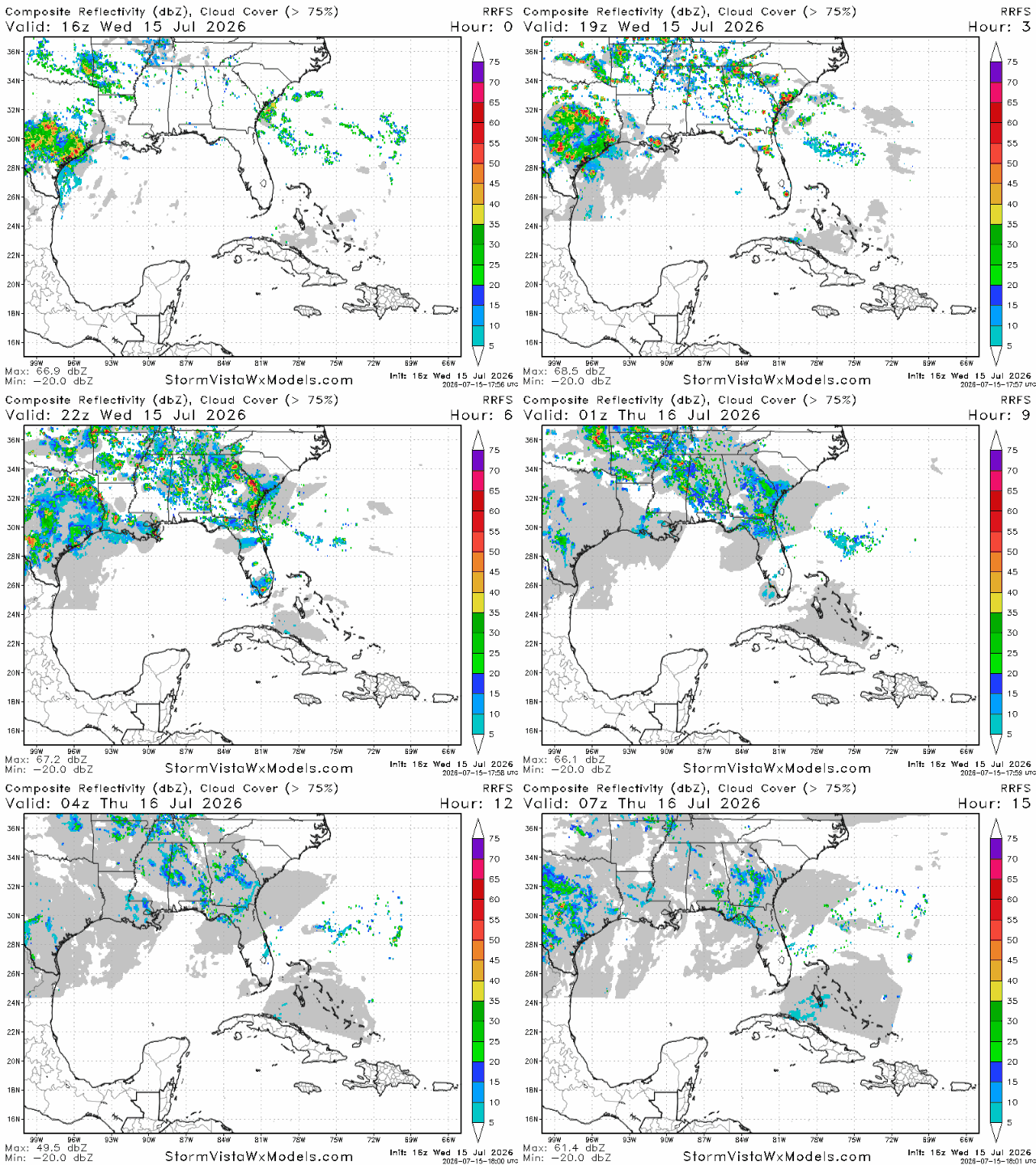
I think the model above is confused because of the high-pressure area sitting above Central Louisiana. This ridge, ideally, should be pushing the Texas storms away from our area, as the first NWS graphic shows. This would theoretically keep the Southern LA/MS/AL region somewhat dry, but afternoon thunderstorms will still be a possibility. Even beneath the ridge, abundant Gulf moisture combined with strong daytime heating will still allow scattered thunderstorms to develop during the afternoon that would form independently rather than from the Texas storm complex.
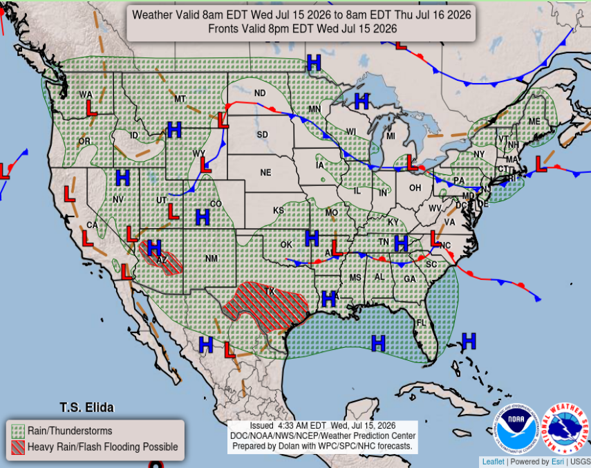
Overall for the Southern MS/AL/LA region, expect warmer temperatures and below-average precipitation the next few days as the high-pressure system really sets in across the area. Tonight, scattered thunderstorms could develop, but they most likely will form independently from the Texas system, as the ridge pushes those storms away from our area. The western side of Louisiana would be most impacted from this storm, if the high pressure does not fully push the storms northward and away.
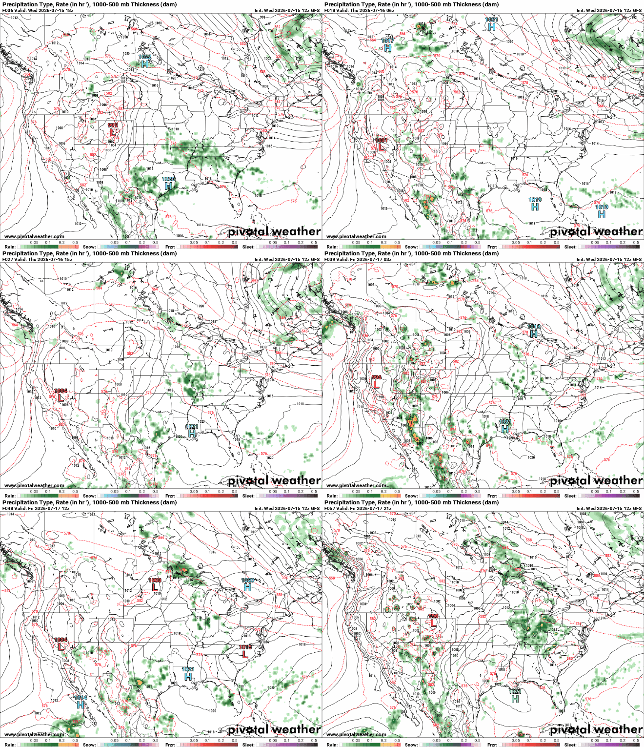
The above forecast shows the high pressure lurking around the Gulf Coast for the next few days. This will bring higher temperatures with less of a risk for organized storm systems, although afternoon thunderstorms will still develop due to daytime heating. Take this forecast as a reminder that not every model will be completely accurate, as they all interpret the atmosphere differently. That’s why meteorologists compare multiple models and apply knowledge of the current weather pattern before issuing a forecast. Have a great day!


