Well, it was a good run, right? We made it 96 consecutive days at 90F or higher. Today should be the last day. Making it 97-straight days of Summer Heat. Remember back when this all started? June 21st! We hit 91F that day. And we never looked back.
Even though we started the streak on June 21st, the entire month was pretty warm. We tagged 90F on 24 of the 30 days in June. We also had a few rounds of late Spring severe weather, too.
Then the ridge built into the the Southern US and said, “I ain’t movin’!”
Well, it is finally loosening its grip enough to the point where we have a chance for cooler air to sneak into the area.
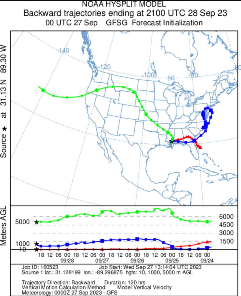
And we can see that on the Reverse Trajectory Model. Looking at tomorrow afternoon, this shows the air higher up (about 15,000ft) is still riding around the big ridge of high pressure from the west coast. But in the lower levels of the atmosphere (down around 3000ft), we are actually seeing air moving in from the Carolinas. And at the surface our air is coming this direction from off the coast of Florida.
This is a five-day journey for all of that air. What about the 10-day journey?
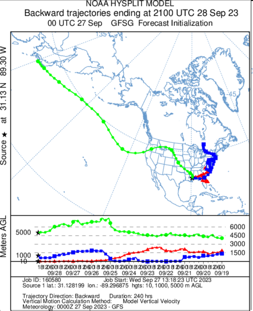
Japan, Canada and western North Carolina. And in late September, that means cooler air! So the forecast for tomorrow is a bit cooler, with highs in the mid 80s anticipated.
But don’t get used to it. It looks like we warm right back up to around 90 to close out the month.
[wpcode id=”41149″]
REGIONAL DAY TO DAY FORECAST
Wednesday: Partly sunny with storms possible. Highs around 90. Northeast winds 5 to 10 mph. Chance of rain 40 percent.
Wednesday Night: Mostly cloudy. Lows in the upper 60s. Northeast winds 5 to 10 mph.
Thursday: Mostly cloudy with storms possible. Highs in the mid 80s. Northeast winds 5 to 10 mph. Chance of rain 40 percent.
Thursday Night: Mostly cloudy in the evening, then becoming partly cloudy. Lows in the upper 60s. Northeast winds 5 to 10 mph.
Friday: Mostly sunny. A slight chance of showers and thunderstorms in the afternoon. Highs in the upper 80s. Chance of rain 20 percent.
Friday Night: Partly cloudy in the evening, then becoming mostly clear. Lows in the upper 60s.
Saturday: Sunny. Highs in the lower 90s.
Saturday Night: Mostly clear. Lows in the upper 60s.
Sunday: Sunny. Highs in the lower 90s.
Sunday Night: Mostly clear. Lows in the mid 60s.
Monday: Sunny. Highs around 90.
Monday Night: Mostly clear. Lows in the mid 60s.
Tuesday: Sunny. Highs in the lower 90s.


